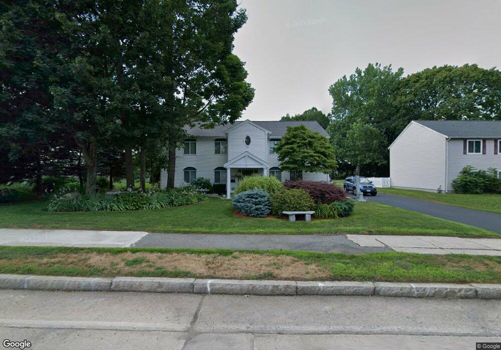
414 Andover St Lowell, MA 01852
Belvidere NeighborhoodEstimated Value: $769,053 - $794,000
3
Beds
3
Baths
2,600
Sq Ft
$300/Sq Ft
Est. Value
About This Home
This home is located at 414 Andover St, Lowell, MA 01852 and is currently estimated at $779,013, approximately $299 per square foot. 414 Andover St is a home located in Middlesex County with nearby schools including Moody Elementary School, Abraham Lincoln Elementary School, and Greenhalge Elementary School.
Ownership History
Date
Name
Owned For
Owner Type
Purchase Details
Closed on
Apr 27, 2001
Sold by
Madden Karen G and Mitchell Karen G
Bought by
Sdoia Eugene and Digiorgio Helen
Current Estimated Value
Purchase Details
Closed on
Mar 2, 1993
Sold by
Rindo Michael E
Bought by
Saab Mark A and Saab Elisia
Purchase Details
Closed on
Sep 22, 1992
Sold by
Rindo Inc Michael F
Bought by
Rindo Michael E
Create a Home Valuation Report for This Property
The Home Valuation Report is an in-depth analysis detailing your home's value as well as a comparison with similar homes in the area
Home Values in the Area
Average Home Value in this Area
Purchase History
| Date | Buyer | Sale Price | Title Company |
|---|---|---|---|
| Sdoia Eugene | $282,500 | -- | |
| Sdoia Eugene | $282,500 | -- | |
| Saab Mark A | $45,000 | -- | |
| Saab Mark A | $45,000 | -- | |
| Rindo Michael E | $60,000 | -- | |
| Rindo Michael E | $60,000 | -- |
Source: Public Records
Mortgage History
| Date | Status | Borrower | Loan Amount |
|---|---|---|---|
| Open | Rindo Michael E | $178,000 | |
| Closed | Rindo Michael E | $66,500 |
Source: Public Records
Tax History Compared to Growth
Tax History
| Year | Tax Paid | Tax Assessment Tax Assessment Total Assessment is a certain percentage of the fair market value that is determined by local assessors to be the total taxable value of land and additions on the property. | Land | Improvement |
|---|---|---|---|---|
| 2025 | $8,729 | $760,400 | $254,000 | $506,400 |
| 2024 | $8,688 | $729,500 | $237,400 | $492,100 |
| 2023 | $8,319 | $669,800 | $206,400 | $463,400 |
| 2022 | $7,468 | $588,500 | $187,700 | $400,800 |
| 2021 | $7,025 | $521,900 | $163,100 | $358,800 |
| 2020 | $6,840 | $512,000 | $163,100 | $348,900 |
| 2019 | $7,504 | $534,500 | $162,200 | $372,300 |
| 2018 | $7,145 | $496,500 | $154,500 | $342,000 |
| 2017 | $6,718 | $450,300 | $143,400 | $306,900 |
| 2016 | $6,199 | $408,900 | $131,900 | $277,000 |
| 2015 | $6,291 | $406,400 | $131,900 | $274,500 |
| 2013 | $5,620 | $374,400 | $145,700 | $228,700 |
Source: Public Records
Map
Nearby Homes
- 318 Andover St
- 45 Luce St
- 26 Luce St
- 53 Fairmount St
- 216 Nesmith St Unit 2
- 111 Draper St
- 44 Hanks St
- 112 Fort Hill Ave
- 21 Vernon St
- 192 1st St
- 4 Glenmere St
- 288 Hovey St
- 45 Clark Rd
- 158 Concord St
- 15 Sharyn Cir
- 12 Fremont St
- 100 Merrimack Ave Unit 91
- 100 Merrimack Ave Unit 124
- 97 Hoyt Ave
- 70 Enfield St
- 424 Andover St
- 595 E Merrimack St
- 605 E Merrimack St
- 436 Andover St
- 396 Andover St
- 611 E Merrimack St
- 419 Andover St
- 579 E Merrimack St
- 403 Andover St
- 427 Andover St
- 617 E Merrimack St
- 444 Andover St
- 600 E Merrimack St
- 437 Andover St
- 14 Pentucket Ave
- 386 Andover St
- 588 E Merrimack St
- 391 Andover St
- 625 E Merrimack St
- 17 Wentworth Ave