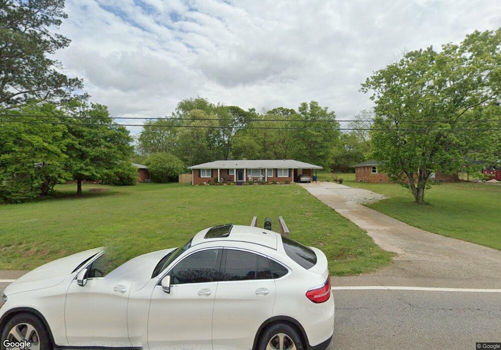
414 Conyers Rd McDonough, GA 30253
Estimated Value: $248,590 - $287,000
3
Beds
2
Baths
1,454
Sq Ft
$180/Sq Ft
Est. Value
About This Home
This home is located at 414 Conyers Rd, McDonough, GA 30253 and is currently estimated at $261,148, approximately $179 per square foot. 414 Conyers Rd is a home located in Henry County with nearby schools including Walnut Creek Elementary School, McDonough Middle School, and McDonough Methodist Academy.
Ownership History
Date
Name
Owned For
Owner Type
Purchase Details
Closed on
Mar 23, 2020
Sold by
Elliott Manita A
Bought by
Elliott Manita A and Storey Carolyn V
Current Estimated Value
Home Financials for this Owner
Home Financials are based on the most recent Mortgage that was taken out on this home.
Original Mortgage
$129,800
Outstanding Balance
$114,737
Interest Rate
3.4%
Mortgage Type
New Conventional
Estimated Equity
$146,411
Purchase Details
Closed on
Jan 26, 2015
Sold by
Miller Dorothy Moore
Bought by
Miller William Edward and Miller Deborah L
Create a Home Valuation Report for This Property
The Home Valuation Report is an in-depth analysis detailing your home's value as well as a comparison with similar homes in the area
Home Values in the Area
Average Home Value in this Area
Purchase History
| Date | Buyer | Sale Price | Title Company |
|---|---|---|---|
| Elliott Manita A | -- | -- | |
| Elliott Manita A | $163,200 | -- | |
| Miller William Edward | -- | -- |
Source: Public Records
Mortgage History
| Date | Status | Borrower | Loan Amount |
|---|---|---|---|
| Open | Elliott Manita A | $129,800 | |
| Closed | Elliott Manita A | $129,800 |
Source: Public Records
Tax History Compared to Growth
Tax History
| Year | Tax Paid | Tax Assessment Tax Assessment Total Assessment is a certain percentage of the fair market value that is determined by local assessors to be the total taxable value of land and additions on the property. | Land | Improvement |
|---|---|---|---|---|
| 2025 | $514 | $111,600 | $12,600 | $99,000 |
| 2024 | $514 | $105,720 | $11,160 | $94,560 |
| 2023 | $350 | $103,920 | $10,760 | $93,160 |
| 2022 | $482 | $80,520 | $9,920 | $70,600 |
| 2021 | $474 | $63,840 | $8,520 | $55,320 |
| 2020 | $1,640 | $41,720 | $8,040 | $33,680 |
| 2019 | $1,531 | $38,880 | $7,600 | $31,280 |
| 2018 | $1,347 | $34,080 | $7,040 | $27,040 |
| 2016 | $1,171 | $29,480 | $5,480 | $24,000 |
| 2015 | $1,019 | $24,760 | $6,240 | $18,520 |
| 2014 | $125 | $20,240 | $6,240 | $14,000 |
Source: Public Records
Map
Nearby Homes
- 0 Parker Dr Unit 7676371
- 0 Parker Dr Unit 10637365
- 312 Relative Trail
- 701 Cams Creek
- 2229 Mcgarity Rd
- 440 Burke Cir
- 411 Burke Cir
- 654 Conyers Rd
- 504 Pomegranate Cir
- 280 Burke Cir
- 1013 Odelle Cir
- 300 Madison Grace Ave
- 200 Parker Dr
- 297 Decatur Rd
- 920 Ambeau Cir
- 905 Ambeau Cir
- 210 Parker Dr
- 56 N Zack Hinton Pkwy
- 9 Lemon St
- 359 Keys Ferry St
- 405 Conyers Rd
- 404 Conyers Rd
- 119 Russell Cir Unit 2
- 432 Conyers Rd
- 0 Parker Dr Unit 8446133
- 0 Parker Dr Unit 7478432
- 0 Parker Dr Unit 1 10403686
- 0 Parker Dr Unit 20053659
- 0 Parker Dr Unit 7405577
- 0 Parker Dr Unit 7353581
- 0 Parker Dr Unit 8333981
- 0 Parker Dr Unit 8645882
- 117 Russell Cir
- 121 Russell Cir
- 115 Russell Cir
- 328 Relative Trail
- 324 Relative Trail Unit 7
- 324 Relative Trail
- 320 Relative Trail Unit 6
- 320 Relative Trail