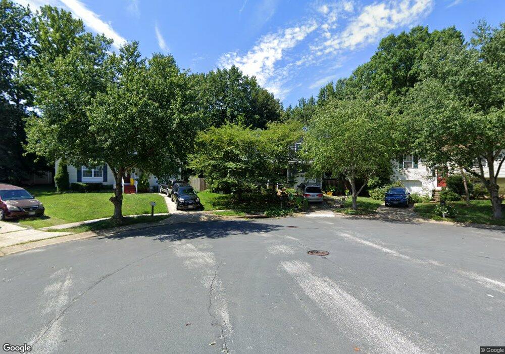
414 Forest Bridge Ct Laurel, MD 20724
Maryland City NeighborhoodEstimated Value: $493,993 - $661,000
--
Bed
3
Baths
2,384
Sq Ft
$238/Sq Ft
Est. Value
About This Home
This home is located at 414 Forest Bridge Ct, Laurel, MD 20724 and is currently estimated at $567,498, approximately $238 per square foot. 414 Forest Bridge Ct is a home located in Anne Arundel County with nearby schools including Brock Bridge Elementary School, Meade Middle School, and Meade High School.
Ownership History
Date
Name
Owned For
Owner Type
Purchase Details
Closed on
Nov 7, 1997
Sold by
Venit John M
Bought by
Venit John M and Venit Cherlynn R
Current Estimated Value
Purchase Details
Closed on
Jul 31, 1992
Sold by
Brock Bridge Ltd Ptnshp
Bought by
Venit John M
Home Financials for this Owner
Home Financials are based on the most recent Mortgage that was taken out on this home.
Original Mortgage
$134,600
Interest Rate
8.05%
Create a Home Valuation Report for This Property
The Home Valuation Report is an in-depth analysis detailing your home's value as well as a comparison with similar homes in the area
Home Values in the Area
Average Home Value in this Area
Purchase History
| Date | Buyer | Sale Price | Title Company |
|---|---|---|---|
| Venit John M | -- | -- | |
| Venit John M | $157,500 | -- |
Source: Public Records
Mortgage History
| Date | Status | Borrower | Loan Amount |
|---|---|---|---|
| Previous Owner | Venit John M | $134,600 | |
| Closed | Venit John M | -- |
Source: Public Records
Tax History Compared to Growth
Tax History
| Year | Tax Paid | Tax Assessment Tax Assessment Total Assessment is a certain percentage of the fair market value that is determined by local assessors to be the total taxable value of land and additions on the property. | Land | Improvement |
|---|---|---|---|---|
| 2025 | $3,476 | $463,500 | $197,600 | $265,900 |
| 2024 | $3,476 | $439,767 | $0 | $0 |
| 2023 | $3,365 | $416,033 | $0 | $0 |
| 2022 | $3,133 | $392,300 | $150,900 | $241,400 |
| 2021 | $6,161 | $384,533 | $0 | $0 |
| 2020 | $2,987 | $376,767 | $0 | $0 |
| 2019 | $2,938 | $369,000 | $145,900 | $223,100 |
| 2018 | $3,584 | $353,433 | $0 | $0 |
| 2017 | $2,755 | $337,867 | $0 | $0 |
| 2016 | -- | $322,300 | $0 | $0 |
| 2015 | -- | $312,833 | $0 | $0 |
| 2014 | -- | $303,367 | $0 | $0 |
Source: Public Records
Map
Nearby Homes
- 11 S Carol St
- 5 S Paula St
- 1774 Mill Branch Dr
- 1768 Mill Branch Dr
- Serenade Plan at Patuxent Greens - Townhomes
- 1760 Mill Branch Dr
- 3372 Sudlersville S
- 313 Old Line Ave
- 312 Park Hall S
- 1224 Bear Branch Rd
- 183 Lyons Creek Dr
- 1222 Bear Branch Rd
- 328 Vale Summit S
- 1221 Bear Branch Rd
- 1219 Bear Branch Rd
- 149 Lyons Creek Dr
- 577 Brock Bridge Rd
- 3341 Valley Lee S
- 3381 Horsehead S
- Monaco Plan at Patuxent Greens - Singles
- 416 Forest Bridge Ct
- 412 Forest Bridge Ct
- 417 Forest Bridge Ct
- 410 Forest Bridge Ct
- 415 Forest Bridge Ct
- 408 Forest Bridge Ct
- 462 Brock Bridge Rd
- 3503 Serene Ct
- 413 Forest Bridge Ct
- 411 Forest Bridge Ct
- 406 Forest Bridge Ct
- 409 Forest Bridge Ct
- 404 Forest Bridge Ct
- 407 Forest Bridge Ct
- 3506 Serene Ct
- 3504 Serene Ct
- 3502 Serene Ct
- 402 Forest Bridge Ct
- 405 Forest Bridge Ct
- 403 Forest Bridge Ct