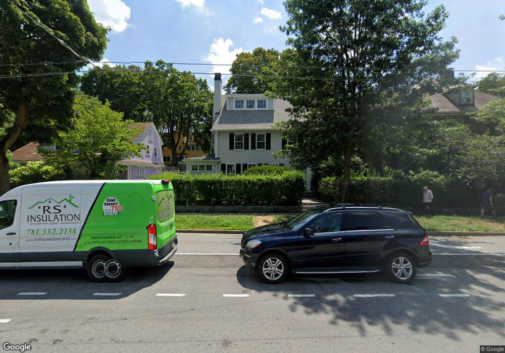
414 Mount Auburn St Cambridge, MA 02138
West Cambridge NeighborhoodEstimated Value: $2,195,650 - $2,492,000
4
Beds
3
Baths
2,190
Sq Ft
$1,066/Sq Ft
Est. Value
About This Home
This home is located at 414 Mount Auburn St, Cambridge, MA 02138 and is currently estimated at $2,334,913, approximately $1,066 per square foot. 414 Mount Auburn St is a home located in Middlesex County with nearby schools including Shady Hill School, Buckingham Browne & Nichols School, and St Peter School.
Ownership History
Date
Name
Owned For
Owner Type
Purchase Details
Closed on
Dec 10, 2010
Sold by
Duncan Timothy E
Bought by
Band Alexander C and Fung Abby Y
Current Estimated Value
Home Financials for this Owner
Home Financials are based on the most recent Mortgage that was taken out on this home.
Original Mortgage
$687,220
Outstanding Balance
$454,495
Interest Rate
4.24%
Mortgage Type
Purchase Money Mortgage
Estimated Equity
$1,880,418
Purchase Details
Closed on
Oct 3, 2005
Sold by
Duncan Lyn M
Bought by
Duncan Timothy E
Purchase Details
Closed on
Jun 18, 1993
Sold by
Est Mulcare Miriam E and Dolben Joseph A
Bought by
Duncan Timothy F and Duncan Lyn M
Home Financials for this Owner
Home Financials are based on the most recent Mortgage that was taken out on this home.
Original Mortgage
$203,150
Interest Rate
7.38%
Mortgage Type
Purchase Money Mortgage
Create a Home Valuation Report for This Property
The Home Valuation Report is an in-depth analysis detailing your home's value as well as a comparison with similar homes in the area
Home Values in the Area
Average Home Value in this Area
Purchase History
| Date | Buyer | Sale Price | Title Company |
|---|---|---|---|
| Band Alexander C | $859,000 | -- | |
| Duncan Timothy E | $375,000 | -- | |
| Duncan Timothy F | $257,000 | -- |
Source: Public Records
Mortgage History
| Date | Status | Borrower | Loan Amount |
|---|---|---|---|
| Open | Band Alexander C | $687,220 | |
| Previous Owner | Duncan Timothy F | $264,000 | |
| Previous Owner | Duncan Timothy F | $203,150 |
Source: Public Records
Tax History Compared to Growth
Tax History
| Year | Tax Paid | Tax Assessment Tax Assessment Total Assessment is a certain percentage of the fair market value that is determined by local assessors to be the total taxable value of land and additions on the property. | Land | Improvement |
|---|---|---|---|---|
| 2025 | $11,387 | $1,793,300 | $701,200 | $1,092,100 |
| 2024 | $10,301 | $1,740,100 | $694,400 | $1,045,700 |
| 2023 | $9,449 | $1,612,500 | $707,900 | $904,600 |
| 2022 | $8,728 | $1,474,300 | $672,200 | $802,100 |
| 2021 | $8,226 | $1,406,100 | $659,100 | $747,000 |
| 2020 | $7,821 | $1,360,200 | $652,600 | $707,600 |
| 2019 | $7,690 | $1,294,600 | $639,600 | $655,000 |
| 2018 | $7,484 | $1,189,800 | $564,500 | $625,300 |
| 2017 | $7,462 | $1,149,800 | $564,500 | $585,300 |
| 2016 | $7,125 | $1,019,300 | $476,400 | $542,900 |
| 2015 | $7,068 | $903,900 | $417,700 | $486,200 |
| 2014 | $7,302 | $871,400 | $391,500 | $479,900 |
Source: Public Records
Map
Nearby Homes
- 43 Larch Rd
- 172 Brattle St
- 158 Brattle St
- 1010 Memorial Dr Unit 6G
- 134 Lexington Ave Unit 2
- 48 Hubbard Park Rd
- 20 Maynard Place
- 153 Brattle St
- 15 Hubbard Park Rd
- 382 Huron Ave
- 465 Huron Ave Unit 1
- 35 Homer Ave Unit 7
- 107 Grozier Rd Unit 1
- 47 Homer Ave Unit 5-3
- 1 Aberdeen Way Unit 113
- 31 Chilton St Unit 1
- 71-73 Reservoir St
- 234 Huron Ave
- 243 Lexington Ave
- 87 Holworthy St Unit 2
- 414 Mount Auburn St Unit 144 - B
- 29 Coolidge Hill Rd
- 412 Mount Auburn St
- 416 Mount Auburn St
- 27 Coolidge Hill Rd
- 25 Coolidge Hill Rd
- 23 Coolidge Hill Rd
- 19 Coolidge Hill Rd
- 15 Coolidge Hill Rd
- 21 Coolidge Hill Rd
- 408 Mount Auburn St
- 5 Coolidge Hill Rd
- 36 Coolidge Hill Rd
- 34 Coolidge Hill Rd
- 426 Mount Auburn St
- 32 Coolidge Hill Rd
- 9 Coolidge Hill Rd
- 9 Coolidge Hill Rd Unit 1
- 26 Coolidge Hill Rd
- 20 Coolidge Hill Rd