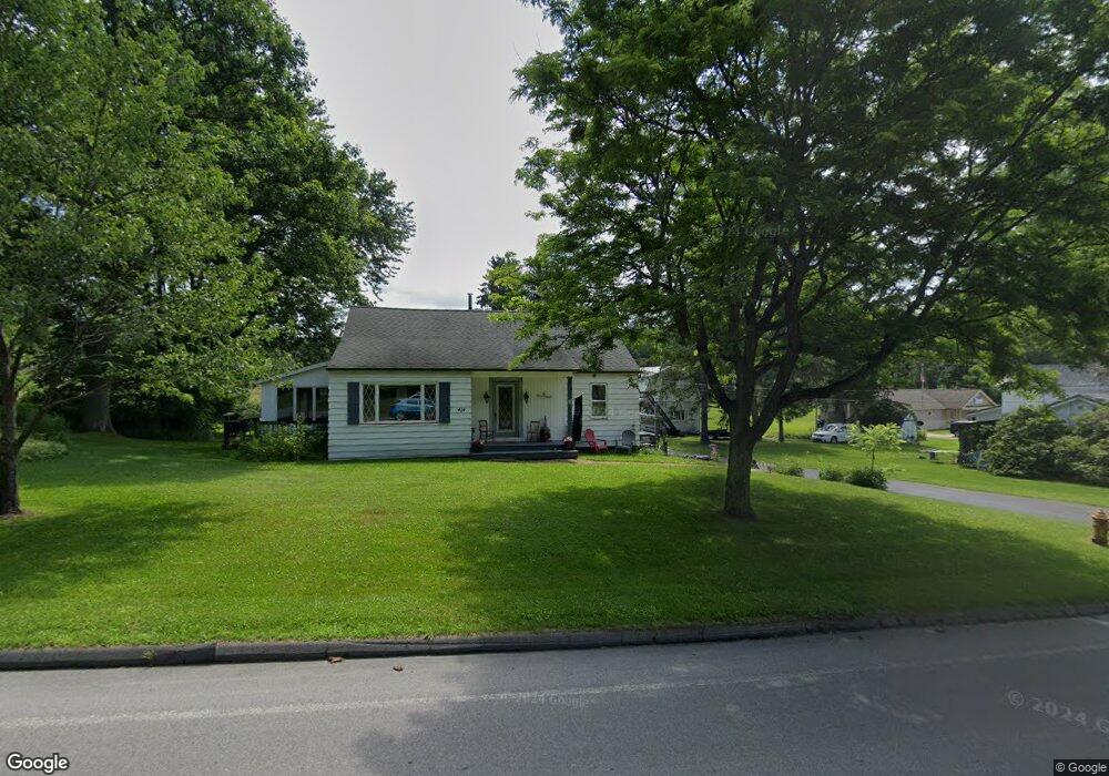
414 N Main St Ulysses, PA 16948
Estimated Value: $136,695 - $209,000
--
Bed
--
Bath
1,280
Sq Ft
$135/Sq Ft
Est. Value
About This Home
This home is located at 414 N Main St, Ulysses, PA 16948 and is currently estimated at $172,924, approximately $135 per square foot. 414 N Main St is a home with nearby schools including Northern Potter Children's School, Northern Potter Junior/Senior High School, and Ulysses Amish School.
Ownership History
Date
Name
Owned For
Owner Type
Purchase Details
Closed on
Apr 4, 2019
Sold by
Erway Mary and Dietter Nancy J
Bought by
Shope Kane S
Current Estimated Value
Home Financials for this Owner
Home Financials are based on the most recent Mortgage that was taken out on this home.
Original Mortgage
$112,917
Interest Rate
4.5%
Mortgage Type
FHA
Purchase Details
Closed on
May 16, 2016
Sold by
Buck Raymond E and Buck Sylvia P
Bought by
Erway Mary and Dietter Nancy J
Create a Home Valuation Report for This Property
The Home Valuation Report is an in-depth analysis detailing your home's value as well as a comparison with similar homes in the area
Home Values in the Area
Average Home Value in this Area
Purchase History
| Date | Buyer | Sale Price | Title Company |
|---|---|---|---|
| Shope Kane S | $115,000 | None Available | |
| Erway Mary | -- | None Available |
Source: Public Records
Mortgage History
| Date | Status | Borrower | Loan Amount |
|---|---|---|---|
| Previous Owner | Shope Kane S | $112,917 |
Source: Public Records
Tax History Compared to Growth
Tax History
| Year | Tax Paid | Tax Assessment Tax Assessment Total Assessment is a certain percentage of the fair market value that is determined by local assessors to be the total taxable value of land and additions on the property. | Land | Improvement |
|---|---|---|---|---|
| 2025 | $3,078 | $36,870 | $6,590 | $30,280 |
| 2024 | $2,903 | $36,870 | $6,590 | $30,280 |
| 2023 | $2,732 | $36,870 | $6,590 | $30,280 |
| 2022 | $2,607 | $36,720 | $6,440 | $30,280 |
| 2021 | $2,570 | $36,720 | $6,440 | $30,280 |
| 2020 | $2,499 | $36,720 | $6,440 | $30,280 |
| 2019 | $2,449 | $36,720 | $6,440 | $30,280 |
| 2018 | $2,364 | $36,720 | $6,440 | $30,280 |
| 2017 | -- | $36,720 | $6,440 | $30,280 |
| 2016 | $2,247 | $36,720 | $6,440 | $30,280 |
| 2015 | -- | $36,720 | $6,440 | $30,280 |
| 2012 | -- | $36,720 | $6,440 | $30,280 |
Source: Public Records
Map
Nearby Homes
- 381 Northern Potter Rd
- 101 Cowburn Rd
- 350 Brown Rd
- 301 Brown Rd
- 1354 White Knoll Rd
- 0 Swartz Rd Unit LotWP001 19392979
- 0 Swartz Rd Unit 11244668
- 1201 Johnson Rd
- 2110 State Route 49 W
- 651 Dennis Hill Rd
- 377 Bingham Center Rd
- 000 Bingham Center Rd
- 00 Bingham Center Rd
- 0 Bingham Center Rd
- 0 T455
- 0 N Brookland Rd
- 930 Marsh Creek Rd
- 313 N Brookland Rd
- 2955 Genesee Mills Rd
- 250 Whitman Rd