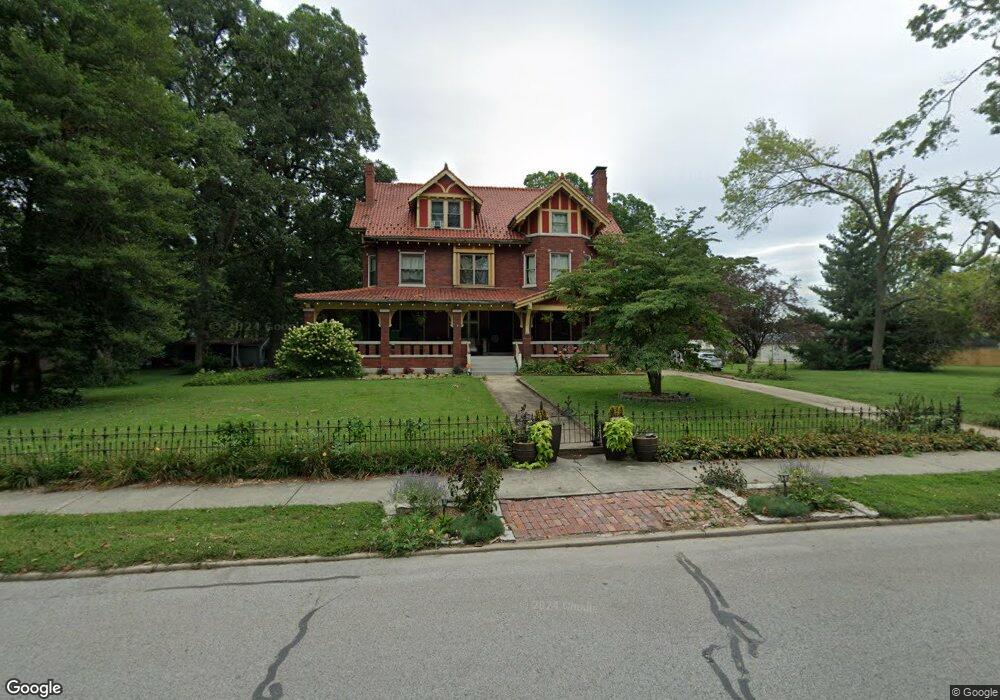
414 S Railway St Mascoutah, IL 62258
Estimated Value: $305,000 - $540,847
--
Bed
--
Bath
2,301
Sq Ft
$194/Sq Ft
Est. Value
About This Home
This home is located at 414 S Railway St, Mascoutah, IL 62258 and is currently estimated at $446,462, approximately $194 per square foot. 414 S Railway St is a home located in St. Clair County with nearby schools including Mascoutah High School and Holy Childhood of Jesus School.
Ownership History
Date
Name
Owned For
Owner Type
Purchase Details
Closed on
Apr 26, 2007
Sold by
Jenner Kyle W
Bought by
Kilgore Patrick and Kilgore Kimberly
Current Estimated Value
Home Financials for this Owner
Home Financials are based on the most recent Mortgage that was taken out on this home.
Original Mortgage
$450,000
Outstanding Balance
$274,318
Interest Rate
6.21%
Mortgage Type
Purchase Money Mortgage
Estimated Equity
$172,144
Create a Home Valuation Report for This Property
The Home Valuation Report is an in-depth analysis detailing your home's value as well as a comparison with similar homes in the area
Home Values in the Area
Average Home Value in this Area
Purchase History
| Date | Buyer | Sale Price | Title Company |
|---|---|---|---|
| Kilgore Patrick | $675,000 | Landstar Title Company |
Source: Public Records
Mortgage History
| Date | Status | Borrower | Loan Amount |
|---|---|---|---|
| Open | Kilgore Patrick | $450,000 |
Source: Public Records
Tax History Compared to Growth
Tax History
| Year | Tax Paid | Tax Assessment Tax Assessment Total Assessment is a certain percentage of the fair market value that is determined by local assessors to be the total taxable value of land and additions on the property. | Land | Improvement |
|---|---|---|---|---|
| 2024 | $12,815 | $178,484 | $17,379 | $161,105 |
| 2023 | $12,198 | $163,118 | $15,883 | $147,235 |
| 2022 | $12,057 | $148,451 | $14,455 | $133,996 |
| 2021 | $10,782 | $131,250 | $13,999 | $117,251 |
| 2020 | $10,318 | $123,114 | $13,132 | $109,982 |
| 2019 | $10,073 | $123,114 | $13,132 | $109,982 |
| 2018 | $9,856 | $119,807 | $12,779 | $107,028 |
| 2017 | $9,726 | $113,192 | $15,531 | $97,661 |
| 2016 | $9,620 | $111,564 | $15,308 | $96,256 |
| 2014 | $8,511 | $109,013 | $14,958 | $94,055 |
| 2013 | $7,512 | $107,467 | $14,746 | $92,721 |
Source: Public Records
Map
Nearby Homes
- 108 E Main St
- 118 W Green St
- 3 W Patterson St
- 57 W Patterson St
- 25 W Oak St
- 326 S 5th St
- 612 N 1st St
- 708 Mortar St
- 926 W Green St
- 500 N 9th St
- 1035 W Main St
- 1220 Winding Oaks Ln
- 633 Moorland Cir
- 1032 W Madison St
- 414 Turquoise Ct
- 330 Grant Dr
- 841 Topaz Ct
- 847 Topaz Ct
- 1205 W Madison St
- 9715 Winchester St
- 400 S Railway St
- 401 S Market St
- 415 S Railway St
- 428 S Railway St
- 425 S Railway St
- 312 S Railway St
- 409 S Railway St
- 432 S Railway St
- 432 S Railway St
- 403 S Railway St
- 422 S Market St
- 309 S Market St
- 433 S Railway St
- 102 E Phillips St
- 439 S Railway St
- 302 S Railway St
- 107 Fillmore St
- 305 S Railway St
- 440 S Railway St
- 20 E George St