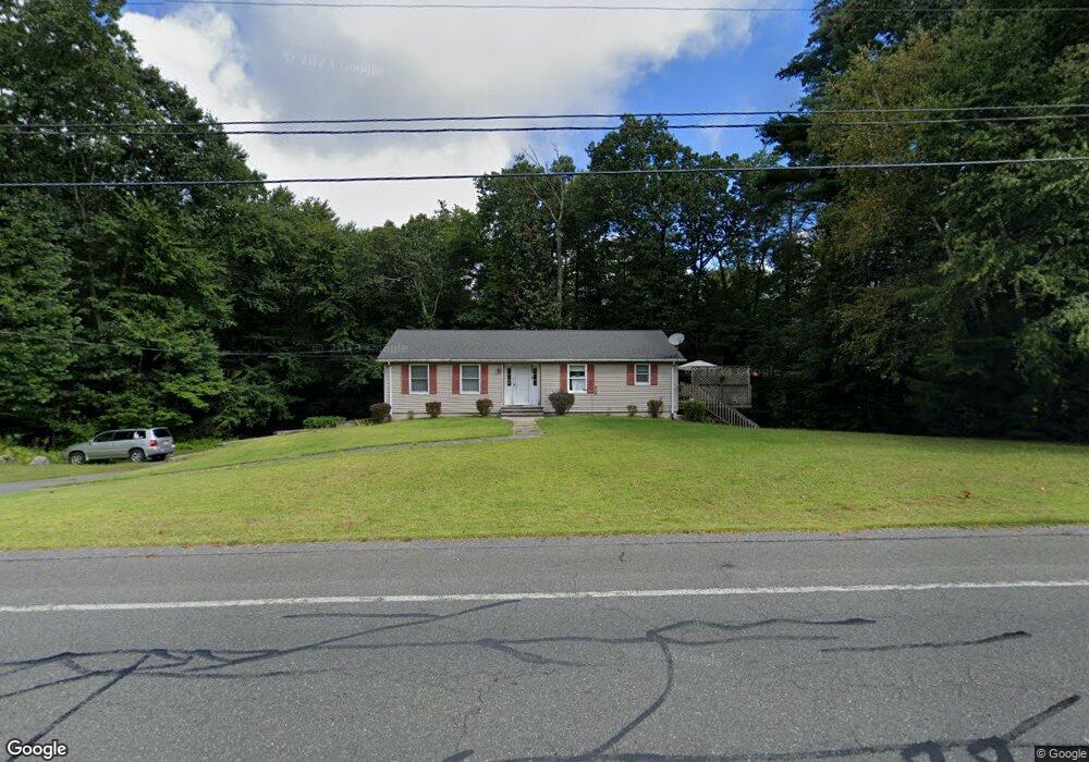
414 Springfield St Palmer, MA 01069
Estimated Value: $319,000 - $356,000
3
Beds
2
Baths
1,296
Sq Ft
$260/Sq Ft
Est. Value
About This Home
This home is located at 414 Springfield St, Palmer, MA 01069 and is currently estimated at $337,450, approximately $260 per square foot. 414 Springfield St is a home located in Hampden County with nearby schools including Old Mill Pond Elementary School, Palmer High School, and Converse Middle School.
Ownership History
Date
Name
Owned For
Owner Type
Purchase Details
Closed on
Oct 4, 1991
Sold by
Corsi Keith A and Corsi Ann M
Bought by
Shepard Patricia A
Current Estimated Value
Home Financials for this Owner
Home Financials are based on the most recent Mortgage that was taken out on this home.
Original Mortgage
$93,000
Interest Rate
9.08%
Mortgage Type
Purchase Money Mortgage
Create a Home Valuation Report for This Property
The Home Valuation Report is an in-depth analysis detailing your home's value as well as a comparison with similar homes in the area
Home Values in the Area
Average Home Value in this Area
Purchase History
| Date | Buyer | Sale Price | Title Company |
|---|---|---|---|
| Shepard Patricia A | $108,000 | -- |
Source: Public Records
Mortgage History
| Date | Status | Borrower | Loan Amount |
|---|---|---|---|
| Open | Shepard Patricia A | $11,200 | |
| Closed | Shepard Patricia A | $86,400 | |
| Closed | Shepard Patricia A | $93,000 |
Source: Public Records
Tax History
| Year | Tax Paid | Tax Assessment Tax Assessment Total Assessment is a certain percentage of the fair market value that is determined by local assessors to be the total taxable value of land and additions on the property. | Land | Improvement |
|---|---|---|---|---|
| 2025 | $5,396 | $296,000 | $71,000 | $225,000 |
| 2024 | $5,075 | $269,100 | $64,900 | $204,200 |
| 2023 | $4,950 | $251,000 | $64,900 | $186,100 |
| 2022 | $4,667 | $213,900 | $57,000 | $156,900 |
| 2021 | $4,479 | $192,400 | $63,100 | $129,300 |
| 2020 | $4,335 | $185,100 | $63,100 | $122,000 |
| 2019 | $4,239 | $185,100 | $63,100 | $122,000 |
| 2018 | $4,119 | $179,800 | $61,400 | $118,400 |
| 2017 | $4,001 | $179,800 | $61,400 | $118,400 |
| 2016 | $3,910 | $176,200 | $59,700 | $116,500 |
| 2015 | $3,762 | $176,200 | $59,700 | $116,500 |
Source: Public Records
Map
Nearby Homes
- 406 Springfield St
- 30 Red Bridge Rd Land Lot 3
- 30 Red Bridge Rd Land Lot 1
- 30 Red Bridge Rd Land Lot 6
- 30 Red Bridge Rd Land Lot 8
- 30 Red Bridge Rd Land Lot 4
- 30 Red Bridge Rd Land Lot 5
- 30 Red Bridge Rd Land Lot 7
- 10 Alden St
- 46 Kelley St
- 2022-2024 Prospect St
- 2166-2168 Main St
- 2151 Main St
- 517 S Washington St
- 105 Railroad St
- 2173 Main St
- 38 King Dr
- Lot 88 Turning Leaf Equinox Pass
- 625 Alden St
- 645 Alden St
- 410 Springfield St
- 405 Springfield St
- 407 Springfield St
- 403 Springfield St
- 389 Springfield St
- 416 Springfield St
- 426 Springfield St
- 370 Springfield St
- 430 Springfield St
- 375 Springfield St
- 449 Springfield St
- 364 Springfield St
- 361 Springfield St
- 358 Springfield St
- 450 Springfield St
- LOT 19 Ridge Rd
- L S-8 Rondeau Rd
- 352 Springfield St
- 458 Springfield St
- 14 Overlook Dr
Your Personal Tour Guide
Ask me questions while you tour the home.