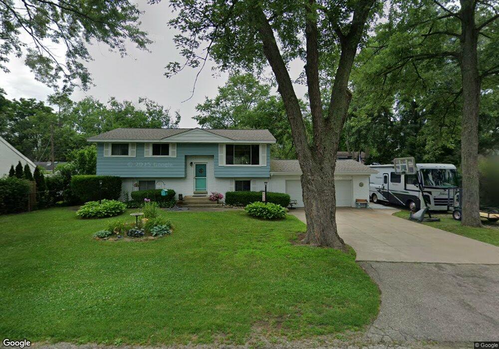
4140 Crestdale Ave West Bloomfield, MI 48323
Estimated Value: $275,949 - $324,000
3
Beds
2
Baths
1,887
Sq Ft
$158/Sq Ft
Est. Value
About This Home
This home is located at 4140 Crestdale Ave, West Bloomfield, MI 48323 and is currently estimated at $297,487, approximately $157 per square foot. 4140 Crestdale Ave is a home located in Oakland County with nearby schools including Clifford H. Smart Middle School, Walled Lake Northern High School, and Our Lady Of Refuge School.
Ownership History
Date
Name
Owned For
Owner Type
Purchase Details
Closed on
Feb 14, 2025
Sold by
Hacker Forrest
Bought by
Forrest Hacker Revocable Living Trust and Hacker
Current Estimated Value
Purchase Details
Closed on
May 21, 2024
Sold by
Hacker Forrest and Hacker Phyllis Marie
Bought by
Hacker Forrest and Hacker Phyllis Marie
Purchase Details
Closed on
Oct 10, 1996
Sold by
Gosney Gregory G
Bought by
Hacker Forrest
Home Financials for this Owner
Home Financials are based on the most recent Mortgage that was taken out on this home.
Original Mortgage
$100,000
Interest Rate
8.32%
Purchase Details
Closed on
May 1, 1989
Sold by
Gosney Joyce E
Bought by
Gosney Joyce E
Create a Home Valuation Report for This Property
The Home Valuation Report is an in-depth analysis detailing your home's value as well as a comparison with similar homes in the area
Home Values in the Area
Average Home Value in this Area
Purchase History
| Date | Buyer | Sale Price | Title Company |
|---|---|---|---|
| Forrest Hacker Revocable Living Trust | -- | None Listed On Document | |
| Forrest Hacker Revocable Living Trust | -- | None Listed On Document | |
| Hacker Forrest | -- | None Listed On Document | |
| Hacker Forrest | -- | None Listed On Document | |
| Hacker Forrest | $125,900 | -- | |
| Gosney Joyce E | -- | -- |
Source: Public Records
Mortgage History
| Date | Status | Borrower | Loan Amount |
|---|---|---|---|
| Previous Owner | Hacker Forrest | $100,000 |
Source: Public Records
Tax History Compared to Growth
Tax History
| Year | Tax Paid | Tax Assessment Tax Assessment Total Assessment is a certain percentage of the fair market value that is determined by local assessors to be the total taxable value of land and additions on the property. | Land | Improvement |
|---|---|---|---|---|
| 2024 | -- | $118,070 | $0 | $0 |
| 2022 | $0 | $96,990 | $27,050 | $69,940 |
| 2021 | $0 | $93,678 | $0 | $0 |
| 2020 | $0 | $92,010 | $27,050 | $64,960 |
| 2018 | $0 | $81,400 | $22,550 | $58,850 |
| 2015 | -- | $0 | $0 | $0 |
| 2014 | -- | $0 | $0 | $0 |
| 2011 | -- | $53,070 | $0 | $0 |
Source: Public Records
Map
Nearby Homes
- 4245 Bunker Ave
- 6978 Colony Dr
- 4212 Greendale Ave
- 4335 Crestdale Ave
- 7337 Richardson Rd
- 6903 Dandison Blvd
- 7381 Crestmore St
- 3991 Fieldview Ave
- 3965 Carrick Ave
- 4066 Green Lake Rd
- 4442 Borland St
- 3950 Bradmore Ave
- 0000 Langtoft
- 6675 Langtoft St
- 6768 Buckland Ave
- 6980 Hambro St
- 3632 Fieldview Ave
- 7369 Sweetbriar
- 7359 Woodlore Dr
- 4540 Rolling Pine Ct
- 4152 Crestdale Ave
- 4133 Bunker Ave
- 7161 Colony Dr
- 4161 Bunker Ave
- 4155 Crestdale Ave
- 7141 Colony Dr Unit Bldg-Unit
- 7141 Colony Dr
- 4170 Crestdale Ave
- 4171 Bunker Ave
- 4159 Crestdale Ave
- 7131 Colony Dr
- 4132 Bunker Ave
- 4134 Middledale Ave
- 7111 Colony Dr
- 4174 Bunker Ave
- 4165 Crestdale Ave
- 4126 Middledale Ave
- 7210 Colony Dr
- 7210 Colony Dr
- 4150 Middledale Ave