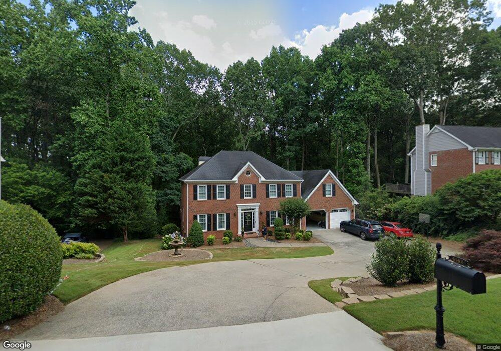
4142 Barberry Dr NE Unit 2B Roswell, GA 30075
East Cobb NeighborhoodEstimated Value: $613,000 - $703,000
4
Beds
4
Baths
2,591
Sq Ft
$252/Sq Ft
Est. Value
About This Home
This home is located at 4142 Barberry Dr NE Unit 2B, Roswell, GA 30075 and is currently estimated at $653,258, approximately $252 per square foot. 4142 Barberry Dr NE Unit 2B is a home located in Cobb County with nearby schools including Shallowford Falls Elementary School, Simpson Middle School, and Lassiter High School.
Ownership History
Date
Name
Owned For
Owner Type
Purchase Details
Closed on
Jul 31, 2018
Sold by
Steeves Calvin W
Bought by
The Steeves Family Trust
Current Estimated Value
Purchase Details
Closed on
Nov 26, 1996
Sold by
Wilson David D Lori
Bought by
Steeves Calvin W Elba L
Purchase Details
Closed on
May 27, 1994
Sold by
Phillips Larry Susan
Bought by
Wilson David D Lori
Home Financials for this Owner
Home Financials are based on the most recent Mortgage that was taken out on this home.
Original Mortgage
$166,500
Interest Rate
8.46%
Create a Home Valuation Report for This Property
The Home Valuation Report is an in-depth analysis detailing your home's value as well as a comparison with similar homes in the area
Home Values in the Area
Average Home Value in this Area
Purchase History
| Date | Buyer | Sale Price | Title Company |
|---|---|---|---|
| The Steeves Family Trust | -- | -- | |
| Steeves Calvin W Elba L | $197,000 | -- | |
| Wilson David D Lori | $185,000 | -- |
Source: Public Records
Mortgage History
| Date | Status | Borrower | Loan Amount |
|---|---|---|---|
| Previous Owner | Wilson David D Lori | $166,500 | |
| Closed | Steeves Calvin W Elba L | $0 |
Source: Public Records
Tax History Compared to Growth
Tax History
| Year | Tax Paid | Tax Assessment Tax Assessment Total Assessment is a certain percentage of the fair market value that is determined by local assessors to be the total taxable value of land and additions on the property. | Land | Improvement |
|---|---|---|---|---|
| 2025 | $1,344 | $246,332 | $52,000 | $194,332 |
| 2024 | $1,349 | $246,332 | $52,000 | $194,332 |
| 2023 | $1,043 | $213,076 | $40,800 | $172,276 |
| 2022 | $1,168 | $185,756 | $40,800 | $144,956 |
| 2021 | $1,114 | $167,716 | $38,800 | $128,916 |
| 2020 | $4,095 | $167,716 | $38,800 | $128,916 |
| 2019 | $3,818 | $155,068 | $33,600 | $121,468 |
| 2018 | $3,818 | $155,068 | $33,600 | $121,468 |
| 2017 | $3,593 | $149,740 | $33,600 | $116,140 |
| 2016 | $3,601 | $149,740 | $33,600 | $116,140 |
| 2015 | $3,099 | $124,100 | $34,800 | $89,300 |
| 2014 | $3,119 | $124,100 | $0 | $0 |
Source: Public Records
Map
Nearby Homes
- 4149 Barberry Dr NE
- 4146 Chimney Lake Dr NE
- 3988 Rock Mill Dr
- 3968 Rock Mill Dr
- 3645 Lassiter Rd
- 3262 Carriage Way
- 4220 Singing Post Ln NE
- 4150 Chimney Heights NE
- 4319 Summit Oaks Ln NE
- 3810 Galloway Dr NE
- 3701 Shallowford Rd
- 3832 Wesley Chapel Rd
- 3333 N Hembree Rd
- 3856 Fenway Crossing
- 3402 Johnson Ferry Rd NE
- 3935 Chapel Heights Dr
- 3605 Shallowford Rd
- 3741 Northpoint Dr
- 4140 Barberry Dr NE
- 4144 Barberry Dr NE
- 4159 Barberry Dr NE Unit 2B
- 4069 Bittersweet Dr NE
- 4146 Barberry Dr NE Unit 2B
- 4067 Bittersweet Dr NE Unit 2A
- 4138 Barberry Dr NE
- 4157 Barberry Dr NE
- 4155 Barberry Dr NE
- 4155 Barberry Dr NE Unit 2B
- 4078 Bittersweet Dr NE
- 4148 Barberry Dr NE Unit IIB
- 4136 Barberry Dr NE
- 4153 Barberry Dr NE Unit 2B
- 4065 Bittersweet Dr NE
- 4151 Barberry Dr NE
- 4068 Bittersweet Dr NE
- 4147 Barberry Dr NE Unit 2B
- 4150 Barberry Dr NE
- 4134 Barberry Dr NE