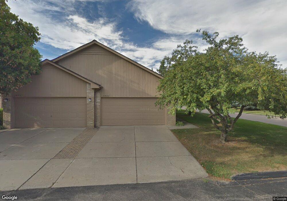
41424 Ambercrest Dr Unit 42 Sterling Heights, MI 48314
Estimated Value: $258,000 - $274,701
2
Beds
2
Baths
1,094
Sq Ft
$243/Sq Ft
Est. Value
About This Home
This home is located at 41424 Ambercrest Dr Unit 42, Sterling Heights, MI 48314 and is currently estimated at $266,175, approximately $243 per square foot. 41424 Ambercrest Dr Unit 42 is a home located in Macomb County with nearby schools including Schuchard Elementary School, Frank Jeannette Junior High School, and Adlai Stevenson High School.
Ownership History
Date
Name
Owned For
Owner Type
Purchase Details
Closed on
Dec 3, 2024
Sold by
Naik Aniket and Naik Sakshi
Bought by
Savaya Janan
Current Estimated Value
Purchase Details
Closed on
Sep 16, 2022
Sold by
Lynn Eklund
Bought by
Naik Aniket and Naik Sakshi
Home Financials for this Owner
Home Financials are based on the most recent Mortgage that was taken out on this home.
Original Mortgage
$221,160
Interest Rate
5.22%
Mortgage Type
New Conventional
Purchase Details
Closed on
Sep 12, 2017
Sold by
Rossio James S and Ann B Rossio Trust
Bought by
Eklund Lynn
Purchase Details
Closed on
Apr 27, 2007
Sold by
Rossio Ann B and Rossio John C
Bought by
Rossio Anna B and Anna B Rossio Trust
Create a Home Valuation Report for This Property
The Home Valuation Report is an in-depth analysis detailing your home's value as well as a comparison with similar homes in the area
Home Values in the Area
Average Home Value in this Area
Purchase History
| Date | Buyer | Sale Price | Title Company |
|---|---|---|---|
| Savaya Janan | $262,000 | Liberty Title | |
| Naik Aniket | $228,000 | -- | |
| Eklund Lynn | $150,000 | Lighthouse Title Inc | |
| Rossio Anna B | -- | None Available |
Source: Public Records
Mortgage History
| Date | Status | Borrower | Loan Amount |
|---|---|---|---|
| Previous Owner | Naik Aniket | $221,160 |
Source: Public Records
Tax History Compared to Growth
Tax History
| Year | Tax Paid | Tax Assessment Tax Assessment Total Assessment is a certain percentage of the fair market value that is determined by local assessors to be the total taxable value of land and additions on the property. | Land | Improvement |
|---|---|---|---|---|
| 2025 | $4,588 | $127,000 | $0 | $0 |
| 2024 | $4,195 | $119,500 | $0 | $0 |
| 2023 | $3,960 | $113,700 | $0 | $0 |
| 2022 | $3,034 | $94,700 | $0 | $0 |
| 2021 | $2,971 | $85,600 | $0 | $0 |
| 2020 | $2,650 | $80,600 | $0 | $0 |
| 2019 | $1,511 | $75,600 | $0 | $0 |
| 2018 | $2,644 | $69,900 | $0 | $0 |
| 2017 | $1,564 | $69,200 | $7,500 | $61,700 |
| 2016 | $1,511 | $69,200 | $0 | $0 |
| 2015 | -- | $68,500 | $0 | $0 |
| 2014 | -- | $40,700 | $0 | $0 |
Source: Public Records
Map
Nearby Homes
- 2336 Heritage Pointe Dr Unit 17
- 41395 Ambercrest Dr
- 41466 Dequindre Rd
- 41599 Red Oak Dr
- 41659 Touchstone Dr
- 5238 Windmill Dr
- 2111 Beyer Ln
- 42192 Dequindre Rd
- 2698 Willard Dr
- 5092 Julian Dr
- 2741 Denise Dr
- 2700 Renshaw Dr
- 3550 Kirkton Dr
- 3715 Knightbridge Cir
- 5208 Crowfoot Dr
- 42739 Pond View Dr
- 2684 Coral Dr
- 1917 Ravenhill Dr
- 4714 Butler Dr
- 5761 Bingham Dr
- 41410 Ambercrest Dr
- 41402 Ambercrest Dr Unit 39
- 41410 Ambercrest Dr Unit 40
- 2258 Heritage
- 41416 Ambercrest Dr Unit H41
- 41302 Ambercrest Dr
- 41302 Ambercrest Dr Unit 1 Bldg 10
- 41302 Ambercrest Dr Unit 1
- 2226 Heritage Pointe Dr
- 2218 Heritage Pointe Dr
- 2210 Heritage Pointe Dr
- 2202 Heritage Pointe Dr Unit 7
- 2226 Heritage Pointe Dr Unit 10
- 41423 Ambercrest Dr
- 41431 Ambercrest Dr Unit 60
- 41435 Ambercrest Dr Unit 59
- 41447 Ambercrest Dr
- 41455 Ambercrest Dr
- 41423 Ambercrest Dr Unit 3
- 41455 Ambercrest Dr Unit 57