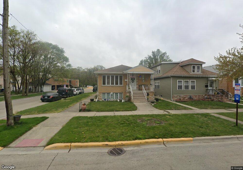
4144 Maple Ave Berwyn, IL 60402
Estimated Value: $301,153 - $346,000
3
Beds
2
Baths
1,272
Sq Ft
$254/Sq Ft
Est. Value
About This Home
This home is located at 4144 Maple Ave, Berwyn, IL 60402 and is currently estimated at $323,538, approximately $254 per square foot. 4144 Maple Ave is a home located in Cook County with nearby schools including Home Elementary School, George Washington Middle School, and J. Sterling Morton High School West.
Ownership History
Date
Name
Owned For
Owner Type
Purchase Details
Closed on
Jan 4, 2007
Sold by
Barnes Ronald E
Bought by
Hansen Dennis M and Hansen Shirley A
Current Estimated Value
Home Financials for this Owner
Home Financials are based on the most recent Mortgage that was taken out on this home.
Original Mortgage
$256,500
Outstanding Balance
$166,828
Interest Rate
8.15%
Mortgage Type
Unknown
Estimated Equity
$156,710
Purchase Details
Closed on
Apr 30, 1999
Sold by
Lewandowski Allan E and Lewandowski Peggy J
Bought by
Barnes Ronald E
Home Financials for this Owner
Home Financials are based on the most recent Mortgage that was taken out on this home.
Original Mortgage
$137,250
Interest Rate
7.04%
Create a Home Valuation Report for This Property
The Home Valuation Report is an in-depth analysis detailing your home's value as well as a comparison with similar homes in the area
Home Values in the Area
Average Home Value in this Area
Purchase History
| Date | Buyer | Sale Price | Title Company |
|---|---|---|---|
| Hansen Dennis M | $270,000 | Multiple | |
| Barnes Ronald E | $141,500 | -- |
Source: Public Records
Mortgage History
| Date | Status | Borrower | Loan Amount |
|---|---|---|---|
| Open | Hansen Dennis M | $256,500 | |
| Previous Owner | Barnes Ronald E | $137,250 |
Source: Public Records
Tax History
| Year | Tax Paid | Tax Assessment Tax Assessment Total Assessment is a certain percentage of the fair market value that is determined by local assessors to be the total taxable value of land and additions on the property. | Land | Improvement |
|---|---|---|---|---|
| 2025 | $5,345 | $22,000 | $3,891 | $18,109 |
| 2024 | $5,345 | $22,000 | $3,891 | $18,109 |
| 2023 | $4,814 | $22,000 | $3,891 | $18,109 |
| 2022 | $4,814 | $18,286 | $3,350 | $14,936 |
| 2021 | $4,723 | $18,285 | $3,350 | $14,935 |
| 2020 | $4,796 | $18,285 | $3,350 | $14,935 |
| 2019 | $4,439 | $16,539 | $3,026 | $13,513 |
| 2018 | $4,329 | $16,539 | $3,026 | $13,513 |
| 2017 | $4,251 | $16,539 | $3,026 | $13,513 |
| 2016 | $3,884 | $13,133 | $2,485 | $10,648 |
| 2015 | $3,669 | $13,133 | $2,485 | $10,648 |
| 2014 | $3,605 | $13,133 | $2,485 | $10,648 |
| 2013 | $3,132 | $12,712 | $2,485 | $10,227 |
Source: Public Records
Map
Nearby Homes
- 4115 S Harlem Ave Unit GE
- 4105 Maple Ave
- 4215 S Harlem Ave Unit 3
- 4215 S Harlem Ave Unit 8
- 7120 41st St
- 4122 Wenonah Ave
- 4235 S Harlem Ave
- 4109 Wenonah Ave
- 4312 Wenonah Ave
- 4327 Wenonah Ave
- 7316 40th St Unit 2E
- 7316 40th St Unit P-9
- 7316 40th St Unit P-10
- 7316 40th St Unit P-13
- 7335 Oakwood Ave Unit P-10
- 7335 Oakwood Ave Unit P-12
- 7335 Oakwood Ave Unit P-8
- 7335 Oakwood Ave Unit P-11
- 7335 Oakwood Ave Unit P-14
- 3900 Home Ave
Your Personal Tour Guide
Ask me questions while you tour the home.