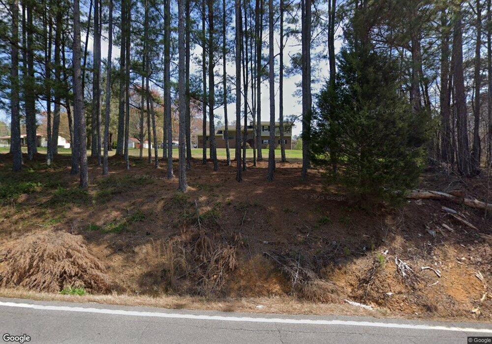
4145 Highway 95 Rock Spring, GA 30739
Rock Spring NeighborhoodEstimated Value: $290,081 - $427,000
--
Bed
2
Baths
1,441
Sq Ft
$241/Sq Ft
Est. Value
About This Home
This home is located at 4145 Highway 95, Rock Spring, GA 30739 and is currently estimated at $347,360, approximately $241 per square foot. 4145 Highway 95 is a home located in Walker County with nearby schools including Rock Spring Elementary School, Lafayette High School, and Alice M Daley Adventist School.
Ownership History
Date
Name
Owned For
Owner Type
Purchase Details
Closed on
Jun 16, 1978
Sold by
Lockman Lockman T and Lockman Glenda
Bought by
Oliver Dewey A and Oliver Valinda
Current Estimated Value
Purchase Details
Closed on
Jan 22, 1974
Sold by
Williams Gordon
Bought by
Lockman Lockman T and Lockman Glenda
Purchase Details
Closed on
Jan 1, 1968
Bought by
Williams Gordon
Create a Home Valuation Report for This Property
The Home Valuation Report is an in-depth analysis detailing your home's value as well as a comparison with similar homes in the area
Home Values in the Area
Average Home Value in this Area
Purchase History
| Date | Buyer | Sale Price | Title Company |
|---|---|---|---|
| Oliver Dewey A | $65,000 | -- | |
| Lockman Lockman T | -- | -- | |
| Williams Gordon | -- | -- |
Source: Public Records
Tax History Compared to Growth
Tax History
| Year | Tax Paid | Tax Assessment Tax Assessment Total Assessment is a certain percentage of the fair market value that is determined by local assessors to be the total taxable value of land and additions on the property. | Land | Improvement |
|---|---|---|---|---|
| 2024 | $211 | $121,504 | $24,310 | $97,194 |
| 2023 | $210 | $111,682 | $19,293 | $92,389 |
| 2022 | $798 | $99,719 | $19,527 | $80,192 |
| 2021 | $522 | $81,519 | $19,527 | $61,992 |
| 2020 | $388 | $73,821 | $19,527 | $54,294 |
| 2019 | $388 | $73,821 | $19,527 | $54,294 |
| 2018 | $1,437 | $54,296 | $19,527 | $34,769 |
| 2017 | $339 | $54,296 | $19,527 | $34,769 |
| 2016 | $134 | $54,296 | $19,527 | $34,769 |
| 2015 | $185 | $62,892 | $16,764 | $46,128 |
| 2014 | $1,601 | $62,892 | $16,764 | $46,128 |
| 2013 | -- | $62,892 | $16,764 | $46,128 |
Source: Public Records
Map
Nearby Homes
- 0 Tarvin Rd Unit 1523862
- 0 Clyde Byrd Rd
- 5062 Georgia 95
- 533 Van Dell Dr
- 23 Oak Meadow Dr
- 58 Oak Run
- 106 Meadow Oak Dr
- 201 Van Dell Dr
- 1314 Mcintire Rd
- 1585 E Reed Rd
- 287 E Teems Rd
- 200 Ash Ln
- 1186 E Reed Rd
- 57 McGaha Rd
- 0 Georgia 95
- 76 Side Kick Ln
- 1052 Huffman Rd
- 524 E Teems Rd
- 0 Temperance Hall Rd Unit 10506446
- 0 Temperance Hall Rd Unit 1510568
- 4143 Highway 95 Unit 4143 & 4113
- 4143 Highway 95
- 4113 Highway 95
- 4113 Georgia 95
- 4264 Highway 95
- 4065 Georgia 95
- 4065 Highway 95
- 71 Midway Dr Unit OAK
- 4029 Highway 95
- 55 Colbert Hollow Rd
- 4238 Highway 95
- 4238 Highway 95
- 4138 Highway 95
- 4244 Highway 95
- 00 Colbert Hollow Rd
- 0 Colbert Hollow Rd
- 0 Colbert Hollow Rd Unit 1157035
- 0 Colbert Hollow Rd Unit 1157036
- 0 Colbert Hollow Rd Unit 1136718
- 0 Colbert Hollow Rd Unit 1136714
