Estimated Value: $258,000 - $296,000
3
Beds
1
Bath
1,432
Sq Ft
$191/Sq Ft
Est. Value
About This Home
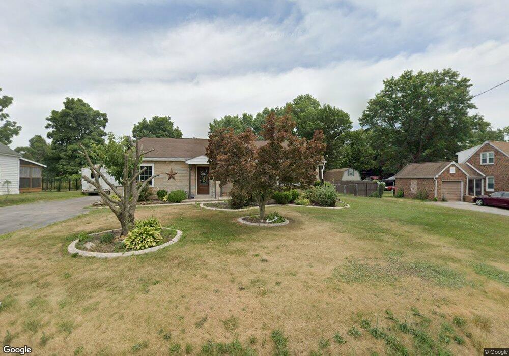
This home is located at 4145 Lewisberry Rd, York, PA 17404 and is currently estimated at $273,896, approximately $191 per square foot. 4145 Lewisberry Rd is a home located in York County with nearby schools including Northeastern Senior High School and Bible Baptist Christian Academy.
Ownership History
Date
Name
Owned For
Owner Type
Purchase Details
Closed on
May 19, 2005
Sold by
Keeney Lonnie R and Keeney Denise M
Bought by
Melhorn Michael E and Melhorn Denise A
Current Estimated Value
Home Financials for this Owner
Home Financials are based on the most recent Mortgage that was taken out on this home.
Original Mortgage
$134,550
Outstanding Balance
$70,650
Interest Rate
5.95%
Mortgage Type
Fannie Mae Freddie Mac
Estimated Equity
$203,246
Purchase Details
Closed on
Nov 24, 1986
Bought by
Keeney Lonnie R and Keeney Denise M
Create a Home Valuation Report for This Property
The Home Valuation Report is an in-depth analysis detailing your home's value as well as a comparison with similar homes in the area
Home Values in the Area
Average Home Value in this Area
Purchase History
| Date | Buyer | Sale Price | Title Company |
|---|---|---|---|
| Melhorn Michael E | $149,500 | -- | |
| Keeney Lonnie R | $64,000 | -- |
Source: Public Records
Mortgage History
| Date | Status | Borrower | Loan Amount |
|---|---|---|---|
| Open | Melhorn Michael E | $134,550 |
Source: Public Records
Tax History Compared to Growth
Tax History
| Year | Tax Paid | Tax Assessment Tax Assessment Total Assessment is a certain percentage of the fair market value that is determined by local assessors to be the total taxable value of land and additions on the property. | Land | Improvement |
|---|---|---|---|---|
| 2025 | $3,914 | $108,900 | $39,330 | $69,570 |
| 2024 | $3,826 | $108,900 | $39,330 | $69,570 |
| 2023 | $3,826 | $108,900 | $39,330 | $69,570 |
| 2022 | $3,802 | $108,900 | $39,330 | $69,570 |
| 2021 | $3,697 | $108,900 | $39,330 | $69,570 |
| 2020 | $3,697 | $108,900 | $39,330 | $69,570 |
| 2019 | $3,648 | $108,900 | $39,330 | $69,570 |
| 2018 | $3,631 | $108,900 | $39,330 | $69,570 |
| 2017 | $3,631 | $108,900 | $39,330 | $69,570 |
| 2016 | $0 | $108,900 | $39,330 | $69,570 |
| 2015 | -- | $108,900 | $39,330 | $69,570 |
| 2014 | -- | $108,900 | $39,330 | $69,570 |
Source: Public Records
Map
Nearby Homes
- 130 Locust Run Dr
- 225 E Canal Rd
- 1050 Matthew Dr
- 435 Fisher Dr
- 365 Fisher Dr
- 40 Heather Way
- 240 Fisher Dr
- 514 Darrow Rd
- 85 Thomas Dr
- 273 Copenhaffer Rd
- Woodford Plan at Welbourne Reserve
- Sebastian Plan at Welbourne Reserve
- Covington Plan at Welbourne Reserve
- Parker Plan at Welbourne Reserve
- Lachlan Plan at Welbourne Reserve
- Harrison Plan at Welbourne Reserve
- Augusta Plan at Welbourne Reserve
- Magnolia Plan at Welbourne Reserve
- Arcadia Plan at Welbourne Reserve
- Andrews Plan at Welbourne Reserve
- 4185 Lewisberry Rd
- 4185 Lewisberry Rd
- 4185 Lewisberry Rd Unit 2
- 4135 Lewisberry Rd
- site 999 Lewisberry Rd Unit 240
- 4160 Lewisberry Rd
- 4125 Lewisberry Rd
- 4140 Lewisberry Rd
- 4115 Lewisberry Rd
- Lot 2 - 41 Lewisberry Rd
- 4180 Lewisberry Rd
- 4095 Lewisberry Rd
- 565 Locust Run Dr
- 635 Locust Run Dr
- 625 Locust Run Dr
- 615 Locust Run Dr
- 545 Locust Run Dr
- 645 Locust Run Dr
- 535 Locust Run Dr
- 525 Locust Run Dr