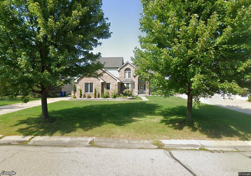
41452 Singh Dr Canton, MI 48188
Estimated Value: $569,214 - $594,000
Studio
3
Baths
2,993
Sq Ft
$194/Sq Ft
Est. Value
About This Home
This home is located at 41452 Singh Dr, Canton, MI 48188 and is currently estimated at $581,304, approximately $194 per square foot. 41452 Singh Dr is a home located in Wayne County with nearby schools including Canton High School, Salem High School, and Plymouth High School.
Ownership History
Date
Name
Owned For
Owner Type
Purchase Details
Closed on
May 17, 2021
Sold by
Alsharifi Maitham and Alsharifi Luna
Bought by
Sobh Lama and Sobh Hussein
Current Estimated Value
Home Financials for this Owner
Home Financials are based on the most recent Mortgage that was taken out on this home.
Original Mortgage
$230,000
Outstanding Balance
$191,487
Interest Rate
3.1%
Mortgage Type
New Conventional
Estimated Equity
$389,817
Purchase Details
Closed on
May 24, 2005
Sold by
Luma Building Co Inc
Bought by
Alsharifi Maitham
Purchase Details
Closed on
Aug 27, 2004
Sold by
Luma M & R Building Llc
Bought by
Luma Building Co Inc
Home Financials for this Owner
Home Financials are based on the most recent Mortgage that was taken out on this home.
Original Mortgage
$289,900
Interest Rate
5.95%
Mortgage Type
Construction
Purchase Details
Closed on
Jan 18, 2001
Sold by
Woodcreek Singh Of
Bought by
Luma M & R Building
Create a Home Valuation Report for This Property
The Home Valuation Report is an in-depth analysis detailing your home's value as well as a comparison with similar homes in the area
Home Values in the Area
Average Home Value in this Area
Purchase History
| Date | Buyer | Sale Price | Title Company |
|---|---|---|---|
| Sobh Lama | $460,000 | Title One Inc | |
| Alsharifi Maitham | $386,650 | Blue Water Title Company | |
| Luma Building Co Inc | -- | Blue Water Title | |
| Luma M & R Building | $56,000 | -- |
Source: Public Records
Mortgage History
| Date | Status | Borrower | Loan Amount |
|---|---|---|---|
| Open | Sobh Lama | $230,000 | |
| Previous Owner | Luma Building Co Inc | $289,900 |
Source: Public Records
Tax History
| Year | Tax Paid | Tax Assessment Tax Assessment Total Assessment is a certain percentage of the fair market value that is determined by local assessors to be the total taxable value of land and additions on the property. | Land | Improvement |
|---|---|---|---|---|
| 2025 | $4,606 | $271,000 | $0 | $0 |
| 2024 | $4,475 | $272,600 | $0 | $0 |
| 2023 | $4,267 | $252,000 | $0 | $0 |
| 2022 | $9,098 | $223,200 | $0 | $0 |
| 2021 | $7,023 | $212,100 | $0 | $0 |
| 2020 | $9,984 | $212,700 | $0 | $0 |
| 2019 | $9,799 | $197,410 | $0 | $0 |
| 2018 | $2,841 | $190,280 | $0 | $0 |
| 2017 | $6,840 | $188,400 | $0 | $0 |
| 2016 | $6,171 | $191,700 | $0 | $0 |
| 2015 | $15,612 | $172,720 | $0 | $0 |
| 2013 | $15,499 | $162,670 | $0 | $0 |
| 2010 | -- | $147,840 | $58,509 | $89,331 |
Source: Public Records
Map
Nearby Homes
- 2435 S Haggerty Rd
- 1878 Otter Pond Ln
- 2463 Arcadia Dr
- 2340 S Lilley Rd
- 1890 Cedar Valley Dr Unit 38
- 2087 Arcadia Dr Unit 65
- 1803 Pinecroft Dr Unit 171
- 41925 South Dr
- 2393 Arcadia Dr
- 000 S Lotz Rd
- 41878 Woodbrook Dr
- 2006 S Lilley Rd
- 3761 Park Creek Ln
- 1381 Hampshire Dr
- 1402 Heritage Dr
- 41275 Old Michigan Ave
- 40049 Rolling Green Ct
- 2087 Fairway Cir Unit 63
- 2112 E Roundtable Dr
- 42264 Chase Dr
- 41478 Singh Dr
- 41426 Singh Dr
- 2649 Woodsboro Ct
- 2372 Monument Ln
- 41530 Singh Dr
- 41517 Singh Dr
- 2659 Woodsboro Ct
- 41556 Singh Dr
- 41543 Singh Dr
- 2669 Woodsboro Ct
- 2660 Woodsboro Ct
- 41569 Singh Dr
- 41582 Singh Dr
- 2621 S Haggerty Rd
- 2670 Woodsboro Ct
- 41595 Singh Dr
- 2661 Emily Ct
- 41608 Singh Dr
- 41634 Singh Dr
- 2671 Emily Ct
Your Personal Tour Guide
Ask me questions while you tour the home.