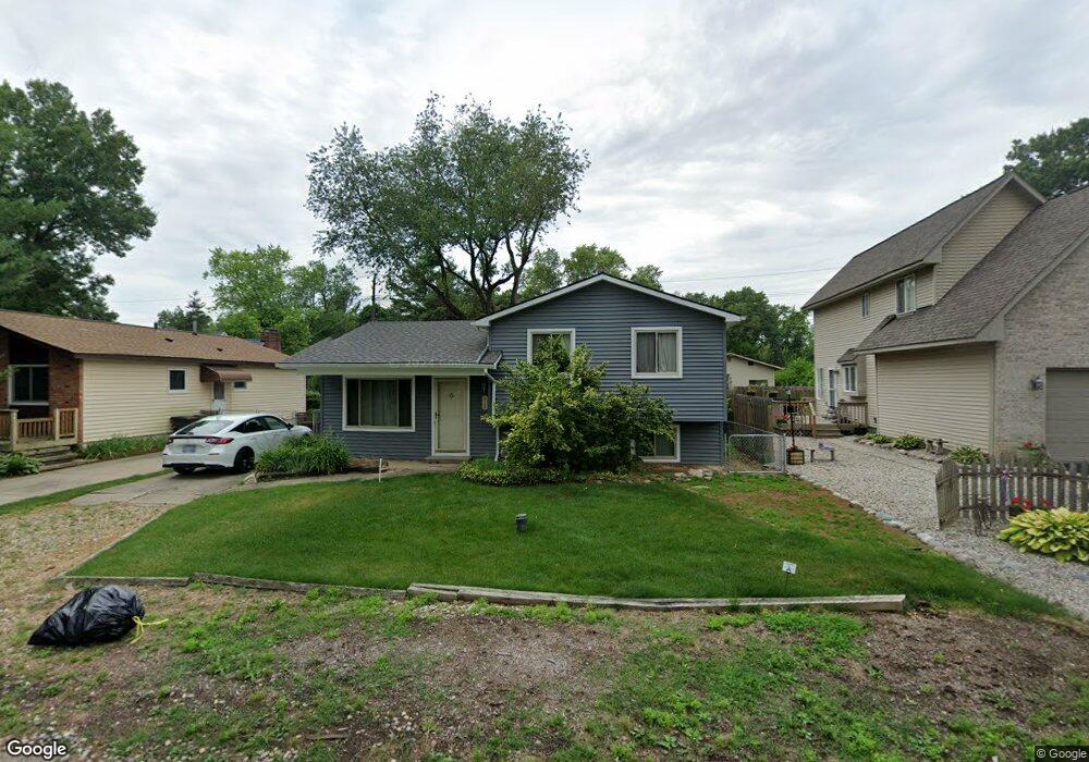
4148 Crooks St West Bloomfield, MI 48323
Estimated Value: $246,029 - $265,000
3
Beds
1
Bath
1,384
Sq Ft
$186/Sq Ft
Est. Value
About This Home
This home is located at 4148 Crooks St, West Bloomfield, MI 48323 and is currently estimated at $257,507, approximately $186 per square foot. 4148 Crooks St is a home located in Oakland County with nearby schools including Walled Lake Central High School, St. Matthew Lutheran School, and St. William School.
Ownership History
Date
Name
Owned For
Owner Type
Purchase Details
Closed on
Oct 12, 2005
Sold by
Usitalo Suzette and Usitalo Eric
Bought by
Somberg Julie
Current Estimated Value
Home Financials for this Owner
Home Financials are based on the most recent Mortgage that was taken out on this home.
Original Mortgage
$35,400
Interest Rate
5.8%
Mortgage Type
Stand Alone Second
Purchase Details
Closed on
Feb 12, 1998
Sold by
Mangin William
Bought by
Dobis Suzette
Home Financials for this Owner
Home Financials are based on the most recent Mortgage that was taken out on this home.
Original Mortgage
$108,500
Interest Rate
6.95%
Create a Home Valuation Report for This Property
The Home Valuation Report is an in-depth analysis detailing your home's value as well as a comparison with similar homes in the area
Home Values in the Area
Average Home Value in this Area
Purchase History
| Date | Buyer | Sale Price | Title Company |
|---|---|---|---|
| Somberg Julie | $177,000 | Multiple | |
| Dobis Suzette | $118,500 | -- |
Source: Public Records
Mortgage History
| Date | Status | Borrower | Loan Amount |
|---|---|---|---|
| Closed | Somberg Julie | $35,400 | |
| Open | Somberg Julie | $141,600 | |
| Previous Owner | Dobis Suzette | $108,500 |
Source: Public Records
Tax History Compared to Growth
Tax History
| Year | Tax Paid | Tax Assessment Tax Assessment Total Assessment is a certain percentage of the fair market value that is determined by local assessors to be the total taxable value of land and additions on the property. | Land | Improvement |
|---|---|---|---|---|
| 2024 | $1,885 | $88,370 | $0 | $0 |
| 2022 | $1,786 | $81,060 | $24,350 | $56,710 |
| 2021 | $2,679 | $74,870 | $0 | $0 |
| 2020 | $1,646 | $74,030 | $24,350 | $49,680 |
| 2018 | $2,211 | $67,830 | $20,980 | $46,850 |
| 2015 | -- | $52,020 | $0 | $0 |
| 2014 | -- | $47,200 | $0 | $0 |
| 2011 | -- | $42,230 | $0 | $0 |
Source: Public Records
Map
Nearby Homes
- 7381 Crestmore St
- 7969 Richardson Rd
- 7337 Richardson Rd
- 4212 Greendale Ave
- 7359 Woodlore Dr
- 4245 Bunker Ave
- 4335 Crestdale Ave
- 6978 Colony Dr
- 7369 Sweetbriar
- 7555 Windgate Cir
- 1047 Addison Cir
- 103 Addison Cir
- 6903 Dandison Blvd
- 6980 Hambro St
- 3991 Fieldview Ave
- 4442 Borland St
- 7841 Trailside Ct
- 3965 Carrick Ave
- 7146 Arrowood Dr
- 4066 Green Lake Rd