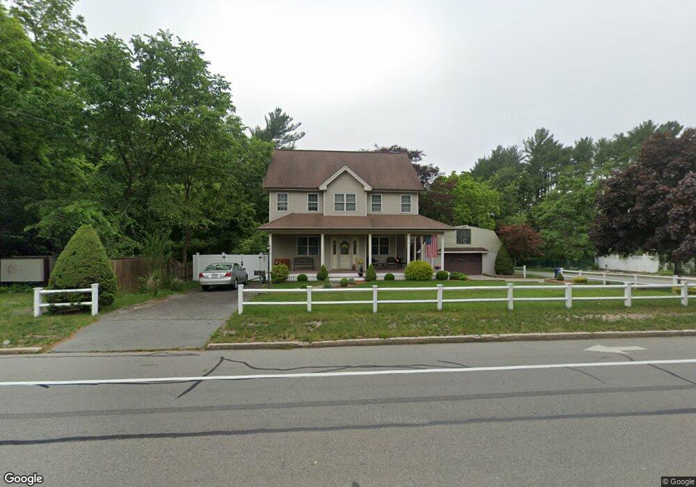
4149 Acushnet Ave New Bedford, MA 02745
Estimated Value: $525,000 - $572,000
3
Beds
3
Baths
1,619
Sq Ft
$335/Sq Ft
Est. Value
About This Home
This home is located at 4149 Acushnet Ave, New Bedford, MA 02745 and is currently estimated at $541,744, approximately $334 per square foot. 4149 Acushnet Ave is a home located in Bristol County with nearby schools including Casimir Pulaski Elementary School, Normandin Middle School, and New Bedford High School.
Ownership History
Date
Name
Owned For
Owner Type
Purchase Details
Closed on
Jan 5, 1988
Sold by
Burke Kathryn J
Bought by
Halle Gerald A
Current Estimated Value
Create a Home Valuation Report for This Property
The Home Valuation Report is an in-depth analysis detailing your home's value as well as a comparison with similar homes in the area
Home Values in the Area
Average Home Value in this Area
Purchase History
| Date | Buyer | Sale Price | Title Company |
|---|---|---|---|
| Halle Gerald A | $92,000 | -- |
Source: Public Records
Mortgage History
| Date | Status | Borrower | Loan Amount |
|---|---|---|---|
| Open | Halle Gerald A | $96,000 | |
| Previous Owner | Halle Gerald A | $42,000 | |
| Closed | Halle Gerald A | $0 |
Source: Public Records
Tax History Compared to Growth
Tax History
| Year | Tax Paid | Tax Assessment Tax Assessment Total Assessment is a certain percentage of the fair market value that is determined by local assessors to be the total taxable value of land and additions on the property. | Land | Improvement |
|---|---|---|---|---|
| 2025 | $5,632 | $498,000 | $140,700 | $357,300 |
| 2024 | $5,544 | $462,000 | $153,100 | $308,900 |
| 2023 | $6,002 | $420,000 | $123,100 | $296,900 |
| 2022 | $5,388 | $357,500 | $114,400 | $243,100 |
| 2021 | $0 | $345,600 | $114,400 | $231,200 |
| 2020 | $5,318 | $329,100 | $114,400 | $214,700 |
| 2019 | $5,201 | $315,800 | $110,000 | $205,800 |
| 2018 | $1,946 | $289,600 | $110,000 | $179,600 |
| 2017 | $1,910 | $277,300 | $107,800 | $169,500 |
| 2016 | $4,492 | $272,400 | $105,600 | $166,800 |
| 2015 | $4,173 | $265,300 | $101,200 | $164,100 |
| 2014 | $3,978 | $262,400 | $99,000 | $163,400 |
Source: Public Records
Map
Nearby Homes
- 1069 Cherokee St
- 64 Blaze Rd
- 26 Blueberry Dr
- 16 Swallow St
- 34 Poplar Rd
- 13 Luscomb Ln
- 210 Heritage Dr
- 1063 Westgate St
- SS Charbonneau Ln
- 145 Heritage Dr
- 2 Woodland Rd
- 1573 Braley Rd Unit 39
- 4597 Acushnet Ave
- 62 Longview Rd
- 1599 Braley Rd Unit 68
- ES Phillips Rd
- 8 Holly Tree Ln
- 700 Pine Hill Dr
- 888 Hillcrest Rd
- 12 Randall St
- lot 4 Jordan
- 20 Jordan St
- 4155 Acushnet Ave
- 4148 Acushnet Ave
- 4144 Acushnet Ave
- 4162 Acushnet Ave
- 4167 Acushnet Ave
- 1014 Pequot St
- 4179 Acushnet Ave
- 4125 Acushnet Ave
- 989 Manila St
- 00 Bismark Meadows Rd
- 4174 Acushnet Ave
- 3 Pequot St
- 4176 Acushnet Ave
- 0 Bismark St
- 1030 Pequot St Unit 1032
- 1030-1032 Pequot St
- 4115 Acushnet Ave
- 4189 Acushnet Ave