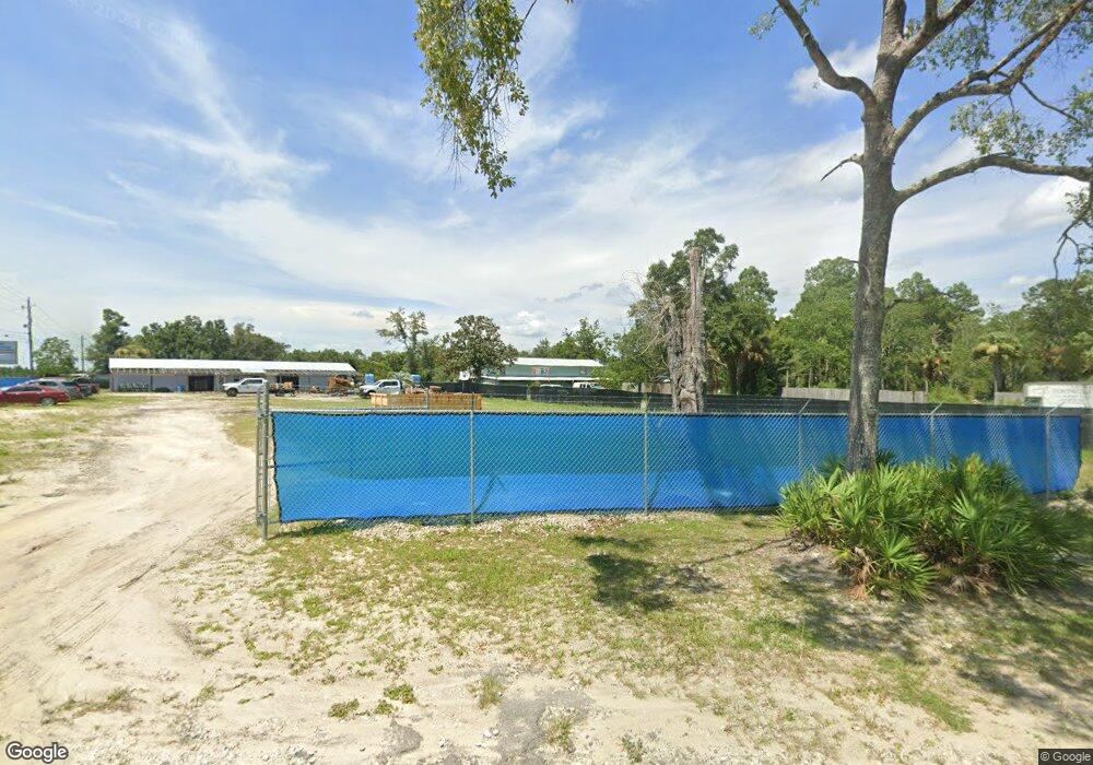
415 Annie Lee Brock Rd Southport, FL 32409
Estimated Value: $410,184
--
Bed
--
Bath
2,304
Sq Ft
$178/Sq Ft
Est. Value
About This Home
This home is located at 415 Annie Lee Brock Rd, Southport, FL 32409 and is currently estimated at $410,184, approximately $178 per square foot. 415 Annie Lee Brock Rd is a home located in Bay County with nearby schools including Deane Bozeman School.
Ownership History
Date
Name
Owned For
Owner Type
Purchase Details
Closed on
Jan 24, 2025
Sold by
Elsayed Ahmed and Aboushanab Nourham
Bought by
415 Annie Lee Brock Llc
Current Estimated Value
Purchase Details
Closed on
Feb 3, 2020
Sold by
Koll Georg
Bought by
Cherry Tammy
Home Financials for this Owner
Home Financials are based on the most recent Mortgage that was taken out on this home.
Original Mortgage
$620,000
Interest Rate
3.7%
Mortgage Type
Seller Take Back
Purchase Details
Closed on
May 23, 2019
Sold by
Koll Georg
Bought by
Elsaved Ahmed and Aboushanab Nourham
Home Financials for this Owner
Home Financials are based on the most recent Mortgage that was taken out on this home.
Original Mortgage
$204,000
Interest Rate
4.1%
Mortgage Type
Commercial
Create a Home Valuation Report for This Property
The Home Valuation Report is an in-depth analysis detailing your home's value as well as a comparison with similar homes in the area
Home Values in the Area
Average Home Value in this Area
Purchase History
| Date | Buyer | Sale Price | Title Company |
|---|---|---|---|
| 415 Annie Lee Brock Llc | $400,000 | Equitable Title Of Dr Phillips | |
| Cherry Tammy | $650,000 | First International Ttl Inc | |
| Elsaved Ahmed | $300,000 | Mti Title Insurance Agcy Inc |
Source: Public Records
Mortgage History
| Date | Status | Borrower | Loan Amount |
|---|---|---|---|
| Previous Owner | Cherry Tammy | $620,000 | |
| Previous Owner | Elsaved Ahmed | $204,000 |
Source: Public Records
Tax History Compared to Growth
Tax History
| Year | Tax Paid | Tax Assessment Tax Assessment Total Assessment is a certain percentage of the fair market value that is determined by local assessors to be the total taxable value of land and additions on the property. | Land | Improvement |
|---|---|---|---|---|
| 2024 | $1,347 | $100,755 | -- | -- |
| 2023 | $1,347 | $91,595 | $25,000 | $66,595 |
| 2022 | $1,266 | $92,311 | $25,000 | $67,311 |
| 2021 | $1,264 | $89,447 | $25,000 | $64,447 |
| 2020 | $1,283 | $90,163 | $25,000 | $65,163 |
| 2019 | $970 | $80,879 | $15,000 | $65,879 |
Source: Public Records
Map
Nearby Homes
- 11902 Highway 77
- 11902 Hwy 77
- 11802 Highway 77
- 440 Skunk Valley Rd
- 000 Hwy 77
- 211 Skunk Valley Rd
- 11432 Highway 77
- 114 Lake Merial Trail
- 116 Lake Merial Trail
- 104 Lake Merial Trail
- 160 Lake Merial Blvd
- 158 Lake Merial Blvd
- 154 Lake Merial Blvd
- 109 Lake Merial Trail
- 12827 Lake Merial Strand Dr
- 12819 Lake Merial Strand Dr
- 105 Lake Merial Trail
- 130 Lake Merial Blvd
- Navarre Plan at Lake Merial - Cornerstone
- Destin Plan at Lake Merial - Cornerstone
- 415 Annie Lee Brock Rd
- 0000 Highway 77 Rd
- 11814 Highway 77
- 11902 Hwy 77
- 11902 Highway 77
- 11902 Highway 77
- 11813 Highway 77
- 11823 Highway 77
- 11803 Highway 77
- 11802 Highway 77
- 12000 Highway 77
- 413 Briggs Ln
- 315 Briggs Ln
- 11705 Highway 77
- 526 Briggs Ln
- 11640 Highway 77
- 530 Briggs Ln
- 540 Annie Lee Brock Rd
- 540 Annie Lee Brock Rd
- 540 Briggs Ln
