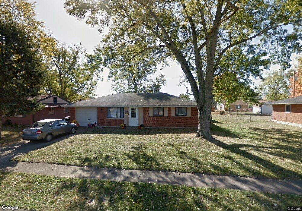
415 Brownstone Dr Englewood, OH 45322
Estimated Value: $137,000 - $196,000
3
Beds
2
Baths
1,428
Sq Ft
$123/Sq Ft
Est. Value
About This Home
This home is located at 415 Brownstone Dr, Englewood, OH 45322 and is currently estimated at $175,545, approximately $122 per square foot. 415 Brownstone Dr is a home located in Montgomery County with nearby schools including Northmont High School, Imagine Schools - Woodbury Academy, and Trotwood Preparatory & Fitness Academy.
Ownership History
Date
Name
Owned For
Owner Type
Purchase Details
Closed on
Aug 7, 2021
Sold by
Rexford Nicholas Dean and Rexford Falisha
Bought by
Vb One Llc
Current Estimated Value
Purchase Details
Closed on
Oct 15, 2018
Sold by
The Harris Family Ltd
Bought by
Rexford Nicholas Dean and Rexford Falisha
Home Financials for this Owner
Home Financials are based on the most recent Mortgage that was taken out on this home.
Original Mortgage
$65,250
Interest Rate
4.7%
Mortgage Type
New Conventional
Purchase Details
Closed on
Aug 20, 2012
Sold by
Harris Donald Kent and Harris Carolyn C
Bought by
Harris Family Ltd
Home Financials for this Owner
Home Financials are based on the most recent Mortgage that was taken out on this home.
Original Mortgage
$74,200
Interest Rate
2.83%
Mortgage Type
Future Advance Clause Open End Mortgage
Purchase Details
Closed on
May 5, 2005
Sold by
Harris Donald Kent and Harris Carolyn C
Bought by
The Harris Family Ltd
Home Financials for this Owner
Home Financials are based on the most recent Mortgage that was taken out on this home.
Original Mortgage
$79,600
Interest Rate
5.64%
Mortgage Type
Fannie Mae Freddie Mac
Purchase Details
Closed on
Mar 28, 2005
Sold by
Cutright Daniel E
Bought by
Harris Donald Kent and Harris Carolyn C
Home Financials for this Owner
Home Financials are based on the most recent Mortgage that was taken out on this home.
Original Mortgage
$79,600
Interest Rate
5.64%
Mortgage Type
Fannie Mae Freddie Mac
Purchase Details
Closed on
Sep 27, 2000
Sold by
Voorhees Don A and Voorhees Norma J
Bought by
Cutright Daniel E
Home Financials for this Owner
Home Financials are based on the most recent Mortgage that was taken out on this home.
Original Mortgage
$89,222
Interest Rate
8.03%
Mortgage Type
FHA
Create a Home Valuation Report for This Property
The Home Valuation Report is an in-depth analysis detailing your home's value as well as a comparison with similar homes in the area
Home Values in the Area
Average Home Value in this Area
Purchase History
| Date | Buyer | Sale Price | Title Company |
|---|---|---|---|
| Vb One Llc | $130,000 | Total Title Services Llc | |
| Rexford Nicholas Dean | $87,000 | Chicago Title Company Llc | |
| Harris Family Ltd | -- | Towne Title & Escrow | |
| Harris Donald Kent | -- | Town Title & Escrow | |
| The Harris Family Ltd | -- | Midwest Abstract Company | |
| Harris Donald Kent | $99,500 | Midwest Abstract Company | |
| Cutright Daniel E | $90,400 | -- |
Source: Public Records
Mortgage History
| Date | Status | Borrower | Loan Amount |
|---|---|---|---|
| Previous Owner | Rexford Nicholas Dean | $65,250 | |
| Previous Owner | Harris Donald Kent | $74,200 | |
| Previous Owner | Harris Donald Kent | $72,700 | |
| Previous Owner | Harris Donald Kent | $79,600 | |
| Previous Owner | Cutright Daniel E | $89,222 |
Source: Public Records
Tax History Compared to Growth
Tax History
| Year | Tax Paid | Tax Assessment Tax Assessment Total Assessment is a certain percentage of the fair market value that is determined by local assessors to be the total taxable value of land and additions on the property. | Land | Improvement |
|---|---|---|---|---|
| 2024 | $2,832 | $48,440 | $8,880 | $39,560 |
| 2023 | $2,832 | $48,440 | $8,880 | $39,560 |
| 2022 | $2,663 | $34,060 | $6,250 | $27,810 |
| 2021 | $2,671 | $34,060 | $6,250 | $27,810 |
| 2020 | $2,625 | $34,060 | $6,250 | $27,810 |
| 2019 | $2,650 | $29,760 | $7,190 | $22,570 |
| 2018 | $2,516 | $29,760 | $7,190 | $22,570 |
| 2017 | $2,481 | $29,760 | $7,190 | $22,570 |
| 2016 | $2,349 | $28,310 | $6,250 | $22,060 |
| 2015 | $2,153 | $28,310 | $6,250 | $22,060 |
| 2014 | $2,153 | $28,310 | $6,250 | $22,060 |
| 2012 | -- | $31,770 | $6,820 | $24,950 |
Source: Public Records
Map
Nearby Homes
- 803 Albert St
- 206 Lodestone Dr
- 104 Silverstone Dr
- 109 Silverstone Dr
- 607 Albert St
- 108 Tate Ave
- 510 Rohr Ln
- 520 S Main St
- 208 S Walnut St
- 534 Unger Ave
- 717 Woodlawn Ave
- 510 Lambert Ln
- 718 Bonnycastle Ave
- 123 Chestnut St
- 505 Durst Dr
- 108 Denwood Trail
- 1010 Heathwood Dr
- 206 Gardengrove Way
- 306 Pauly Dr
- 1017 Terracewood Dr
- 417 Brownstone Dr
- 413 Brownstone Dr
- 307 Eller Ave
- 305 Eller Ave
- 725 Albert St
- 309 Eller Ave
- 414 Brownstone Dr
- 411 Brownstone Dr
- 412 Brownstone Dr
- 416 Brownstone Dr
- 727 Albert St
- 410 Brownstone Dr
- 721 Albert St
- 311 Eller Ave
- 408 Brownstone Dr
- 106 Lodestone Dr
- 108 Lodestone Dr
- 728 Albert St
- 717 Albert St
- 929 Hile Ln