Estimated Value: $355,000 - $466,000
4
Beds
4
Baths
1,760
Sq Ft
$223/Sq Ft
Est. Value
About This Home
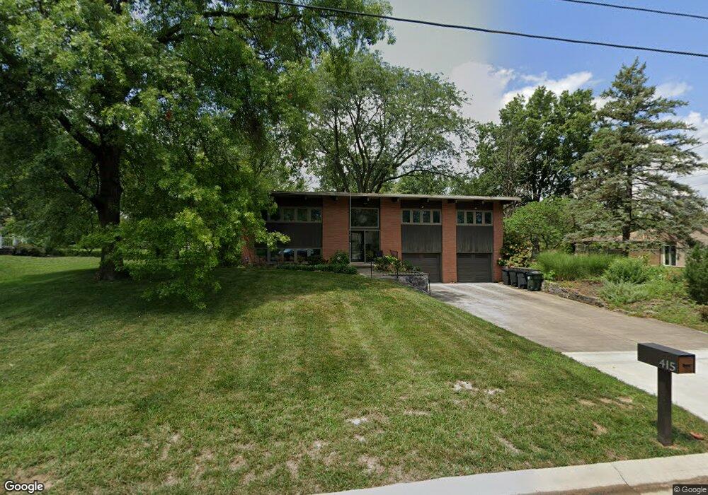
This home is located at 415 David Ln, Mason, OH 45040 and is currently estimated at $393,099, approximately $223 per square foot. 415 David Ln is a home located in Warren County with nearby schools including Mason Intermediate Elementary School, Mason Middle School, and William Mason High School.
Ownership History
Date
Name
Owned For
Owner Type
Purchase Details
Closed on
Sep 28, 2005
Sold by
Wright Charlotte G and Wright Jack D
Bought by
Peter Justin and Peter Lauren
Current Estimated Value
Home Financials for this Owner
Home Financials are based on the most recent Mortgage that was taken out on this home.
Original Mortgage
$196,200
Outstanding Balance
$102,234
Interest Rate
5.83%
Mortgage Type
Fannie Mae Freddie Mac
Estimated Equity
$290,865
Purchase Details
Closed on
Jan 21, 1981
Sold by
Wright Wright and Wright Jack D
Create a Home Valuation Report for This Property
The Home Valuation Report is an in-depth analysis detailing your home's value as well as a comparison with similar homes in the area
Home Values in the Area
Average Home Value in this Area
Purchase History
| Date | Buyer | Sale Price | Title Company |
|---|---|---|---|
| Peter Justin | $218,000 | Lawyers Title Of Cincinnati | |
| -- | -- | -- |
Source: Public Records
Mortgage History
| Date | Status | Borrower | Loan Amount |
|---|---|---|---|
| Open | Peter Justin | $196,200 |
Source: Public Records
Tax History
| Year | Tax Paid | Tax Assessment Tax Assessment Total Assessment is a certain percentage of the fair market value that is determined by local assessors to be the total taxable value of land and additions on the property. | Land | Improvement |
|---|---|---|---|---|
| 2025 | $3,966 | $97,730 | $24,500 | $73,230 |
| 2024 | $3,966 | $97,730 | $24,500 | $73,230 |
| 2023 | $3,842 | $79,982 | $15,067 | $64,914 |
| 2022 | $3,793 | $79,982 | $15,068 | $64,915 |
| 2021 | $3,593 | $79,982 | $15,068 | $64,915 |
| 2020 | $3,407 | $65,027 | $12,250 | $52,777 |
| 2019 | $3,132 | $65,027 | $12,250 | $52,777 |
| 2018 | $3,143 | $65,027 | $12,250 | $52,777 |
| 2017 | $3,006 | $58,055 | $11,267 | $46,788 |
| 2016 | $3,096 | $58,055 | $11,267 | $46,788 |
| 2015 | $3,102 | $58,055 | $11,267 | $46,788 |
| 2014 | $3,024 | $52,780 | $10,240 | $42,540 |
| 2013 | $3,031 | $63,130 | $12,250 | $50,880 |
Source: Public Records
Map
Nearby Homes
- 5921 Fairway Dr
- 382 Walnut Ln
- 602 Bunker Ln
- 618 Bunker Ln
- 4109 Old Manchester Ct
- 3856 Sandtrap Cir
- 6416 Eagleview Dr
- 4019 Fieldsedge Dr
- 3634 Pebble Creek Ct
- 6674 Villager Place Unit 153D
- 220 Kings Mills Rd
- 6764 Pondfield Ln
- 6768 Pondfield Ln Unit 271E
- 6510 Prestwick Ct
- 5873 Falling Brook Dr
- 5399 Country Ridge Dr
- 5533 Cox-Smith Rd
- 5523 Cox-Smith Rd
- 5513 Cox-Smith Rd
- 5276 Bay Pointe Dr
Your Personal Tour Guide
Ask me questions while you tour the home.