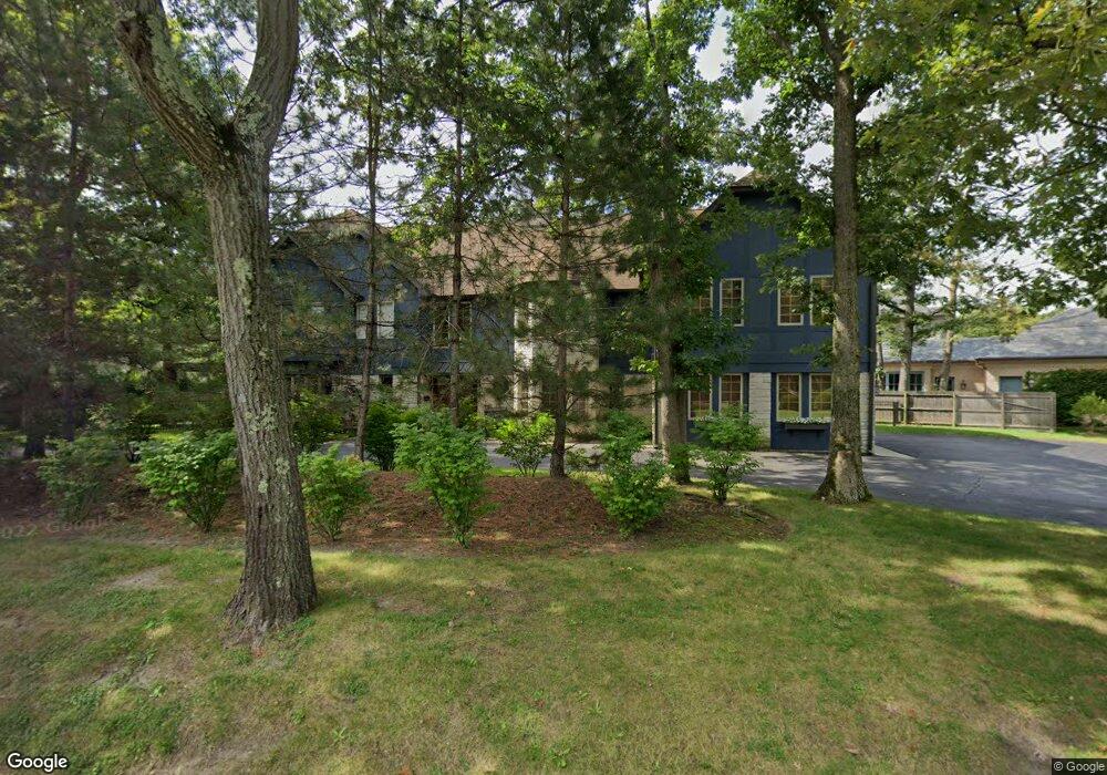
415 E Sheridan Rd Lake Bluff, IL 60044
Estimated Value: $1,328,000 - $1,718,000
4
Beds
5
Baths
4,366
Sq Ft
$363/Sq Ft
Est. Value
About This Home
This home is located at 415 E Sheridan Rd, Lake Bluff, IL 60044 and is currently estimated at $1,584,960, approximately $363 per square foot. 415 E Sheridan Rd is a home located in Lake County with nearby schools including Lake Bluff Elementary School, Lake Bluff Middle School, and Lake Forest High School.
Ownership History
Date
Name
Owned For
Owner Type
Purchase Details
Closed on
Dec 1, 2011
Sold by
Orsi Piero and Orsi Mariapia
Bought by
Gerber Lynn F
Current Estimated Value
Home Financials for this Owner
Home Financials are based on the most recent Mortgage that was taken out on this home.
Original Mortgage
$562,000
Outstanding Balance
$386,287
Interest Rate
4.11%
Mortgage Type
New Conventional
Estimated Equity
$1,198,673
Purchase Details
Closed on
Jun 16, 2011
Sold by
First Chicago Bank & Trust
Bought by
Orsi Piero and Orsi Mariapia
Purchase Details
Closed on
Jul 26, 2001
Sold by
Lancy Randa
Bought by
Bloomingdale Bank & Trust and Trust #1096B
Home Financials for this Owner
Home Financials are based on the most recent Mortgage that was taken out on this home.
Original Mortgage
$476,000
Interest Rate
7.5%
Create a Home Valuation Report for This Property
The Home Valuation Report is an in-depth analysis detailing your home's value as well as a comparison with similar homes in the area
Home Values in the Area
Average Home Value in this Area
Purchase History
| Date | Buyer | Sale Price | Title Company |
|---|---|---|---|
| Gerber Lynn F | $702,500 | Precision Title | |
| Orsi Piero | -- | Republic Title Co | |
| Bloomingdale Bank & Trust | $595,000 | Chicago Title Insurance Co |
Source: Public Records
Mortgage History
| Date | Status | Borrower | Loan Amount |
|---|---|---|---|
| Open | Gerber Lynn F | $562,000 | |
| Previous Owner | Bloomingdale Bank & Trust | $476,000 |
Source: Public Records
Tax History Compared to Growth
Tax History
| Year | Tax Paid | Tax Assessment Tax Assessment Total Assessment is a certain percentage of the fair market value that is determined by local assessors to be the total taxable value of land and additions on the property. | Land | Improvement |
|---|---|---|---|---|
| 2024 | $20,121 | $300,350 | $118,076 | $182,274 |
| 2023 | $17,869 | $268,807 | $105,676 | $163,131 |
| 2022 | $17,869 | $258,599 | $101,663 | $156,936 |
| 2021 | $17,245 | $256,368 | $100,786 | $155,582 |
| 2020 | $16,870 | $257,785 | $101,343 | $156,442 |
| 2019 | $16,266 | $253,053 | $99,483 | $153,570 |
| 2018 | $18,898 | $300,671 | $110,958 | $189,713 |
| 2017 | $18,739 | $295,645 | $109,103 | $186,542 |
| 2016 | $18,064 | $298,575 | $110,771 | $187,804 |
| 2015 | $19,034 | $281,144 | $104,304 | $176,840 |
| 2014 | $15,082 | $223,726 | $87,790 | $135,936 |
| 2012 | $14,148 | $225,667 | $88,552 | $137,115 |
Source: Public Records
Map
Nearby Homes
- 246 Park Ave
- 145 Moffett Rd
- 131 Moffett Rd
- 166 Park Ave
- 321 Newman Ct
- 700 Forest Cove Rd
- 546 Lakeland Dr
- 1301 N Western Ave Unit 134
- 1301 N Western Ave Unit 335
- 1230 N Western Ave Unit 301
- 788 E Woodland Rd
- 1271 N Green Bay Rd
- 701 E Center Ave
- 111 E Laurel Ave Unit THI
- 119 E Laurel Ave Unit 207
- 120 E Scranton Ave Unit 202
- 120 E Scranton Ave Unit 203
- 120 E Scranton Ave Unit 201
- 120 E Scranton Ave Unit 102
- 120 E Scranton Ave Unit 103
- 405 E Sheridan Rd
- 1590 N Sheridan Rd
- 345 E Sheridan Rd
- 408 Ravine Park Dr
- 420 Ravine Park Dr
- 22 Moffett Rd
- 501 Cambridge Rd
- 394 Ravine Park Dr
- 1591 N Sheridan Rd
- 388 Ravine Park Dr
- 1575 N Sheridan Rd
- 500 Cambridge Rd
- 342 E Sheridan Rd
- 32 Moffett Rd
- 332 E Sheridan Rd
- 1550 N Sheridan Rd
- 333 E Sheridan Rd
- 1565 N Sheridan Rd
- 382 Ravine Park Dr
- 391 Ravine Park Dr