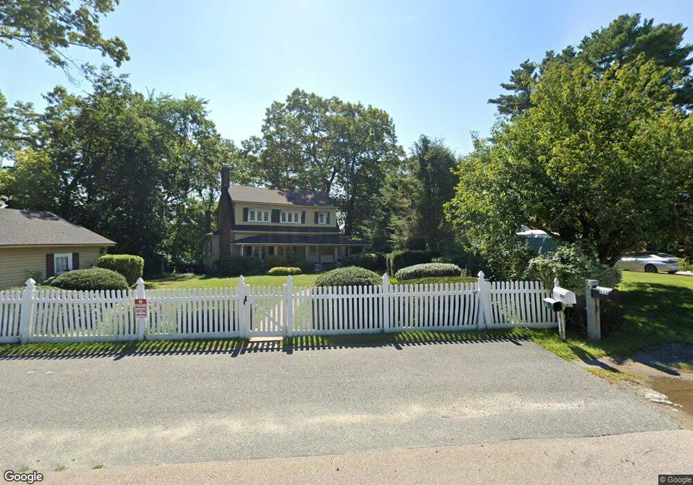
415 Franklin St Wrentham, MA 02093
Estimated Value: $639,000 - $807,000
2
Beds
2
Baths
1,642
Sq Ft
$456/Sq Ft
Est. Value
About This Home
This home is located at 415 Franklin St, Wrentham, MA 02093 and is currently estimated at $748,507, approximately $455 per square foot. 415 Franklin St is a home located in Norfolk County with nearby schools including Delaney Elementary School and Charles E Roderick.
Ownership History
Date
Name
Owned For
Owner Type
Purchase Details
Closed on
Sep 27, 2019
Sold by
Ross Susan A
Bought by
Ross Susan A and Devlin James P
Current Estimated Value
Purchase Details
Closed on
Feb 14, 2012
Sold by
Ross Richard J and Ross Susan A
Bought by
Ross Susan A
Purchase Details
Closed on
Jan 21, 2000
Sold by
Franklin St Etc
Bought by
Ross Richard J and Ross Susan A
Home Financials for this Owner
Home Financials are based on the most recent Mortgage that was taken out on this home.
Original Mortgage
$190,000
Interest Rate
7.84%
Mortgage Type
Purchase Money Mortgage
Create a Home Valuation Report for This Property
The Home Valuation Report is an in-depth analysis detailing your home's value as well as a comparison with similar homes in the area
Home Values in the Area
Average Home Value in this Area
Purchase History
| Date | Buyer | Sale Price | Title Company |
|---|---|---|---|
| Ross Susan A | -- | -- | |
| Ross Susan A | -- | -- | |
| Ross Richard J | $290,000 | -- |
Source: Public Records
Mortgage History
| Date | Status | Borrower | Loan Amount |
|---|---|---|---|
| Previous Owner | Ross Richard J | $193,000 | |
| Previous Owner | Ross Richard J | $190,000 | |
| Previous Owner | Ross Richard J | $45,000 | |
| Previous Owner | Ross Richard J | $15,000 |
Source: Public Records
Tax History Compared to Growth
Tax History
| Year | Tax Paid | Tax Assessment Tax Assessment Total Assessment is a certain percentage of the fair market value that is determined by local assessors to be the total taxable value of land and additions on the property. | Land | Improvement |
|---|---|---|---|---|
| 2025 | $8,636 | $745,100 | $490,600 | $254,500 |
| 2024 | $8,326 | $693,800 | $490,600 | $203,200 |
| 2023 | $7,903 | $626,200 | $446,000 | $180,200 |
| 2022 | $7,688 | $562,400 | $395,900 | $166,500 |
| 2021 | $7,184 | $510,600 | $351,500 | $159,100 |
| 2020 | $7,795 | $547,000 | $383,200 | $163,800 |
| 2019 | $8,102 | $573,800 | $412,600 | $161,200 |
| 2018 | $8,365 | $587,400 | $412,900 | $174,500 |
| 2017 | $8,222 | $577,000 | $404,900 | $172,100 |
| 2016 | $8,025 | $562,000 | $393,200 | $168,800 |
| 2015 | $7,876 | $525,800 | $378,000 | $147,800 |
| 2014 | $7,774 | $507,800 | $363,500 | $144,300 |
Source: Public Records
Map
Nearby Homes
- 570 Franklin St
- 10 Nature View Dr
- 15 Nature View Dr
- 131 Creek St Unit 7
- 50 Reed Fulton Ave Unit Lot 61
- 270 Dedham St
- 45 Joshua Rd
- 246 Forest Grove Ave
- 11 Earle Stewart Ln
- Lot 3 - 14 Earle Stewart Ln
- 1 Lorraine Metcalf Dr
- Lot 1 - Blueberry 2 Car Plan at King Philip Estates
- Lot 8 - Blueberry 2 Car Plan at King Philip Estates
- Lot 6 - Blueberry 3 Car Plan at King Philip Estates
- Lot 2 - Camden 2 Car Plan at King Philip Estates
- Lot 7 - Cedar Plan at King Philip Estates
- Lot 4 - Hemingway 2 Car Plan at King Philip Estates
- Lot 3 - Blueberry 2 Car Plan at King Philip Estates
- 3 Oak Rd
- 362 East St
- 421 Franklin St
- 405 Franklin St
- 425 Franklin St
- 391 Franklin St
- 400 Franklin St
- 383 Franklin St
- 394 Franklin St
- 431 Franklin St
- 420 Franklin St
- 430 Franklin St
- 435 Franklin St
- 377 Franklin St
- 371 Franklin St
- 388 Franklin St
- 439 Franklin St
- 440 Franklin St
- 443 Franklin St
- 380 Franklin St
- 369 Franklin St
- 359 Franklin St