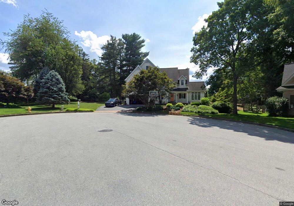
415 Hessian Dr Kennett Square, PA 19348
Estimated Value: $733,563 - $901,000
5
Beds
4
Baths
3,365
Sq Ft
$242/Sq Ft
Est. Value
About This Home
This home is located at 415 Hessian Dr, Kennett Square, PA 19348 and is currently estimated at $812,891, approximately $241 per square foot. 415 Hessian Dr is a home located in Chester County with nearby schools including Kennett Middle School, Kennett High School, and St. Patrick School.
Ownership History
Date
Name
Owned For
Owner Type
Purchase Details
Closed on
Jul 29, 2010
Sold by
Mccarthy Albert J and Mccarthy Cheryl A
Bought by
Scicchitano Jeffrey T and Scicchitano Kimberly
Current Estimated Value
Home Financials for this Owner
Home Financials are based on the most recent Mortgage that was taken out on this home.
Original Mortgage
$382,000
Outstanding Balance
$255,586
Interest Rate
4.78%
Mortgage Type
New Conventional
Estimated Equity
$557,305
Purchase Details
Closed on
Jul 29, 1997
Sold by
Ciccarone John J
Bought by
Mccarthy Albert J and Mccarthy Cheryl A
Home Financials for this Owner
Home Financials are based on the most recent Mortgage that was taken out on this home.
Original Mortgage
$150,000
Interest Rate
7.55%
Purchase Details
Closed on
Dec 20, 1994
Sold by
Weiss Properties Inc
Bought by
Regester William T and Regester Barbara P
Home Financials for this Owner
Home Financials are based on the most recent Mortgage that was taken out on this home.
Original Mortgage
$257,500
Interest Rate
9.75%
Create a Home Valuation Report for This Property
The Home Valuation Report is an in-depth analysis detailing your home's value as well as a comparison with similar homes in the area
Home Values in the Area
Average Home Value in this Area
Purchase History
| Date | Buyer | Sale Price | Title Company |
|---|---|---|---|
| Scicchitano Jeffrey T | $485,000 | None Available | |
| Mccarthy Albert J | $70,000 | -- | |
| Regester William T | $321,884 | -- |
Source: Public Records
Mortgage History
| Date | Status | Borrower | Loan Amount |
|---|---|---|---|
| Open | Scicchitano Jeffrey T | $382,000 | |
| Previous Owner | Mccarthy Albert J | $150,000 | |
| Previous Owner | Regester William T | $257,500 |
Source: Public Records
Tax History Compared to Growth
Tax History
| Year | Tax Paid | Tax Assessment Tax Assessment Total Assessment is a certain percentage of the fair market value that is determined by local assessors to be the total taxable value of land and additions on the property. | Land | Improvement |
|---|---|---|---|---|
| 2025 | $12,164 | $249,630 | $48,920 | $200,710 |
| 2024 | $12,164 | $249,630 | $48,920 | $200,710 |
| 2023 | $11,792 | $249,630 | $48,920 | $200,710 |
| 2022 | $10,777 | $249,630 | $48,920 | $200,710 |
| 2021 | $10,681 | $249,630 | $48,920 | $200,710 |
| 2020 | $10,502 | $249,630 | $48,920 | $200,710 |
| 2019 | $10,376 | $249,630 | $48,920 | $200,710 |
| 2018 | $10,134 | $249,630 | $48,920 | $200,710 |
| 2017 | $9,975 | $249,630 | $48,920 | $200,710 |
| 2016 | $990 | $249,630 | $48,920 | $200,710 |
| 2015 | $990 | $249,630 | $48,920 | $200,710 |
| 2014 | $990 | $249,630 | $48,920 | $200,710 |
Source: Public Records
Map
Nearby Homes
- 448 N Mill Rd
- 503 W State St
- 125 W State St
- 106 Penns Manor Dr
- 510 D St
- 602 D St
- 220 E Linden St
- 621 Magnolia Ct
- 631 Magnolia Ct
- 181 Penns Manor Dr
- 607 W Mulberry St
- 311 E State St
- 619 W Mulberry St
- 629 W Mulberry St
- 639 W Mulberry St
- 705 Potter Dr
- 491 N Mill Rd
- 711 Potter Dr
- 228 E Mulberry St
- 501 N Walnut Rd
- 401 Hessian Dr
- 413 Hessian Dr
- 403 Hessian Dr
- 416 Hessian Dr
- 305 Hessian Dr
- 405 Hessian Dr
- 414 Hessian Dr
- 411 Hessian Dr
- 303 Hessian Dr
- 217 W Sickle St
- 407 Hessian Dr
- 400 Hessian Dr
- 409 Hessian Dr
- 352 N Lincoln St
- 402 Hessian Dr
- 304 Hessian Dr
- 412 Hessian Dr
- 404 Hessian Dr
- 301 Hessian Dr
- 302 Hessian Dr