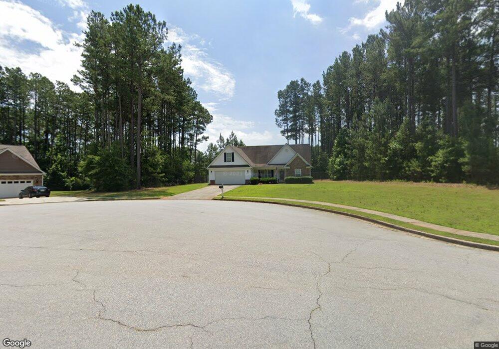
415 Laurel Ln Social Circle, GA 30025
Estimated Value: $336,251 - $380,000
3
Beds
2
Baths
1,797
Sq Ft
$203/Sq Ft
Est. Value
About This Home
This home is located at 415 Laurel Ln, Social Circle, GA 30025 and is currently estimated at $365,313, approximately $203 per square foot. 415 Laurel Ln is a home located in Walton County with nearby schools including Social Circle Primary School, Social Circle Elementary School, and Social Circle Middle School.
Ownership History
Date
Name
Owned For
Owner Type
Purchase Details
Closed on
May 10, 2019
Sold by
Woodie Chasen D
Bought by
Braswell Jonathan M and Braswell Elizabeth Ann
Current Estimated Value
Home Financials for this Owner
Home Financials are based on the most recent Mortgage that was taken out on this home.
Original Mortgage
$189,905
Outstanding Balance
$165,225
Interest Rate
4.1%
Mortgage Type
New Conventional
Estimated Equity
$200,088
Purchase Details
Closed on
Jun 10, 2016
Sold by
Rose Elliott
Bought by
Woodie Chasen D
Home Financials for this Owner
Home Financials are based on the most recent Mortgage that was taken out on this home.
Original Mortgage
$104,000
Interest Rate
3.57%
Mortgage Type
New Conventional
Purchase Details
Closed on
Jan 9, 2008
Sold by
Ownit Mtg Ln
Bought by
Rose Elliott
Home Financials for this Owner
Home Financials are based on the most recent Mortgage that was taken out on this home.
Original Mortgage
$106,000
Interest Rate
6.06%
Mortgage Type
New Conventional
Purchase Details
Closed on
Jul 3, 2007
Sold by
Spann Jehan
Bought by
Ownit Mtg Ln
Purchase Details
Closed on
Jan 26, 2006
Sold by
Boscawen Prop Grp Inc
Bought by
Spann Jehan
Home Financials for this Owner
Home Financials are based on the most recent Mortgage that was taken out on this home.
Original Mortgage
$145,600
Interest Rate
6.21%
Mortgage Type
New Conventional
Create a Home Valuation Report for This Property
The Home Valuation Report is an in-depth analysis detailing your home's value as well as a comparison with similar homes in the area
Home Values in the Area
Average Home Value in this Area
Purchase History
| Date | Buyer | Sale Price | Title Company |
|---|---|---|---|
| Braswell Jonathan M | $199,900 | -- | |
| Woodie Chasen D | $158,000 | -- | |
| Rose Elliott | $132,500 | -- | |
| Ownit Mtg Ln | -- | -- | |
| Spann Jehan | $182,000 | -- |
Source: Public Records
Mortgage History
| Date | Status | Borrower | Loan Amount |
|---|---|---|---|
| Open | Braswell Jonathan M | $189,905 | |
| Previous Owner | Woodie Chasen D | $104,000 | |
| Previous Owner | Rose Elliott | $106,000 | |
| Previous Owner | Spann Jehan | $145,600 |
Source: Public Records
Tax History
| Year | Tax Paid | Tax Assessment Tax Assessment Total Assessment is a certain percentage of the fair market value that is determined by local assessors to be the total taxable value of land and additions on the property. | Land | Improvement |
|---|---|---|---|---|
| 2025 | $4,031 | $131,120 | $24,000 | $107,120 |
| 2024 | $3,712 | $120,600 | $24,000 | $96,600 |
| 2023 | $3,560 | $111,920 | $22,000 | $89,920 |
| 2022 | $678 | $91,600 | $17,000 | $74,600 |
| 2021 | $678 | $79,920 | $15,200 | $64,720 |
| 2020 | $695 | $73,320 | $14,000 | $59,320 |
| 2019 | $599 | $65,840 | $12,000 | $53,840 |
| 2018 | $599 | $65,840 | $12,000 | $53,840 |
| 2017 | $2,671 | $63,920 | $12,000 | $51,920 |
| 2016 | $621 | $58,960 | $12,000 | $46,960 |
| 2015 | $504 | $48,840 | $8,000 | $40,840 |
| 2014 | $483 | $44,680 | $8,000 | $36,680 |
Source: Public Records
Map
Nearby Homes
- 164 Laurel Ln
- 3060 Clegg Farm Rd
- 148 Laurel Ln
- 433 Clover Dr
- 1021 Riverstone Dr
- 211 Tan Yard Rd
- 153 Tan Yard Rd
- 233 Wedowee Rd
- 100 Saint Andrews Ct
- 346 Carnation Dr Unit 1
- 355 Conner Ct
- 356 Carnation Dr
- 443 Windsong Ln
- 1172 Morrow Dr
- 781 Alcova Dr
- 1224 Morrow Dr
- 0 Morrow Dr Unit 7728188
- 0 Morrow Dr Unit 10702126
- 1244 Morrow Dr
- 210 Park Place Trail
Your Personal Tour Guide
Ask me questions while you tour the home.