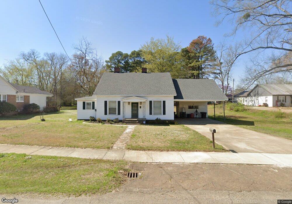
415 N 2nd St Baldwyn, MI 38824
Estimated Value: $54,000 - $150,707
3
Beds
2
Baths
2,114
Sq Ft
$55/Sq Ft
Est. Value
About This Home
This home is located at 415 N 2nd St, Baldwyn, MI 38824 and is currently estimated at $115,427, approximately $54 per square foot. 415 N 2nd St is a home located in Prentiss County with nearby schools including Baldwyn Elementary School, Baldwyn High School, and Baldwyn Middle School.
Ownership History
Date
Name
Owned For
Owner Type
Purchase Details
Closed on
Sep 20, 2022
Sold by
Powell Raymon
Bought by
Barnett Timothy
Current Estimated Value
Home Financials for this Owner
Home Financials are based on the most recent Mortgage that was taken out on this home.
Original Mortgage
$111,000
Outstanding Balance
$106,022
Interest Rate
5.22%
Mortgage Type
VA
Estimated Equity
$9,405
Create a Home Valuation Report for This Property
The Home Valuation Report is an in-depth analysis detailing your home's value as well as a comparison with similar homes in the area
Home Values in the Area
Average Home Value in this Area
Purchase History
| Date | Buyer | Sale Price | Title Company |
|---|---|---|---|
| Barnett Timothy | -- | -- |
Source: Public Records
Mortgage History
| Date | Status | Borrower | Loan Amount |
|---|---|---|---|
| Open | Barnett Timothy | $111,000 |
Source: Public Records
Tax History Compared to Growth
Tax History
| Year | Tax Paid | Tax Assessment Tax Assessment Total Assessment is a certain percentage of the fair market value that is determined by local assessors to be the total taxable value of land and additions on the property. | Land | Improvement |
|---|---|---|---|---|
| 2024 | $302 | $6,800 | $0 | $0 |
| 2023 | $249 | $5,605 | $0 | $0 |
| 2022 | $350 | $7,733 | $0 | $0 |
| 2021 | $350 | $7,733 | $0 | $0 |
| 2020 | $344 | $7,733 | $0 | $0 |
| 2019 | $314 | $7,219 | $0 | $0 |
| 2018 | $692 | $10,829 | $0 | $0 |
| 2017 | $692 | $10,829 | $0 | $0 |
| 2016 | $692 | $10,829 | $0 | $0 |
| 2015 | -- | $10,829 | $0 | $0 |
| 2014 | -- | $9,573 | $0 | $0 |
Source: Public Records
Map
Nearby Homes
- 340 W Main St
- 134 Cox St
- 537 Latimer St
- 553 Holly Dr
- 547 Holly Dr
- 328 S 2nd St
- 1169 Cr 167
- 0 Cr 170 Unit 25-1046
- Tbd N 4th St
- 0 Windance Dr
- 0 Emmanuel Dr
- 0 Church Dr
- 0 Sandhill Ave
- 0 Hwy 45 (12 40 Ac)
- 889 Mallard Lake Dr
- Lot 52 & 33 Mallard Lake Ridgewood Dr
- Lot 18 Mallard Lake Dr
- Lot 19 Mallard Lake Dr
- Lot 15 Mallard Lake Dr
- Lot 17 Mallard Lake Dr