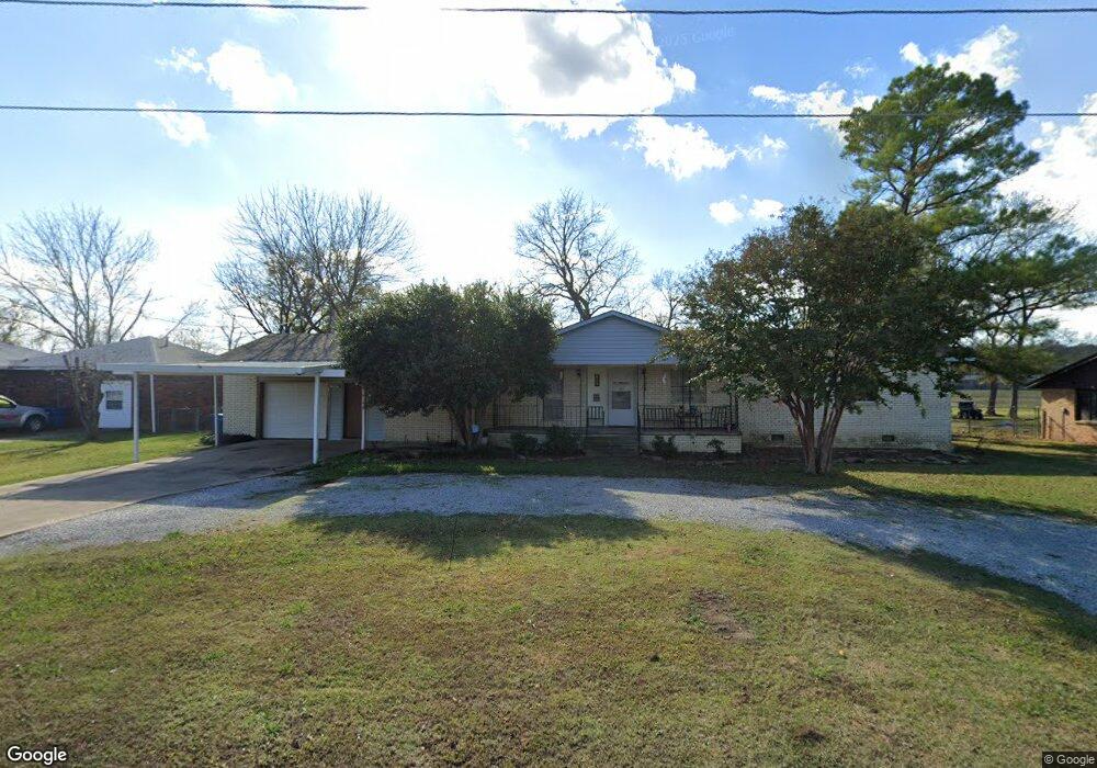
415 NW Blake Ave McAlester, OK 74501
Estimated Value: $182,000 - $192,000
3
Beds
2
Baths
2,028
Sq Ft
$92/Sq Ft
Est. Value
About This Home
This home is located at 415 NW Blake Ave, McAlester, OK 74501 and is currently estimated at $186,629, approximately $92 per square foot. 415 NW Blake Ave is a home with nearby schools including Krebs Public School and Lakewood Christian School.
Ownership History
Date
Name
Owned For
Owner Type
Purchase Details
Closed on
Jun 5, 2015
Sold by
Bedwell Ginger and Bedwell Gary
Bought by
Smith Donald and Smith Jean Amy
Current Estimated Value
Home Financials for this Owner
Home Financials are based on the most recent Mortgage that was taken out on this home.
Original Mortgage
$94,387
Outstanding Balance
$72,922
Interest Rate
3.68%
Mortgage Type
New Conventional
Estimated Equity
$113,707
Purchase Details
Closed on
Feb 8, 2001
Sold by
Mitchell Jana
Bought by
Bedwell Ginger
Create a Home Valuation Report for This Property
The Home Valuation Report is an in-depth analysis detailing your home's value as well as a comparison with similar homes in the area
Home Values in the Area
Average Home Value in this Area
Purchase History
| Date | Buyer | Sale Price | Title Company |
|---|---|---|---|
| Smith Donald | $92,500 | None Available | |
| Bedwell Ginger | $43,500 | -- |
Source: Public Records
Mortgage History
| Date | Status | Borrower | Loan Amount |
|---|---|---|---|
| Open | Smith Donald | $94,387 |
Source: Public Records
Tax History Compared to Growth
Tax History
| Year | Tax Paid | Tax Assessment Tax Assessment Total Assessment is a certain percentage of the fair market value that is determined by local assessors to be the total taxable value of land and additions on the property. | Land | Improvement |
|---|---|---|---|---|
| 2024 | $954 | $12,244 | $405 | $11,839 |
| 2023 | $954 | $11,888 | $405 | $11,483 |
| 2022 | $912 | $11,542 | $405 | $11,137 |
| 2021 | $913 | $11,542 | $405 | $11,137 |
| 2020 | $849 | $10,879 | $405 | $10,474 |
| 2019 | $825 | $10,879 | $405 | $10,474 |
| 2018 | $797 | $10,255 | $405 | $9,850 |
| 2017 | $810 | $10,255 | $405 | $9,850 |
| 2016 | $809 | $10,176 | $405 | $9,771 |
| 2015 | $466 | $7,246 | $288 | $6,958 |
| 2014 | -- | $6,379 | $288 | $6,091 |
Source: Public Records
Map
Nearby Homes
- 0 N George Nigh Bypass Unit 2522698
- 1915 N 13th St
- 2008 N 14th St
- 1100 E Electric Ave
- 519 E Electric Ave
- 2020 N 14th St
- 911 E Polk Ave
- 2115 N 11th St
- 610 E Pierce Ave
- 0 Electric St Unit 2520654
- 0 Electric Unit 2440920
- 0 N 9th St
- 0 E Monroe Ave
- 770 NW Seneca Ave
- 1010 E Jefferson Dr
- 604 E Harrison Ave
- 909 N 6th St
- 530 E Van Buren Ave
- 1025 N 5th St
- 0 Strong Blvd Unit 2522677
- 405 NW Blake Ave
- 1630 Diesel
- 1610 E Electric Ave
- 1501 E Pierce Ave
- 1900 E Electric Ave
- 1400 E Pierce Ave
- 1433 E Polk Ave
- 1501 E Polk Ave
- xxx Electric Ave
- 903 Summit Ridge
- 1430 E Polk Ave
- 1302 N Strong Blvd
- 1309 E Polk Ave
- 1307 E Polk Ave
- 1305 E Polk Ave
- 1370 E Polk Ave
- 2004 Rr 4
- 526A Rr 1
- 1618 NW 17th St
- 1306 E Polk Ave