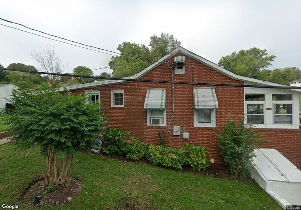
415 Osbourne Rd Tracys Landing, MD 20779
Estimated Value: $437,000 - $495,495
--
Bed
1
Bath
572
Sq Ft
$823/Sq Ft
Est. Value
About This Home
This home is located at 415 Osbourne Rd, Tracys Landing, MD 20779 and is currently estimated at $470,624, approximately $822 per square foot. 415 Osbourne Rd is a home located in Anne Arundel County with nearby schools including Deale Elementary School, Southern Middle School, and Southern High School.
Ownership History
Date
Name
Owned For
Owner Type
Purchase Details
Closed on
Mar 23, 2016
Sold by
Wright Mary D and The Mary D Wright Living Trust
Bought by
Veith William Joseph and Veith Lisa Price
Current Estimated Value
Home Financials for this Owner
Home Financials are based on the most recent Mortgage that was taken out on this home.
Original Mortgage
$100,000
Outstanding Balance
$79,071
Interest Rate
3.62%
Mortgage Type
Purchase Money Mortgage
Estimated Equity
$391,553
Purchase Details
Closed on
Sep 23, 2004
Sold by
Wright John F
Bought by
Wright Mary D and Wright John F
Create a Home Valuation Report for This Property
The Home Valuation Report is an in-depth analysis detailing your home's value as well as a comparison with similar homes in the area
Home Values in the Area
Average Home Value in this Area
Purchase History
| Date | Buyer | Sale Price | Title Company |
|---|---|---|---|
| Veith William Joseph | $260,000 | Gateway Title & Escrow Inc | |
| Wright Mary D | -- | -- |
Source: Public Records
Mortgage History
| Date | Status | Borrower | Loan Amount |
|---|---|---|---|
| Open | Veith William Joseph | $100,000 |
Source: Public Records
Tax History Compared to Growth
Tax History
| Year | Tax Paid | Tax Assessment Tax Assessment Total Assessment is a certain percentage of the fair market value that is determined by local assessors to be the total taxable value of land and additions on the property. | Land | Improvement |
|---|---|---|---|---|
| 2025 | $5,094 | $443,567 | -- | -- |
| 2024 | $5,094 | $404,733 | $0 | $0 |
| 2023 | $4,604 | $365,900 | $262,900 | $103,000 |
| 2022 | $4,063 | $334,667 | $0 | $0 |
| 2021 | $3,736 | $303,433 | $0 | $0 |
| 2020 | $3,369 | $272,200 | $175,200 | $97,000 |
| 2019 | $3,286 | $263,933 | $0 | $0 |
| 2018 | $2,592 | $255,667 | $0 | $0 |
| 2017 | $3,039 | $247,400 | $0 | $0 |
| 2016 | -- | $247,367 | $0 | $0 |
| 2015 | -- | $247,333 | $0 | $0 |
| 2014 | -- | $247,300 | $0 | $0 |
Source: Public Records
Map
Nearby Homes
- 525 James Ave
- 254 Friendship Rd
- 520 Ark Haven Rd
- 60 Friendship Rd
- 175 Tucker Ct
- 6281 Franklin Gibson Rd
- 6690 Old Solomons Island Rd
- 610 E Marshall Ave
- 6047 Melbourne Ave
- 0 Fairhaven Rd
- 617 Ford Rd
- 802 Walnut Ave
- 9550 N Side Dr
- 703 Trapper Way
- 6061 Drum Point Rd
- 6037 Drum Point Rd
- 900 Walnut Ave
- 9230 Sam Owings Place
- 99 Hummingbird Ct
- 619 Park Place
- 404 Elizabeth Ave
- 402 Elizabeth Ave
- 411 Osbourne Rd
- 6607 Eleanore Ave
- 6605 Eleanore Ave
- 6609 Eleanore Ave
- 6611 Eleanore Ave
- 6612 Eleanore Ave
- 6603 Eleanore Ave
- 6613 Eleanore Ave
- 414 Osbourne Rd
- 416 Osbourne Rd
- 6615 Eleanore Ave
- 412 Osbourne Rd
- 6618 Eleanore Ave
- 418 Osbourne Rd
- 632B Fairhaven Rd
- 6617 Eleanore Ave
- 630B Fairhaven Rd
- 6620 Eleanore Ave