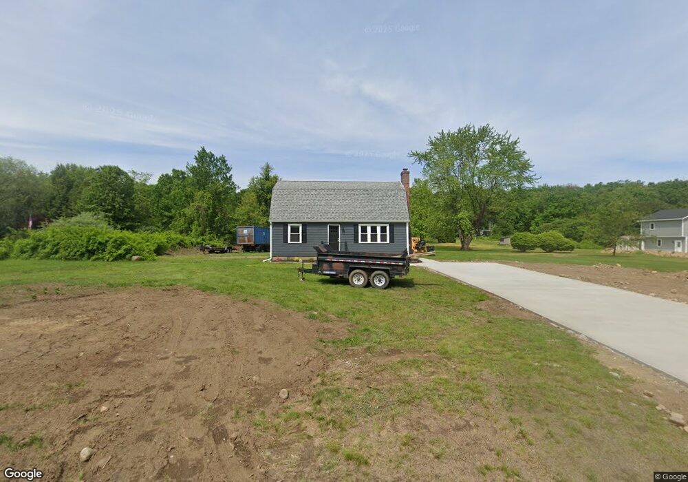
415 Pochassic Rd Westfield, MA 01085
Estimated Value: $377,000 - $401,124
4
Beds
2
Baths
1,632
Sq Ft
$240/Sq Ft
Est. Value
About This Home
This home is located at 415 Pochassic Rd, Westfield, MA 01085 and is currently estimated at $392,281, approximately $240 per square foot. 415 Pochassic Rd is a home located in Hampden County with nearby schools including Westfield High School.
Ownership History
Date
Name
Owned For
Owner Type
Purchase Details
Closed on
Dec 22, 2023
Sold by
Austin Rose C
Bought by
Darosa Dale and Darosa Heather
Current Estimated Value
Purchase Details
Closed on
Apr 4, 1984
Bought by
Austin Terry A and Austin Rose C
Create a Home Valuation Report for This Property
The Home Valuation Report is an in-depth analysis detailing your home's value as well as a comparison with similar homes in the area
Home Values in the Area
Average Home Value in this Area
Purchase History
| Date | Buyer | Sale Price | Title Company |
|---|---|---|---|
| Darosa Dale | $176,020 | None Available | |
| Austin Terry A | -- | -- |
Source: Public Records
Mortgage History
| Date | Status | Borrower | Loan Amount |
|---|---|---|---|
| Previous Owner | Austin Terry A | $23,985 | |
| Previous Owner | Austin Terry A | $22,892 | |
| Previous Owner | Austin Terry A | $24,993 |
Source: Public Records
Tax History Compared to Growth
Tax History
| Year | Tax Paid | Tax Assessment Tax Assessment Total Assessment is a certain percentage of the fair market value that is determined by local assessors to be the total taxable value of land and additions on the property. | Land | Improvement |
|---|---|---|---|---|
| 2025 | $4,929 | $324,700 | $127,900 | $196,800 |
| 2024 | $4,920 | $308,100 | $116,600 | $191,500 |
| 2023 | $4,676 | $285,500 | $110,900 | $174,600 |
| 2022 | $4,676 | $252,900 | $98,700 | $154,200 |
| 2021 | $4,529 | $239,900 | $93,100 | $146,800 |
| 2020 | $4,612 | $239,600 | $93,100 | $146,500 |
| 2019 | $4,508 | $229,200 | $88,700 | $140,500 |
| 2018 | $4,437 | $229,200 | $88,700 | $140,500 |
| 2017 | $4,360 | $224,500 | $90,000 | $134,500 |
| 2016 | $4,364 | $224,500 | $90,000 | $134,500 |
| 2015 | $4,071 | $219,600 | $90,000 | $129,600 |
| 2014 | $3,045 | $219,600 | $90,000 | $129,600 |
Source: Public Records
Map
Nearby Homes
- 549 Russell Rd Unit 6B
- 555 Russell Rd Unit D18
- 291 Pochassic Rd
- 324 Russell Rd Unit 204
- 324 Russell Rd Unit 101
- 14 Pinewood Ln
- 148 Prospect Street Extension
- 745 West Rd
- 11 Highland Cir
- 40 Heritage Ln
- 781 Western Ave
- 70 Yeoman Ave
- 508 Granville Rd
- 8 Ellis St
- 78 Granville Rd Unit 11
- 113 Franklin St
- 77 Orange St
- 1020 Russell Rd
- 10 Day Lily Ln
- 13 King Place
- 409 Pochassic Rd
- 423 Pochassic Rd
- 403 Pochassic Rd
- 399 Pochassic Rd
- 439 Pochassic Rd
- 391 Pochassic Rd
- 356 Prospect Street Extension
- 344 Prospect Street Extension
- 358 Prospect St
- 358 Prospect Street Extension
- 385 Pochassic Rd
- 360 Prospect Street Extension
- 364 Prospect Street Extension
- 362 Prospect Street Extension
- 366 Prospect Street Extension
- 451 Pochassic Rd
- 370 Prospect Street Extension
- 0 Hawks Cir
- 332 Prospect Street Extension
- Lot 00 Hawks Cir