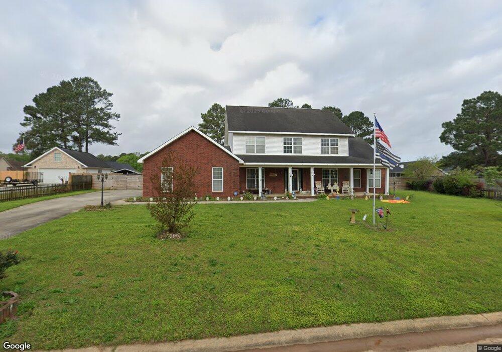
415 Redding Dr Kathleen, GA 31047
Estimated Value: $382,912 - $454,000
Studio
--
Bath
3,089
Sq Ft
$136/Sq Ft
Est. Value
About This Home
This home is located at 415 Redding Dr, Kathleen, GA 31047 and is currently estimated at $418,728, approximately $135 per square foot. 415 Redding Dr is a home located in Houston County with nearby schools including Matthew Arthur Elementary School, Perry Middle School, and Veterans High School.
Ownership History
Date
Name
Owned For
Owner Type
Purchase Details
Closed on
Nov 21, 2006
Sold by
Hollywood Homes Inc
Bought by
Elvins Alfred C and Elvins Jane M
Current Estimated Value
Home Financials for this Owner
Home Financials are based on the most recent Mortgage that was taken out on this home.
Original Mortgage
$259,185
Outstanding Balance
$150,324
Interest Rate
6.33%
Mortgage Type
New Conventional
Estimated Equity
$268,404
Purchase Details
Closed on
Aug 3, 2005
Sold by
Southern Trace Partners Llc
Bought by
Hollywood Homes Inc
Create a Home Valuation Report for This Property
The Home Valuation Report is an in-depth analysis detailing your home's value as well as a comparison with similar homes in the area
Home Values in the Area
Average Home Value in this Area
Purchase History
| Date | Buyer | Sale Price | Title Company |
|---|---|---|---|
| Elvins Alfred C | $325,000 | None Available | |
| Hollywood Homes Inc | $37,000 | -- |
Source: Public Records
Mortgage History
| Date | Status | Borrower | Loan Amount |
|---|---|---|---|
| Open | Elvins Alfred C | $259,185 |
Source: Public Records
Tax History
| Year | Tax Paid | Tax Assessment Tax Assessment Total Assessment is a certain percentage of the fair market value that is determined by local assessors to be the total taxable value of land and additions on the property. | Land | Improvement |
|---|---|---|---|---|
| 2025 | $2,629 | $132,760 | $10,000 | $122,760 |
| 2024 | $2,955 | $125,520 | $10,000 | $115,520 |
| 2023 | $2,640 | $111,240 | $10,000 | $101,240 |
| 2022 | $2,493 | $105,160 | $10,000 | $95,160 |
| 2021 | $2,315 | $97,280 | $10,000 | $87,280 |
| 2020 | $2,307 | $96,520 | $10,000 | $86,520 |
| 2019 | $2,307 | $96,520 | $10,000 | $86,520 |
| 2018 | $2,307 | $96,520 | $10,000 | $86,520 |
| 2017 | $2,309 | $96,520 | $10,000 | $86,520 |
| 2016 | $2,313 | $96,520 | $10,000 | $86,520 |
| 2015 | $2,313 | $96,520 | $10,000 | $86,520 |
| 2014 | -- | $96,520 | $10,000 | $86,520 |
| 2013 | -- | $96,520 | $10,000 | $86,520 |
Source: Public Records
Map
Nearby Homes
- 204 Mitculler Ct
- 301 Willowbrook Ln
- 302 Willowbrook Ln
- 303 Willowbrook Ln
- 304 Willowbrook Ln
- 305 Willowbrook Ln
- 306 Willowbrook Ln
- 307 Willowbrook Ln
- 309 Willowbrook Ln
- 147 Blue Mist Ln
- 418 Bristleleaf Path
- 416 Bristleleaf Path
- 409 Bristleleaf Path
- 521 Bristleleaf Path
- 531 Bristleleaf Path
- 202 Emberwood Way
- 523 Bristleleaf Path
- 104 Black Birch Ln
- 232 Old Hollow Way
- 605 Willowbrook Ln
Your Personal Tour Guide
Ask me questions while you tour the home.