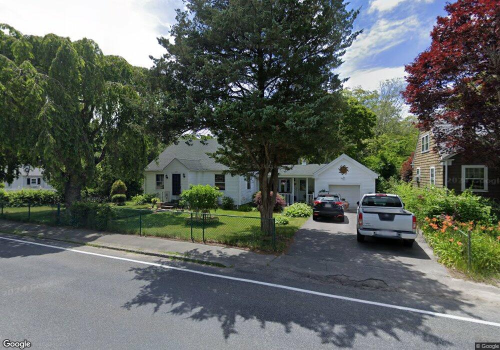
415 Sanford Rd Westport, MA 02790
North Westport NeighborhoodEstimated Value: $481,000 - $512,000
3
Beds
2
Baths
1,841
Sq Ft
$268/Sq Ft
Est. Value
About This Home
This home is located at 415 Sanford Rd, Westport, MA 02790 and is currently estimated at $493,506, approximately $268 per square foot. 415 Sanford Rd is a home located in Bristol County with nearby schools including Alice A. Macomber Primary School, Westport Elementary School, and Westport Middle-High School.
Ownership History
Date
Name
Owned For
Owner Type
Purchase Details
Closed on
Feb 4, 2014
Sold by
Lambert Doris R
Bought by
Amaral Nancy
Current Estimated Value
Purchase Details
Closed on
Jun 18, 1986
Bought by
Amaral Nancy
Create a Home Valuation Report for This Property
The Home Valuation Report is an in-depth analysis detailing your home's value as well as a comparison with similar homes in the area
Home Values in the Area
Average Home Value in this Area
Purchase History
| Date | Buyer | Sale Price | Title Company |
|---|---|---|---|
| Amaral Nancy | -- | -- | |
| Amaral Nancy | -- | -- |
Source: Public Records
Mortgage History
| Date | Status | Borrower | Loan Amount |
|---|---|---|---|
| Previous Owner | Amaral Nancy | $20,000 |
Source: Public Records
Tax History Compared to Growth
Tax History
| Year | Tax Paid | Tax Assessment Tax Assessment Total Assessment is a certain percentage of the fair market value that is determined by local assessors to be the total taxable value of land and additions on the property. | Land | Improvement |
|---|---|---|---|---|
| 2025 | $2,787 | $374,100 | $182,500 | $191,600 |
| 2024 | $2,702 | $349,600 | $162,000 | $187,600 |
| 2023 | $2,680 | $328,400 | $147,600 | $180,800 |
| 2022 | $2,557 | $301,500 | $147,600 | $153,900 |
| 2021 | $5,130 | $283,100 | $122,000 | $161,100 |
| 2020 | $2,345 | $278,200 | $117,100 | $161,100 |
| 2019 | $3,895 | $272,100 | $117,100 | $155,000 |
| 2018 | $5,098 | $228,900 | $116,200 | $112,700 |
| 2017 | $4,790 | $227,300 | $112,500 | $114,800 |
| 2016 | $1,768 | $223,500 | $108,700 | $114,800 |
| 2015 | $1,760 | $221,900 | $111,200 | $110,700 |
Source: Public Records
Map
Nearby Homes
- 411 Sanford Rd
- 421 Sanford Rd
- 407 Sanford Rd
- 422 Sanford Rd
- 410A Sanford Rd
- 410 Sanford Rd Unit 410-B
- 410 Sanford Rd
- 428 Sanford Rd
- 32 Thomas St
- 391 Sanford Rd
- 436 Sanford Rd Unit 438
- 394 Sanford Rd
- 436-438 Sanford Rd
- 120 Benoit St
- 117 Benoit St
- 109 Thomas St
- 35 Thomas St
- 116 Benoit St
- 444 Sanford Rd
- 10 Estrella Ln Unit lane