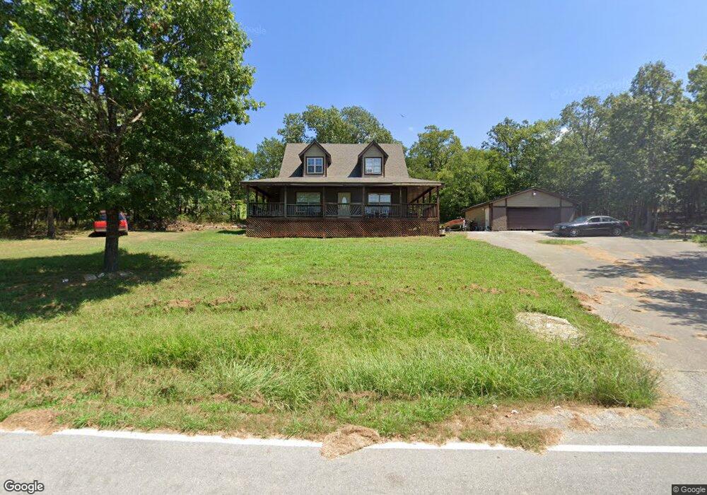
415 Tablerock Cir Unit 1 Branson, MO 65616
Estimated Value: $362,533 - $498,000
2
Beds
2
Baths
1,625
Sq Ft
$260/Sq Ft
Est. Value
About This Home
This home is located at 415 Tablerock Cir Unit 1, Branson, MO 65616 and is currently estimated at $422,883, approximately $260 per square foot. 415 Tablerock Cir Unit 1 is a home located in Stone County with nearby schools including Reeds Spring Primary School, Reeds Spring Elementary School, and Reeds Spring Middle School.
Ownership History
Date
Name
Owned For
Owner Type
Purchase Details
Closed on
Nov 7, 2022
Sold by
Leona Rolston Residuary Trust
Bought by
Rolston Ryan
Current Estimated Value
Purchase Details
Closed on
Apr 23, 2013
Sold by
Gerdel Andrew P and Gerdel Melissa D
Bought by
Koehn Michael and Koehn Kalin
Home Financials for this Owner
Home Financials are based on the most recent Mortgage that was taken out on this home.
Original Mortgage
$130,000
Interest Rate
3.55%
Mortgage Type
New Conventional
Purchase Details
Closed on
Nov 22, 2006
Sold by
Stone Mark and Stone Sherri
Bought by
Gerdel Andrew P and Gerdel Melissa D
Home Financials for this Owner
Home Financials are based on the most recent Mortgage that was taken out on this home.
Original Mortgage
$41,800
Interest Rate
6.37%
Mortgage Type
Stand Alone Second
Create a Home Valuation Report for This Property
The Home Valuation Report is an in-depth analysis detailing your home's value as well as a comparison with similar homes in the area
Home Values in the Area
Average Home Value in this Area
Purchase History
| Date | Buyer | Sale Price | Title Company |
|---|---|---|---|
| Rolston Ryan | -- | -- | |
| Koehn Michael | -- | Hogan Land Title | |
| Gerdel Andrew P | -- | None Available |
Source: Public Records
Mortgage History
| Date | Status | Borrower | Loan Amount |
|---|---|---|---|
| Previous Owner | Koehn Michael | $130,000 | |
| Previous Owner | Gerdel Andrew P | $41,800 |
Source: Public Records
Tax History Compared to Growth
Tax History
| Year | Tax Paid | Tax Assessment Tax Assessment Total Assessment is a certain percentage of the fair market value that is determined by local assessors to be the total taxable value of land and additions on the property. | Land | Improvement |
|---|---|---|---|---|
| 2024 | $1,002 | $20,480 | -- | -- |
| 2023 | $1,002 | $20,480 | $0 | $0 |
| 2022 | $790 | $16,230 | $0 | $0 |
| 2021 | $799 | $16,230 | $0 | $0 |
| 2020 | $704 | $16,230 | $0 | $0 |
| 2019 | $700 | $16,230 | $0 | $0 |
| 2018 | $699 | $16,230 | $0 | $0 |
| 2017 | $821 | $19,040 | $0 | $0 |
| 2016 | $799 | $19,040 | $0 | $0 |
| 2015 | $800 | $19,040 | $0 | $0 |
| 2014 | $786 | $19,040 | $0 | $0 |
| 2012 | -- | $19,040 | $0 | $0 |
Source: Public Records
Map
Nearby Homes
- 410 Tablerock Cir
- 956 Tablerock Cir
- 60 Timber Oaks Trail Unit C
- 49 Timber Trace Ln
- 48 Timber Trace Ln
- 26 Cave Ln Unit Cabin 10
- 70 Dogwood Park Trail Unit 1510
- 168 Jax Trail Unit 49
- 164 Dogwood Park Trail Unit A & B
- 172 Dogwood Park Trail Unit 1110
- 10 View Tablerock Landing
- Lot 47 Dogwood Valley Estates
- 95 Leaning Tree Cir
- 638 Double Day Loop
- 429 Chinquapin Cir Unit 608
- 429 Chinquapin Cir Unit 504
- 429 Chinquapin Cir Unit 607
- 45 Leaning Tree Cir Unit 6
- 24 Village Trail Unit 7
- 24 Village Trail Unit 13-2
- 415 Tablerock Cir
- Lots 23/24 Tablerock
- 0 Lot 21 Table Rock Beach
- 000 Table Rock
- Tbd Table Rock
- 0 Table Rock Unit 30334675
- 0 Table Rock Unit 30334674
- 0 Table Rock Unit 30337630
- 0 Table Rock Unit 30339979
- 0 Table Rock Unit 30339980
- 0 Table Rock Unit 30339978
- 0 Table Rock Unit 30345781
- 0 Table Rock Unit 30345780
- 0 Table Rock Unit 30345779
- 0 Table Rock Unit 30348071
- 0 Lot 44 Tablerock
- 0 Lot 41 Tablerock
- 0 Lot 42 Table Rock Beach
- 416 Tablerock Cir
- 454 Table Rock Circle A-6