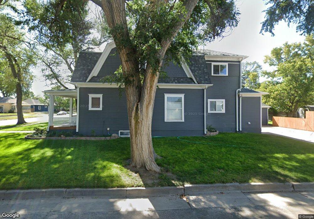
415 W 7th St Alliance, NE 69301
Estimated Value: $55,000 - $96,000
2
Beds
1
Bath
576
Sq Ft
$134/Sq Ft
Est. Value
About This Home
This home is located at 415 W 7th St, Alliance, NE 69301 and is currently estimated at $77,454, approximately $134 per square foot. 415 W 7th St is a home located in Box Butte County with nearby schools including Alliance High School, St. Agnes Academy, and Immanuel Evangelical Lutheran School.
Ownership History
Date
Name
Owned For
Owner Type
Purchase Details
Closed on
Jun 17, 2024
Sold by
Sorensen Troy C and Sorensen Cassi
Bought by
Hughes Devin S
Current Estimated Value
Home Financials for this Owner
Home Financials are based on the most recent Mortgage that was taken out on this home.
Original Mortgage
$40,000
Outstanding Balance
$39,582
Interest Rate
8.05%
Mortgage Type
New Conventional
Estimated Equity
$37,872
Purchase Details
Closed on
Dec 21, 2017
Sold by
Kirkpatrick Samuel G
Bought by
Sorensen Troy C
Create a Home Valuation Report for This Property
The Home Valuation Report is an in-depth analysis detailing your home's value as well as a comparison with similar homes in the area
Home Values in the Area
Average Home Value in this Area
Purchase History
| Date | Buyer | Sale Price | Title Company |
|---|---|---|---|
| Hughes Devin S | $50,000 | Kunzman Title | |
| Sorensen Troy C | $39,000 | -- |
Source: Public Records
Mortgage History
| Date | Status | Borrower | Loan Amount |
|---|---|---|---|
| Open | Hughes Devin S | $40,000 |
Source: Public Records
Tax History Compared to Growth
Tax History
| Year | Tax Paid | Tax Assessment Tax Assessment Total Assessment is a certain percentage of the fair market value that is determined by local assessors to be the total taxable value of land and additions on the property. | Land | Improvement |
|---|---|---|---|---|
| 2024 | $559 | $44,610 | $2,250 | $42,360 |
| 2023 | $767 | $44,610 | $2,250 | $42,360 |
| 2022 | $706 | $38,795 | $2,125 | $36,670 |
| 2021 | $715 | $38,795 | $2,125 | $36,670 |
| 2020 | $713 | $38,795 | $2,125 | $36,670 |
| 2019 | $697 | $38,795 | $2,125 | $36,670 |
| 2018 | $693 | $38,795 | $2,125 | $36,670 |
| 2017 | $622 | $33,499 | $1,625 | $31,874 |
| 2016 | $615 | $33,499 | $1,625 | $31,874 |
| 2015 | $570 | $31,695 | $1,625 | $30,070 |
| 2014 | $570 | $31,695 | $1,625 | $30,070 |
Source: Public Records
Map
Nearby Homes
- 719 Toluca Ave
- 621 Emerson Ave
- 907 Toluca Ave
- 911 Emerson Ave
- 924 Big Horn Ave
- 420 Laramie Ave
- 316 Big Horn Ave
- 904 Laramie Ave
- 819 Black Hills Ave
- 936 Platte Ave
- 1019 Laramie Ave
- 615 Sweetwater Ave
- 1021 Dakota Ave
- 1239 Toluca Ave
- 917 Missouri Ave
- 1004 Missouri Ave
- 613 Mississippi Ave
- 667 E 9th St
- 719 E 8th St
- 620 Hudson Ave
- 619 Toluca Ave
- 623 Toluca Ave
- 624 Big Horn Ave
- 615 Toluca Ave
- 618 Big Horn Ave
- 703 Toluca Ave
- 412 W 7th St
- 614 Big Horn Ave
- 609 Toluca Ave
- 707 Toluca Ave
- 704 Big Horn Ave
- 610 Big Horn Ave
- 708 Big Horn Ave
- 607 Toluca Ave
- 711 Toluca Ave
- 608 Big Horn Ave
- 712 Big Horn Ave
- 601 Toluca Ave
- 715 Toluca Ave
- 604 Big Horn Ave