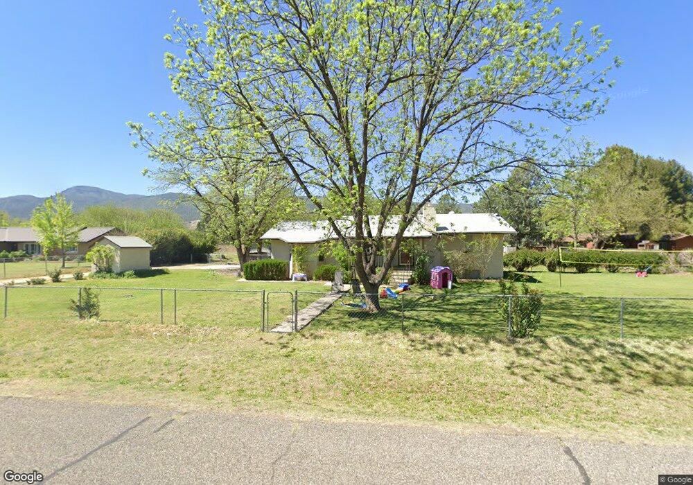
415 W Pheasant Run Cir Camp Verde, AZ 86322
Estimated Value: $381,934 - $516,000
--
Bed
--
Bath
1,399
Sq Ft
$316/Sq Ft
Est. Value
About This Home
This home is located at 415 W Pheasant Run Cir, Camp Verde, AZ 86322 and is currently estimated at $442,734, approximately $316 per square foot. 415 W Pheasant Run Cir is a home located in Yavapai County with nearby schools including Camp Verde Elementary School, Camp Verde Middle School, and Camp Verde High School.
Ownership History
Date
Name
Owned For
Owner Type
Purchase Details
Closed on
Sep 23, 2022
Sold by
Dixie Diane Elder Revocable Living Trust
Bought by
Frewin Mary Katherine and Frewin Joshua C
Current Estimated Value
Home Financials for this Owner
Home Financials are based on the most recent Mortgage that was taken out on this home.
Original Mortgage
$279,000
Outstanding Balance
$265,741
Interest Rate
4.88%
Mortgage Type
New Conventional
Estimated Equity
$176,993
Purchase Details
Closed on
Sep 27, 2012
Sold by
Elder Dixie Diane
Bought by
Elder Dixie Diane
Purchase Details
Closed on
Jun 24, 1994
Sold by
Burns Lewis C and Burns Eudora M
Bought by
Elder Bliss David and Elder Dixie Diane
Home Financials for this Owner
Home Financials are based on the most recent Mortgage that was taken out on this home.
Original Mortgage
$72,500
Interest Rate
3.87%
Mortgage Type
Purchase Money Mortgage
Create a Home Valuation Report for This Property
The Home Valuation Report is an in-depth analysis detailing your home's value as well as a comparison with similar homes in the area
Home Values in the Area
Average Home Value in this Area
Purchase History
| Date | Buyer | Sale Price | Title Company |
|---|---|---|---|
| Frewin Mary Katherine | $350,000 | Yavapai Title Agency | |
| Elder Dixie Diane | -- | None Available | |
| Elder Bliss David | $92,500 | Transamerica Title Ins Co |
Source: Public Records
Mortgage History
| Date | Status | Borrower | Loan Amount |
|---|---|---|---|
| Open | Frewin Mary Katherine | $279,000 | |
| Previous Owner | Elder Bliss David | $72,500 |
Source: Public Records
Tax History Compared to Growth
Tax History
| Year | Tax Paid | Tax Assessment Tax Assessment Total Assessment is a certain percentage of the fair market value that is determined by local assessors to be the total taxable value of land and additions on the property. | Land | Improvement |
|---|---|---|---|---|
| 2026 | $1,476 | $33,166 | -- | -- |
| 2024 | $1,427 | $32,797 | -- | -- |
| 2023 | $1,427 | $27,470 | $7,255 | $20,215 |
| 2022 | $1,345 | $22,367 | $5,349 | $17,018 |
| 2021 | $1,398 | $21,196 | $5,668 | $15,528 |
| 2020 | $1,349 | $0 | $0 | $0 |
| 2019 | $1,320 | $0 | $0 | $0 |
| 2018 | $1,275 | $0 | $0 | $0 |
| 2017 | $1,208 | $0 | $0 | $0 |
| 2016 | $1,161 | $0 | $0 | $0 |
| 2015 | -- | $0 | $0 | $0 |
| 2014 | -- | $0 | $0 | $0 |
Source: Public Records
Map
Nearby Homes
- 1785 S Fort Apache Rd
- 2095 S Hillcrest Dr
- 2050 S Hillcrest Dr
- 1844 S Quarterhorse Ln
- 2045 S Hillcrest Dr
- 1993 S Salt Mine Rd
- 1846 S Dodge Rd
- 1616 S Reeves Arena Rd
- 955 W Copperhead Rd
- 452 E Cole Blvd Unit 17
- 452 E Cole Blvd
- 451 W Salt Mine Rd
- 1703 S Parrish Ln
- 1010 S Clarence Ln
- 469 E Cole Blvd Unit 6
- 356 E Cole Blvd Unit 15
- 328 E Cole Blvd Unit 14
- 405 E Cole Blvd Unit 8
- 437 E Cole Blvd Unit 7
- 270 E Cole Blvd Unit 13
- 395 W Pheasant Run Cir
- 1945 S Pearl Dr
- 462 W Spruce St
- 390 W Pheasant Run Cir
- 420 W Pheasant Run Cir
- 380 W Pheasant Run Cir
- 1938 S Pearl Dr
- 1958 S Pearl Dr
- 452 W Spruce St
- 1928 S Pearl Dr
- 350 W Pheasant Run Cir
- 469 W Spruce St
- 489 W Spruce St
- 1898 S Pearl Dr
- 335 W Pheasant Run Cir
- 355 W Pheasant Run Cir
- 325 W Fort McDowell Place
- 305 W Fort McDowell Place
- 320 W Pheasant Run Cir
- 2038 S Pearl Dr