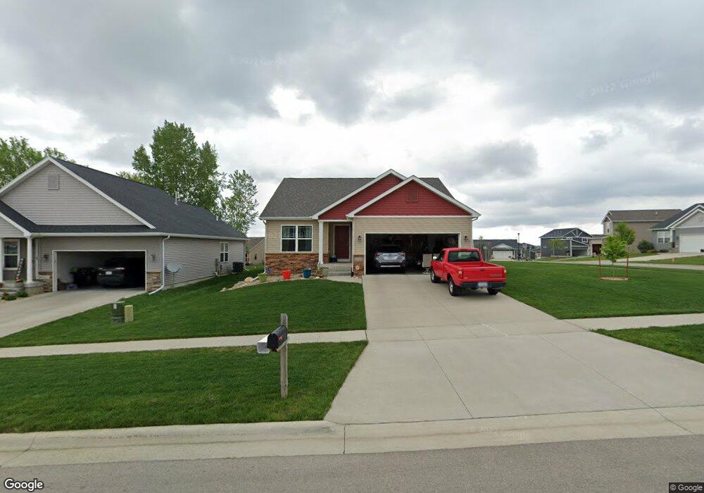
4153 Mockingbird Ln Waterloo, IA 50701
Estimated Value: $294,000 - $320,000
2
Beds
2
Baths
1,267
Sq Ft
$240/Sq Ft
Est. Value
About This Home
This home is located at 4153 Mockingbird Ln, Waterloo, IA 50701 and is currently estimated at $303,525, approximately $239 per square foot. 4153 Mockingbird Ln is a home located in Black Hawk County with nearby schools including Kittrell Elementary School, Hoover Middle School, and West High School.
Ownership History
Date
Name
Owned For
Owner Type
Purchase Details
Closed on
Nov 11, 2014
Sold by
Midwest Development Co
Bought by
Nelsen Gregory S and Nelsen Vickie L
Current Estimated Value
Home Financials for this Owner
Home Financials are based on the most recent Mortgage that was taken out on this home.
Original Mortgage
$77,418
Outstanding Balance
$59,111
Interest Rate
3.99%
Mortgage Type
New Conventional
Estimated Equity
$244,414
Create a Home Valuation Report for This Property
The Home Valuation Report is an in-depth analysis detailing your home's value as well as a comparison with similar homes in the area
Purchase History
| Date | Buyer | Sale Price | Title Company |
|---|---|---|---|
| Nelsen Gregory S | $194,000 | None Available |
Source: Public Records
Mortgage History
| Date | Status | Borrower | Loan Amount |
|---|---|---|---|
| Open | Nelsen Gregory S | $77,418 |
Source: Public Records
Tax History
| Year | Tax Paid | Tax Assessment Tax Assessment Total Assessment is a certain percentage of the fair market value that is determined by local assessors to be the total taxable value of land and additions on the property. | Land | Improvement |
|---|---|---|---|---|
| 2025 | $5,654 | $315,790 | $55,340 | $260,450 |
| 2024 | $5,654 | $284,540 | $55,340 | $229,200 |
| 2023 | $5,226 | $284,540 | $55,340 | $229,200 |
| 2022 | $5,086 | $246,830 | $55,340 | $191,490 |
| 2021 | $4,858 | $246,830 | $55,340 | $191,490 |
| 2020 | $4,776 | $223,110 | $31,620 | $191,490 |
| 2019 | $4,776 | $223,110 | $31,620 | $191,490 |
| 2018 | $510 | $223,110 | $31,620 | $191,490 |
| 2017 | $530 | $223,110 | $31,620 | $191,490 |
| 2016 | $520 | $207,150 | $31,620 | $175,530 |
| 2015 | $520 | $189,190 | $31,620 | $157,570 |
| 2014 | $366 | $15,810 | $15,810 | $0 |
Source: Public Records
Map
Nearby Homes
- 4151 Mockingbird Ln
- 4134 Mockingbird Ln
- 1506 Hummingbird Cir
- 4106 Mourning Dove Dr
- 1420 Hummingbird Cir
- 4233 Mourning Dove Dr
- 724 Grindstone Cir
- 4400 Mourning Dove Dr
- 1234 Hummingbird Cir
- 4144 Omaha Ave
- 4182 Mystic Dr
- 4170 Mystic Dr
- 0 Alexandra Dr
- Lot 7 Crossroads
- Lot 6 Crossroads
- 4408 Nostalgia Ln
- 1115 Flammang Dr Unit 4
- Lot 5 Crossroads
- 3420 Crown Ct Unit 3420
- 1117 Lois Ln
- 4147 Mockingbird Ln
- 4145 Mockingbird Ln
- 1435 Hummingbird Cir
- 4146 Mourning Dove Dr
- 4144 Mourning Dove Dr
- 4134 Mourning Dove Dr
- 4143 Mockingbird Ln
- 1508 Hummingbird Cir
- 1512 Hummingbird Cir
- 4146 Mockingbird Ln
- 1514 Hummingbird Cir
- 1433 Hummingbird Cir
- 1444 Hummingbird Cir
- 4139 Mockingbird Ln
- 1442 Hummingbird Cir
- 4144 Mockingbird Ln
- 1438 Hummingbird Cir
- 4135 Mockingbird Ln
- 1436 Hummingbird Cir
- 4140 Mockingbird Ln
Your Personal Tour Guide
Ask me questions while you tour the home.