Estimated Value: $104,000 - $151,000
Studio
1
Bath
1,544
Sq Ft
$87/Sq Ft
Est. Value
About This Home
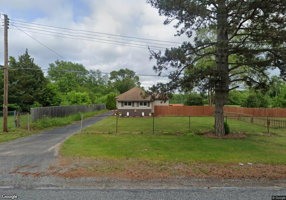
This home is located at 4154 Branch Rd, Flint, MI 48506 and is currently estimated at $133,595, approximately $86 per square foot. 4154 Branch Rd is a home with nearby schools including Weston Elementary School, Kate Dowdall Elementary School, and Leota Fiedler Elementary School.
Ownership History
Date
Name
Owned For
Owner Type
Purchase Details
Closed on
Feb 7, 2023
Sold by
Bruff Gary
Bought by
Bruff Brent
Current Estimated Value
Purchase Details
Closed on
Dec 16, 2021
Sold by
Gary Bruff
Bought by
Bruff Gary and Bruff Brent
Purchase Details
Closed on
Jul 28, 2020
Sold by
Antoinete Keim and Keim Revocable Trusts
Bought by
Bruff Gary R
Home Financials for this Owner
Home Financials are based on the most recent Mortgage that was taken out on this home.
Original Mortgage
$28,000
Interest Rate
3%
Mortgage Type
New Conventional
Purchase Details
Closed on
Jan 30, 2014
Sold by
Keim Nicklette
Bought by
Keim Revocable Trust
Create a Home Valuation Report for This Property
The Home Valuation Report is an in-depth analysis detailing your home's value as well as a comparison with similar homes in the area
Home Values in the Area
Average Home Value in this Area
Purchase History
| Date | Buyer | Sale Price | Title Company |
|---|---|---|---|
| Bruff Brent | -- | -- | |
| Bruff Gary | -- | None Listed On Document | |
| Bruff Gary | -- | None Listed On Document | |
| Bruff Gary R | $35,000 | None Available | |
| Keim Revocable Trust | -- | None Available |
Source: Public Records
Mortgage History
| Date | Status | Borrower | Loan Amount |
|---|---|---|---|
| Previous Owner | Bruff Gary R | $28,000 |
Source: Public Records
Tax History
| Year | Tax Paid | Tax Assessment Tax Assessment Total Assessment is a certain percentage of the fair market value that is determined by local assessors to be the total taxable value of land and additions on the property. | Land | Improvement |
|---|---|---|---|---|
| 2025 | $2,226 | $70,300 | $0 | $0 |
| 2024 | $624 | $64,200 | $0 | $0 |
| 2023 | $595 | $58,600 | $0 | $0 |
| 2022 | $2,670 | $52,800 | $0 | $0 |
| 2021 | $2,653 | $47,700 | $0 | $0 |
| 2020 | $293 | $42,900 | $0 | $0 |
| 2019 | $288 | $37,300 | $0 | $0 |
| 2018 | $978 | $35,600 | $0 | $0 |
| 2017 | $938 | $34,600 | $0 | $0 |
Source: Public Records
Map
Nearby Homes
- 2919 Hampstead Dr
- 2825 Eaton Place
- 5919 Western Rd
- 2727 Eaton Place
- 4907 Delta Dr
- 3364 E Pierson Rd
- 3456 E Pierson Rd
- 4298 N Center Rd
- 3294 Huggins Ave
- 4141 Hidden View Dr
- 2935 Richfield Rd
- 00 Richfield Rd
- 5190 Branch Rd
- 1704 E Webster Rd
- 5910 N Dort Hwy
- 3006 Agree Ave
- 3705 Aldon Ln
- 0 Sugar Maple Farms Unit 50195365
- 3210 Wyoming Ave
- 3118 Wyoming Ave
Your Personal Tour Guide
Ask me questions while you tour the home.