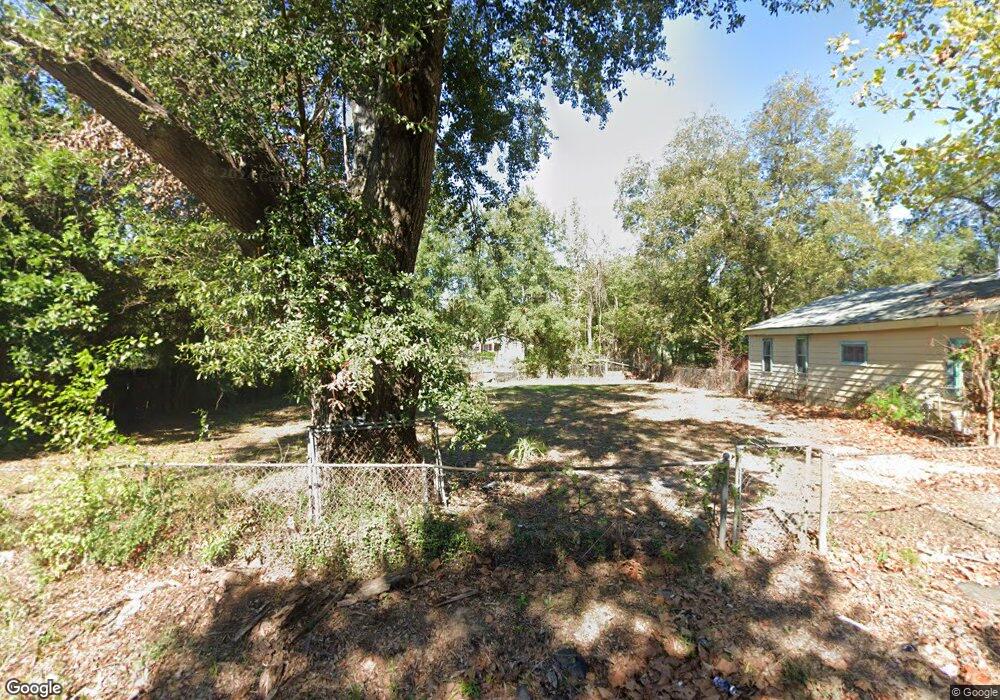
4154 Clover St Shreveport, LA 71109
Mooretown and Hollywood Heights NeighborhoodEstimated Value: $60,000 - $69,000
3
Beds
1
Bath
1,584
Sq Ft
$41/Sq Ft
Est. Value
About This Home
This home is located at 4154 Clover St, Shreveport, LA 71109 and is currently estimated at $64,500, approximately $40 per square foot. 4154 Clover St is a home located in Caddo Parish with nearby schools including Oak Park Elementary School, Judson Fundamental Elementary School, and Fairfield Magnet School.
Ownership History
Date
Name
Owned For
Owner Type
Purchase Details
Closed on
Sep 7, 2021
Sold by
Margaret Mays
Bought by
Johnson Nathaniel L
Current Estimated Value
Purchase Details
Closed on
Jul 3, 2018
Sold by
Caddo Parish Sheriff
Bought by
Parish Caddo
Purchase Details
Closed on
May 18, 2018
Sold by
Caddo County Collector
Bought by
Shreveport City
Purchase Details
Closed on
Nov 27, 2017
Sold by
Ebc Enterprises Llc
Bought by
Johnson Carl Patrick
Purchase Details
Closed on
Jan 20, 2017
Sold by
City Of Shreveport
Bought by
Kbc Enterprises Llc
Create a Home Valuation Report for This Property
The Home Valuation Report is an in-depth analysis detailing your home's value as well as a comparison with similar homes in the area
Home Values in the Area
Average Home Value in this Area
Purchase History
| Date | Buyer | Sale Price | Title Company |
|---|---|---|---|
| Johnson Nathaniel L | -- | None Listed On Document | |
| Parish Caddo | $739 | None Available | |
| Shreveport City | $391 | None Available | |
| Johnson Carl Patrick | -- | -- | |
| Kbc Enterprises Llc | $1,100 | None Available |
Source: Public Records
Tax History Compared to Growth
Tax History
| Year | Tax Paid | Tax Assessment Tax Assessment Total Assessment is a certain percentage of the fair market value that is determined by local assessors to be the total taxable value of land and additions on the property. | Land | Improvement |
|---|---|---|---|---|
| 2024 | $113 | $728 | $728 | $0 |
| 2023 | $134 | $843 | $693 | $150 |
| 2022 | $490 | $3,077 | $693 | $2,384 |
| 2021 | $483 | $3,077 | $693 | $2,384 |
| 2020 | $483 | $3,076 | $693 | $2,383 |
| 2019 | $497 | $3,076 | $693 | $2,383 |
| 2018 | $396 | $3,076 | $693 | $2,383 |
| 2017 | $505 | $3,076 | $693 | $2,383 |
| 2015 | $453 | $3,497 | $693 | $2,804 |
| 2014 | $458 | $3,510 | $690 | $2,820 |
| 2013 | -- | $3,510 | $690 | $2,820 |
Source: Public Records
Map
Nearby Homes
- 5600 Norton St
- 5222 Broadway Ave
- 4310 Saint Louis Ave
- 4302 Illinois Ave
- 4718 Gloria Cir
- 5415 Norton St
- 3841 Flora Ave
- 4536 Curtis Ln
- 3735 Tate St
- 3718 Doris St
- 4031 Robin Ln
- 4228 Barbara Ave
- 0 Miles St
- 3924 Miles St
- 3922 Miles St
- 4814 Mcdaniel Dr
- 4018 Golf Links Blvd
- Lot 1 Spanish Oak Cir
- 3540 Pleasant Dr
- 4130 Mayfield St
- 4150 Clover St
- 4148 Clover St
- 4151 Henry St
- 4155 Clover St
- 4147 Henry St
- 5014 Roberts Ave
- 4201 Henry St
- 4140 Clover St
- 5202 Roberts St
- 4143 Henry St
- 4205 Henry St
- 4136 Clover St
- 5206 Roberts St
- 5017 Francis St
- 5021 Francis St
- 4135 Henry St
- 4209 Henry St
- 5210 Roberts St
- 4135 Clover St
- 5013 Francis St