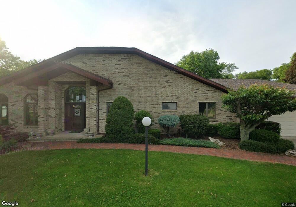
4159 E Mooresdock Rd Port Clinton, OH 43452
Estimated Value: $719,706 - $777,000
2
Beds
2
Baths
1,952
Sq Ft
$380/Sq Ft
Est. Value
About This Home
This home is located at 4159 E Mooresdock Rd, Port Clinton, OH 43452 and is currently estimated at $742,427, approximately $380 per square foot. 4159 E Mooresdock Rd is a home located in Ottawa County with nearby schools including Bataan Memorial Primary School, Bataan Memorial Intermediate School, and Port Clinton Middle School.
Ownership History
Date
Name
Owned For
Owner Type
Purchase Details
Closed on
Jul 30, 2025
Sold by
Brema C Colvin Trust and Colvin Jeffrey T
Bought by
Leonard F Lammlein Trust and Kimberly S Lammlein Trust
Current Estimated Value
Home Financials for this Owner
Home Financials are based on the most recent Mortgage that was taken out on this home.
Original Mortgage
$525,000
Outstanding Balance
$515,853
Interest Rate
5.96%
Mortgage Type
New Conventional
Estimated Equity
$226,574
Purchase Details
Closed on
Aug 12, 1993
Sold by
Hausler James and Hausler Joselyn
Bought by
Colvin Brema C Trustee
Create a Home Valuation Report for This Property
The Home Valuation Report is an in-depth analysis detailing your home's value as well as a comparison with similar homes in the area
Home Values in the Area
Average Home Value in this Area
Purchase History
| Date | Buyer | Sale Price | Title Company |
|---|---|---|---|
| Leonard F Lammlein Trust | $725,000 | Hartung Title | |
| Leonard F Lammlein Trust | $725,000 | Hartung Title | |
| Colvin Brema C Trustee | $360,000 | -- |
Source: Public Records
Mortgage History
| Date | Status | Borrower | Loan Amount |
|---|---|---|---|
| Open | Leonard F Lammlein Trust | $525,000 | |
| Closed | Leonard F Lammlein Trust | $525,000 |
Source: Public Records
Tax History
| Year | Tax Paid | Tax Assessment Tax Assessment Total Assessment is a certain percentage of the fair market value that is determined by local assessors to be the total taxable value of land and additions on the property. | Land | Improvement |
|---|---|---|---|---|
| 2024 | $5,489 | $187,905 | $83,948 | $103,957 |
| 2023 | $5,622 | $159,558 | $69,958 | $89,600 |
| 2022 | $5,229 | $159,558 | $69,958 | $89,600 |
| 2021 | $5,221 | $159,560 | $69,960 | $89,600 |
| 2020 | $4,252 | $126,880 | $56,880 | $70,000 |
| 2019 | $4,208 | $126,880 | $56,880 | $70,000 |
| 2018 | $4,200 | $126,880 | $56,880 | $70,000 |
| 2017 | $4,169 | $124,290 | $56,880 | $67,410 |
| 2016 | $4,179 | $124,290 | $56,880 | $67,410 |
| 2015 | $4,196 | $124,290 | $56,880 | $67,410 |
| 2014 | $2,050 | $124,290 | $56,880 | $67,410 |
| 2013 | $4,109 | $124,290 | $56,880 | $67,410 |
Source: Public Records
Map
Nearby Homes
- 3472 N Karwood Dr
- 3496 N Karwood Dr
- 3617 N Karwood Dr
- 3110 N Marina View Dr
- 3737 N Karwood Dr
- 4439 E Harbors Edge Dr Unit 102
- 4520 E Harbors Edge Dr Unit 61
- 4567 E Kalalujah Lake Dr
- 4866 Westwinds Dr
- 3298 N Valley Dr
- 4862 E Westwinds Dr
- 2690 N Canterbury Cir
- 2690 N Canterbury Cir Unit D
- 2901 Villa Ct Unit C
- 2750 Canterbury Cir Unit D
- 4396 Marin Lakes
- 2696 Chateau Dr Unit 38 C
- 4446 E Marin Harbor
- 4475 Marin Harbor Unit H
- 2509 N Peachtree Ln Unit Sublot 5
- 4165 E Mooresdock Rd Unit B
- 4149 E Mooresdock Rd
- 4173 E Mooresdock Rd
- 4210 E Linda Dr
- 3376 N Karwood Dr
- 4139 E Mooresdock Rd
- 3400 N Karwood Dr
- 4129 E Moores Dock Rd
- 4129 E Mooresdock Rd
- 4188 E Bliss Dr
- 3308 N Stonehouse Dr Unit C9
- 3306 N Stonehouse Dr
- 3424 N Karwood Dr
- 3300 Stonehouse(unit C-5)
- 3304 N Stonehouse Dr
- 4251 E Linda Dr
- 4119 E Mooresdock Rd
- 3302 N Stonehouse Dr Unit C6
- 4119 E Moores Dock Rd
- 4180 E Moores Dock Rd
Your Personal Tour Guide
Ask me questions while you tour the home.