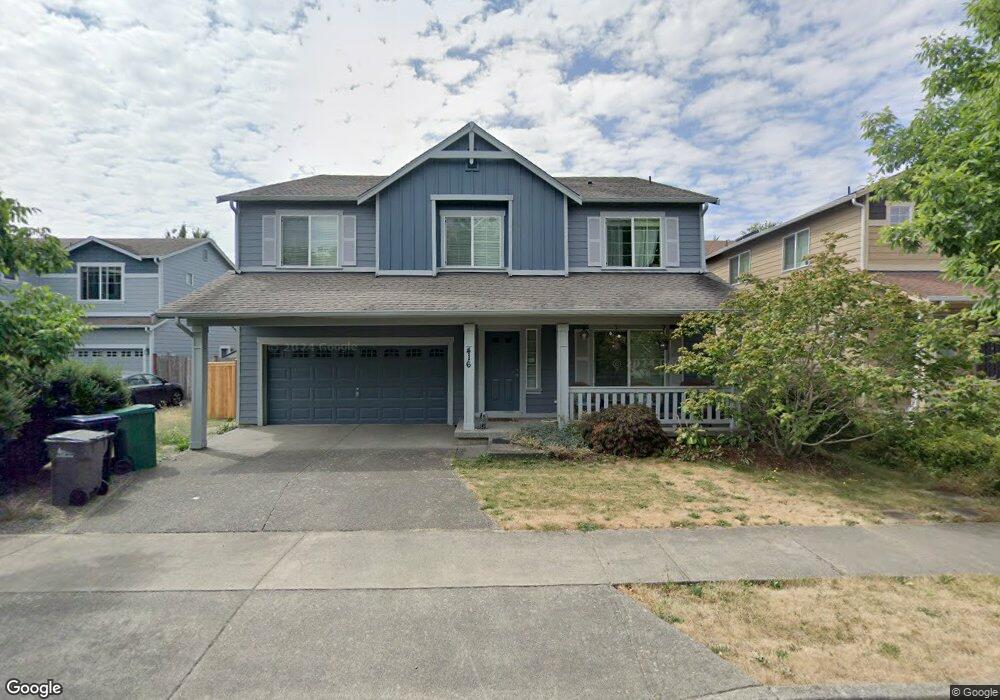
416 Asmundson Ln N Enumclaw, WA 98022
Estimated Value: $703,000 - $743,000
5
Beds
4
Baths
3,427
Sq Ft
$212/Sq Ft
Est. Value
About This Home
This home is located at 416 Asmundson Ln N, Enumclaw, WA 98022 and is currently estimated at $726,907, approximately $212 per square foot. 416 Asmundson Ln N is a home located in King County with nearby schools including Southwood Elementary School, Enumclaw Middle School, and Enumclaw Senior High School.
Ownership History
Date
Name
Owned For
Owner Type
Purchase Details
Closed on
May 9, 2008
Sold by
Cambria Homes Llc
Bought by
Fortner Michael S and Fortner Kimberley Y
Current Estimated Value
Home Financials for this Owner
Home Financials are based on the most recent Mortgage that was taken out on this home.
Original Mortgage
$349,872
Outstanding Balance
$221,572
Interest Rate
5.88%
Estimated Equity
$505,335
Create a Home Valuation Report for This Property
The Home Valuation Report is an in-depth analysis detailing your home's value as well as a comparison with similar homes in the area
Home Values in the Area
Average Home Value in this Area
Purchase History
| Date | Buyer | Sale Price | Title Company |
|---|---|---|---|
| Fortner Michael S | $437,340 | Chicago Title |
Source: Public Records
Mortgage History
| Date | Status | Borrower | Loan Amount |
|---|---|---|---|
| Open | Fortner Michael S | $349,872 |
Source: Public Records
Tax History
| Year | Tax Paid | Tax Assessment Tax Assessment Total Assessment is a certain percentage of the fair market value that is determined by local assessors to be the total taxable value of land and additions on the property. | Land | Improvement |
|---|---|---|---|---|
| 2024 | $6,068 | $632,000 | $202,000 | $430,000 |
| 2023 | $5,630 | $542,000 | $174,000 | $368,000 |
| 2022 | $5,040 | $619,000 | $199,000 | $420,000 |
| 2021 | $4,848 | $502,000 | $172,000 | $330,000 |
| 2020 | $4,426 | $440,000 | $129,000 | $311,000 |
| 2018 | $4,684 | $405,000 | $118,000 | $287,000 |
| 2017 | $4,158 | $382,000 | $108,000 | $274,000 |
| 2016 | $4,091 | $350,000 | $100,000 | $250,000 |
| 2015 | $3,870 | $339,000 | $95,000 | $244,000 |
| 2014 | -- | $307,000 | $100,000 | $207,000 |
| 2013 | -- | $236,000 | $80,000 | $156,000 |
Source: Public Records
Map
Nearby Homes
- 385 Bruhn Ln N
- 176 Love Dr
- 413 Becky Ave E
- 629 Barquist Ln N
- 643 Barquist Ln N
- 657 Barquist Ln N
- 505 Thompson (Lot 1) Dr
- 685 Barquist Ln N
- 549 Thompson (Lot 3) Dr
- 508 Thompson (Lot 22) Dr
- 637 Thompson (Lot 7) Dr
- 659 Thompson (Lot 8) Dr
- 607 Bathke Ave
- 673 Thompson (Lot 9) Dr
- 587 Thompson (Lot 10) Dr
- 806 Pine Dr
- 783 Weaver Dr E
- 823 Cottonwood Dr
- 721 Weaver Dr E
- 755 Weaver Dr E
- 438 Asmundson Ln N
- 404 Asmundson Ln N
- 2 Bruhn Dr E
- 0 Asmundson Ln N Unit 111561
- 450 Asmundson Ln N
- 372 Asmundson Ln N
- 211 Petersen Dr E
- 212 Bondgard Ave E
- 421 Jewell St
- 423 Jewell St
- 360 Asmundson Ln N
- 210 Petersen Dr E
- 224 Bondgard Ave E
- 19 Bondgard Ave E
- 7 Bondgard Ave E
- 3 Bondgard Ave E
- 12 Bondgard Ave E
- 417 Jewell St
- 415 Jewell St
Your Personal Tour Guide
Ask me questions while you tour the home.