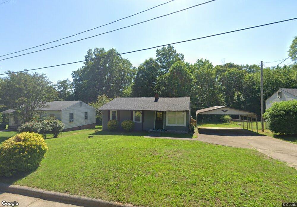
416 Hawthorne Dr Statesville, NC 28677
Estimated Value: $82,000 - $145,000
2
Beds
1
Bath
900
Sq Ft
$128/Sq Ft
Est. Value
About This Home
This home is located at 416 Hawthorne Dr, Statesville, NC 28677 and is currently estimated at $115,582, approximately $128 per square foot. 416 Hawthorne Dr is a home located in Iredell County with nearby schools including N.B. Mills Elementary School, West Iredell Middle School, and West Iredell High School.
Ownership History
Date
Name
Owned For
Owner Type
Purchase Details
Closed on
Oct 27, 2021
Sold by
Gibbs Amauri Jahcorryan
Bought by
Walker Kathy D
Current Estimated Value
Purchase Details
Closed on
Oct 24, 2021
Sold by
Walker Kathy D and Estate Of Erika Ina Shamall Da
Bought by
Gibbs Amauri Jah Corryan
Purchase Details
Closed on
Jul 18, 2000
Sold by
Barnette Thomas G and Barnette Rachel
Bought by
Dalton Erica
Home Financials for this Owner
Home Financials are based on the most recent Mortgage that was taken out on this home.
Original Mortgage
$42,500
Interest Rate
11.2%
Purchase Details
Closed on
Jun 1, 1974
Purchase Details
Closed on
Jun 1, 1965
Create a Home Valuation Report for This Property
The Home Valuation Report is an in-depth analysis detailing your home's value as well as a comparison with similar homes in the area
Home Values in the Area
Average Home Value in this Area
Purchase History
| Date | Buyer | Sale Price | Title Company |
|---|---|---|---|
| Walker Kathy D | -- | None Available | |
| Gibbs Amauri Jah Corryan | -- | None Available | |
| Dalton Erica | $50,000 | -- | |
| -- | $12,500 | -- | |
| -- | -- | -- |
Source: Public Records
Mortgage History
| Date | Status | Borrower | Loan Amount |
|---|---|---|---|
| Previous Owner | Dalton Erica | $42,500 |
Source: Public Records
Tax History Compared to Growth
Tax History
| Year | Tax Paid | Tax Assessment Tax Assessment Total Assessment is a certain percentage of the fair market value that is determined by local assessors to be the total taxable value of land and additions on the property. | Land | Improvement |
|---|---|---|---|---|
| 2024 | $613 | $54,300 | $10,000 | $44,300 |
| 2023 | $313 | $54,300 | $10,000 | $44,300 |
| 2022 | $616 | $45,660 | $10,000 | $35,660 |
| 2021 | $672 | $45,660 | $10,000 | $35,660 |
| 2020 | $672 | $45,660 | $10,000 | $35,660 |
| 2019 | $667 | $45,660 | $10,000 | $35,660 |
| 2018 | $636 | $46,030 | $10,000 | $36,030 |
| 2017 | $627 | $46,030 | $10,000 | $36,030 |
| 2016 | $627 | $46,030 | $10,000 | $36,030 |
| 2015 | $484 | $46,030 | $10,000 | $36,030 |
| 2014 | $496 | $49,590 | $10,000 | $39,590 |
Source: Public Records
Map
Nearby Homes
- 1713 Forest Dr
- 2321 Cline St
- 50 S Miller Ave Unit A
- 50 S Miller Ave Unit B
- 1716 Younger Ave
- 328 N Miller Ave
- 1709 Younger Ave
- 127 Bristol Rd
- 417 Central Dr
- 407 Central Dr
- 2607 Moss Rd
- 214 H St
- 3 Williams Ave
- 612 Stewart Ct
- 1309 Williams Rd
- 812 Candy Dr
- 818 Candy Dr
- Robie Plan at Bristol Terrace
- Penwell Plan at Bristol Terrace
- Hayden Plan at Bristol Terrace
- 422 Hawthorne Dr
- 412 Hawthorne Dr
- 2014 Walker St
- 2002 Newton Dr
- 1571 Walker St
- 320 Hawthorne Dr
- 2020 Newton Dr
- 316 Hawthorne Dr
- 1907 Newton Dr Unit L2-6 L1 21
- 503 Hawthorne Dr
- 511 Hawthorne Dr
- 2019 Cline St
- 2003 Cline St
- 329 Security Dr
- 2005 Cline St
- 2021 Newton Dr
- 515 Park Dr
- 2031 Cline St
- 517 Park Dr
- 2023 Cline St