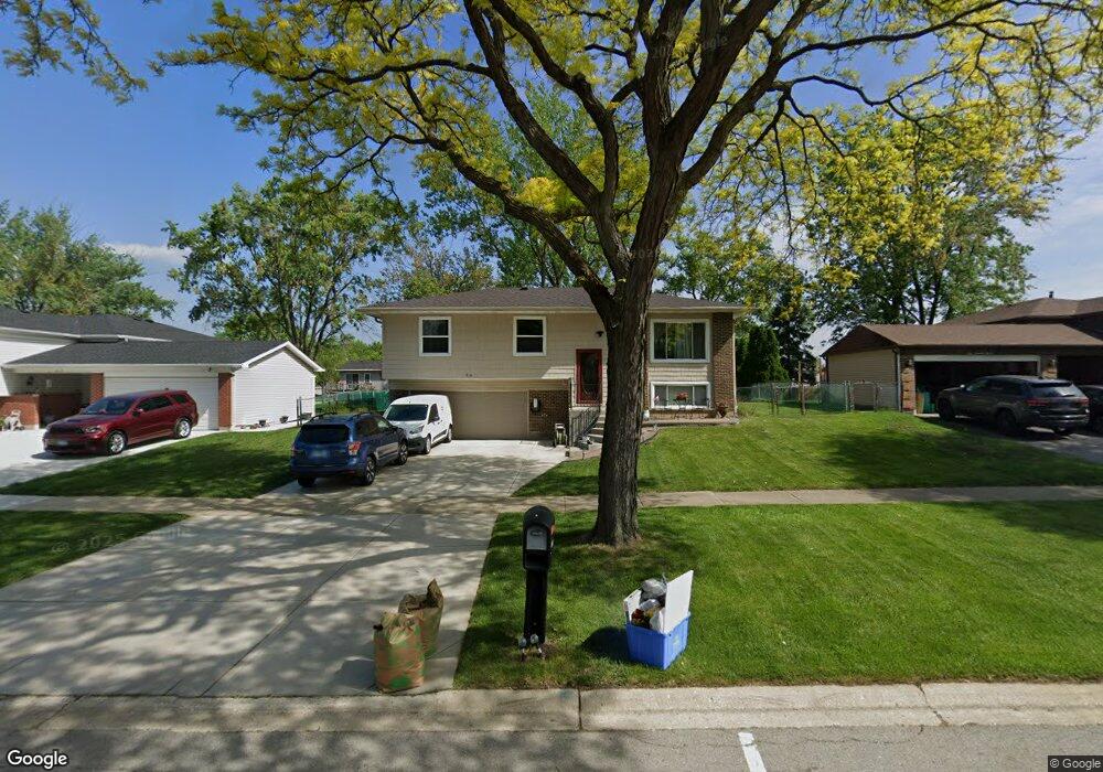
416 Rockhurst Rd Bolingbrook, IL 60440
East Bolingbrook NeighborhoodEstimated Value: $275,000 - $357,000
3
Beds
2
Baths
1,755
Sq Ft
$185/Sq Ft
Est. Value
About This Home
This home is located at 416 Rockhurst Rd, Bolingbrook, IL 60440 and is currently estimated at $324,476, approximately $184 per square foot. 416 Rockhurst Rd is a home located in Will County with nearby schools including Jonas E Salk Elementary School, Hubert H Humphrey Middle School, and Brooks Middle School.
Ownership History
Date
Name
Owned For
Owner Type
Purchase Details
Closed on
Nov 24, 2009
Sold by
The Bank Of New York
Bought by
Baltierrez Amparo
Current Estimated Value
Purchase Details
Closed on
May 5, 2009
Sold by
Phillips Lance E and Case #08 Ch 2603
Bought by
The Bank Of New York
Purchase Details
Closed on
Nov 15, 1999
Sold by
Phillips Lance E
Bought by
Phillips Lance E and Phillips Theresa
Home Financials for this Owner
Home Financials are based on the most recent Mortgage that was taken out on this home.
Original Mortgage
$152,950
Interest Rate
8.02%
Purchase Details
Closed on
Dec 6, 1995
Sold by
Young William B and Young Gloria J
Bought by
Phillips Lance E
Home Financials for this Owner
Home Financials are based on the most recent Mortgage that was taken out on this home.
Original Mortgage
$109,151
Interest Rate
7.45%
Mortgage Type
FHA
Create a Home Valuation Report for This Property
The Home Valuation Report is an in-depth analysis detailing your home's value as well as a comparison with similar homes in the area
Home Values in the Area
Average Home Value in this Area
Purchase History
| Date | Buyer | Sale Price | Title Company |
|---|---|---|---|
| Baltierrez Amparo | $80,000 | None Available | |
| The Bank Of New York | -- | None Available | |
| Phillips Lance E | -- | Stewart Title Company | |
| Phillips Lance E | $110,500 | -- |
Source: Public Records
Mortgage History
| Date | Status | Borrower | Loan Amount |
|---|---|---|---|
| Previous Owner | Phillips Lance E | $152,950 | |
| Previous Owner | Phillips Lance E | $109,151 |
Source: Public Records
Tax History Compared to Growth
Tax History
| Year | Tax Paid | Tax Assessment Tax Assessment Total Assessment is a certain percentage of the fair market value that is determined by local assessors to be the total taxable value of land and additions on the property. | Land | Improvement |
|---|---|---|---|---|
| 2024 | $8,297 | $89,834 | $20,174 | $69,660 |
| 2023 | $8,297 | $80,830 | $18,152 | $62,678 |
| 2022 | $7,203 | $72,872 | $16,365 | $56,507 |
| 2021 | $6,860 | $68,137 | $15,302 | $52,835 |
| 2020 | $6,665 | $65,897 | $14,799 | $51,098 |
| 2019 | $6,475 | $62,759 | $14,094 | $48,665 |
| 2018 | $5,997 | $57,741 | $12,967 | $44,774 |
| 2017 | $5,736 | $54,731 | $12,291 | $42,440 |
| 2016 | $5,595 | $52,100 | $11,700 | $40,400 |
| 2015 | $4,894 | $48,500 | $10,900 | $37,600 |
| 2014 | $4,894 | $44,100 | $9,900 | $34,200 |
| 2013 | $4,894 | $44,100 | $9,900 | $34,200 |
Source: Public Records
Map
Nearby Homes
- 338 Stafford Way
- 220 N Ashbury Ave
- 325 Rockhurst Rd
- 316 Bedford Rd
- 157 Vernon Dr Unit 6
- 304 N Pinecrest Rd
- 308 Pacific Dr
- 355 Falconridge Way
- 220 Falcon Ridge Way
- 168 Bedford Rd
- 101 Seabury Rd
- 219 Monterey Dr
- 233 Malibu Dr Unit 4
- 144 N Pinecrest Rd
- 520 White Oak Rd
- 235 Capitol Dr
- 451 Alcester Ct
- 113 Cedarwood Ave
- 492 Ridge Ln
- 490 Ridge Ln
- 412 Rockhurst Rd
- 420 Rockhurst Rd
- 405 Galahad Rd
- 401 Galahad Rd
- 409 Galahad Rd
- 424 Rockhurst Rd
- 408 Rockhurst Rd
- 367 Galahad Rd
- 413 Galahad Rd
- 421 Rockhurst Rd
- 413 Rockhurst Rd
- 404 Rockhurst Rd Unit 4
- 428 Rockhurst Rd
- 425 Rockhurst Rd
- 409 Rockhurst Rd
- 363 Galahad Rd
- 417 Galahad Rd
- 429 Rockhurst Rd
- 404 Galahad Rd
- 400 Rockhurst Rd