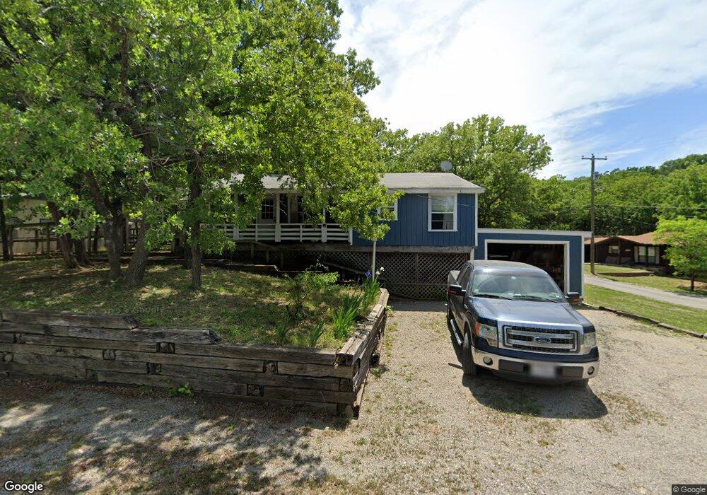
416 Westminister Dr Pottsboro, TX 75076
Estimated Value: $265,253 - $391,000
--
Bed
--
Bath
1,066
Sq Ft
$321/Sq Ft
Est. Value
About This Home
This home is located at 416 Westminister Dr, Pottsboro, TX 75076 and is currently estimated at $342,563, approximately $321 per square foot. 416 Westminister Dr is a home located in Grayson County with nearby schools including Pottsboro Elementary School, Pottsboro Middle School, and Pottsboro High School.
Ownership History
Date
Name
Owned For
Owner Type
Purchase Details
Closed on
Jan 5, 2023
Sold by
Fasolino John A
Bought by
Fasolino Family Trust
Current Estimated Value
Purchase Details
Closed on
Jan 15, 2013
Sold by
Dutton John D and Dutton Ann K
Bought by
Fasolino John and Fasolino Stephanie
Purchase Details
Closed on
Aug 1, 2012
Sold by
Botts Danny C
Bought by
The Dutton Living Trust
Purchase Details
Closed on
Nov 16, 2009
Sold by
Kerr Boodie Star
Bought by
Botts Danny C and Botts Carol Ann
Create a Home Valuation Report for This Property
The Home Valuation Report is an in-depth analysis detailing your home's value as well as a comparison with similar homes in the area
Home Values in the Area
Average Home Value in this Area
Purchase History
| Date | Buyer | Sale Price | Title Company |
|---|---|---|---|
| Fasolino Family Trust | -- | -- | |
| Fasolino John | -- | None Available | |
| The Dutton Living Trust | -- | None Available | |
| Botts Danny C | -- | None Available |
Source: Public Records
Tax History Compared to Growth
Tax History
| Year | Tax Paid | Tax Assessment Tax Assessment Total Assessment is a certain percentage of the fair market value that is determined by local assessors to be the total taxable value of land and additions on the property. | Land | Improvement |
|---|---|---|---|---|
| 2025 | $3,600 | $257,974 | $97,206 | $160,768 |
| 2024 | $3,600 | $259,862 | $94,723 | $165,139 |
| 2023 | $3,066 | $220,960 | $62,084 | $158,876 |
| 2022 | $2,974 | $188,979 | $41,980 | $146,999 |
| 2021 | $2,225 | $136,832 | $20,360 | $116,472 |
| 2020 | $2,364 | $140,019 | $22,396 | $117,623 |
| 2019 | $2,134 | $120,637 | $28,504 | $92,133 |
| 2018 | $1,846 | $103,035 | $16,288 | $86,747 |
| 2017 | $1,715 | $94,516 | $16,288 | $78,228 |
| 2016 | $1,670 | $92,003 | $16,288 | $75,715 |
| 2015 | $1,553 | $84,067 | $16,288 | $67,779 |
| 2014 | $1,558 | $83,638 | $16,288 | $67,350 |
Source: Public Records
Map
Nearby Homes
- 33 Queens Dr
- 219 Ray Rd
- 83 Mayfield Ln
- 11 Mayfield Ln
- 491 Black Forest Dr
- 545 Black Forest Dr
- 16 Wales Dr
- 226 Cambridge Dr
- 142 Wales Dr
- 191 Black Forest Dr
- 207 Wales Dr
- 81 Windsor Dr
- 344 Castle Dr
- 34 Cambridge Dr
- 258 Lou-Sand Hill Rd
- 120 Eagleview Cir
- 110 Eagleview Cir
- 105 Eagleview Cir
- 116 Oak Hills Dr
- 766 Lakepoint Loop
- 388 Westminister Dr
- 33 Cantebury Ln
- 405 Westminister Dr
- 3 Queens Dr
- 415 Westminister Dr
- 393 Westminister Dr
- 59 Queens Dr
- 373 Westminister Dr
- 86 Queens Dr
- 3 Eton Dr
- 95 Queens Dr
- 341 Westminister Dr
- 298 Westminister Dr
- 103 Cantebury Ln
- 90 Eton Dr
- 315 Westminister Dr
- 121 Queens Dr
- 195 Dru St
- 259 Dru St
- 130 Queens Dr