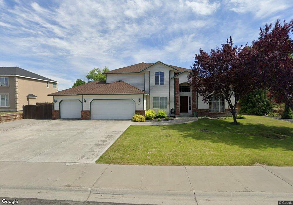
4161 Cove West Dr Moses Lake, WA 98837
Estimated Value: $511,000 - $595,000
4
Beds
4
Baths
2,395
Sq Ft
$231/Sq Ft
Est. Value
About This Home
This home is located at 4161 Cove West Dr, Moses Lake, WA 98837 and is currently estimated at $552,469, approximately $230 per square foot. 4161 Cove West Dr is a home located in Grant County with nearby schools including Peninsula Elementary School, Frontier Middle School, and Moses Lake High School.
Ownership History
Date
Name
Owned For
Owner Type
Purchase Details
Closed on
Jun 11, 2019
Sold by
Babak Leo and Babak Olga
Bought by
Farag Sameh
Current Estimated Value
Home Financials for this Owner
Home Financials are based on the most recent Mortgage that was taken out on this home.
Original Mortgage
$301,750
Outstanding Balance
$265,312
Interest Rate
4.1%
Mortgage Type
New Conventional
Estimated Equity
$287,157
Purchase Details
Closed on
Jan 25, 2010
Sold by
Protium Reo I Lp
Bought by
Babak Leo and Babak Olga G
Home Financials for this Owner
Home Financials are based on the most recent Mortgage that was taken out on this home.
Original Mortgage
$225,834
Interest Rate
5.25%
Mortgage Type
FHA
Purchase Details
Closed on
Oct 2, 2009
Sold by
Sutton Funding Llc
Bought by
Protium Reo I Lp
Purchase Details
Closed on
Aug 30, 2009
Sold by
Parent Jesse J and Parent Zana D
Bought by
Sutton Funding Llc
Create a Home Valuation Report for This Property
The Home Valuation Report is an in-depth analysis detailing your home's value as well as a comparison with similar homes in the area
Home Values in the Area
Average Home Value in this Area
Purchase History
| Date | Buyer | Sale Price | Title Company |
|---|---|---|---|
| Farag Sameh | $355,000 | Frontier Title And Escrow Co | |
| Babak Leo | $230,000 | Chicago Title Ins Co | |
| Protium Reo I Lp | $235,490 | Chicago Title Ins Co | |
| Sutton Funding Llc | $312,040 | Grant County Title |
Source: Public Records
Mortgage History
| Date | Status | Borrower | Loan Amount |
|---|---|---|---|
| Open | Farag Sameh | $301,750 | |
| Previous Owner | Babak Leo | $225,834 |
Source: Public Records
Tax History Compared to Growth
Tax History
| Year | Tax Paid | Tax Assessment Tax Assessment Total Assessment is a certain percentage of the fair market value that is determined by local assessors to be the total taxable value of land and additions on the property. | Land | Improvement |
|---|---|---|---|---|
| 2024 | $4,537 | $407,479 | $92,500 | $314,979 |
| 2023 | $4,191 | $343,230 | $66,250 | $276,980 |
| 2022 | $4,016 | $343,230 | $66,250 | $276,980 |
| 2021 | $3,579 | $343,230 | $66,250 | $276,980 |
| 2020 | $3,613 | $294,965 | $66,250 | $228,715 |
| 2019 | $3,354 | $251,085 | $35,000 | $216,085 |
| 2018 | $3,710 | $240,030 | $35,000 | $205,030 |
| 2017 | $3,505 | $240,030 | $35,000 | $205,030 |
| 2016 | $3,468 | $236,600 | $35,000 | $201,600 |
| 2013 | -- | $203,000 | $35,000 | $168,000 |
Source: Public Records
Map
Nearby Homes
- 4349 W Cove Dr W
- 620 N Dove Ct
- 600 Bluff Dr W
- 4326 W Redhead Ave
- 601 Bluff Dr W
- Canyon A Plan at The Refuge - The Refuge
- Canyon B Plan at The Refuge - The Refuge
- Suncrest Plan at The Refuge - The Refuge
- Skyline Plan at The Refuge - The Refuge
- Cascade B Plan at The Refuge - The Refuge
- Sage Plan at The Refuge - The Refuge
- Olympic Plan at The Refuge - The Refuge
- Cascade A Plan at The Refuge - The Refuge
- 316 Montana St
- 320 Montana St
- 312 Montana St
- 509 Bluff Dr W
- 4330 W Redhead Ave
- 490 N Ruddy St
- 494 N Ruddy St
- 4161 Cove Dr W
- 4141 Cove Dr W
- 4141 Cove West Dr
- 0 NNA Cove Dr W
- 4160 Cove Dr W
- 4160 Cove West Dr
- 4201 Cove West Dr
- 632 N Dove Ct
- 4201 Cove Dr W
- 4121 Cove Dr W
- 4121 Cove West Dr
- 702 Schooner Ct
- 636 N Dove Ct
- 4200 Cove West Dr
- 705 Shipmaster Ct
- 628 N Dove Ct
- 706 Schooner Ct
- 4097 Cove West Dr
- 706 Shipmaster Ct
- 640 N Bluff West Dr