Estimated Value: $469,000 - $530,000
3
Beds
2
Baths
1,659
Sq Ft
$299/Sq Ft
Est. Value
About This Home
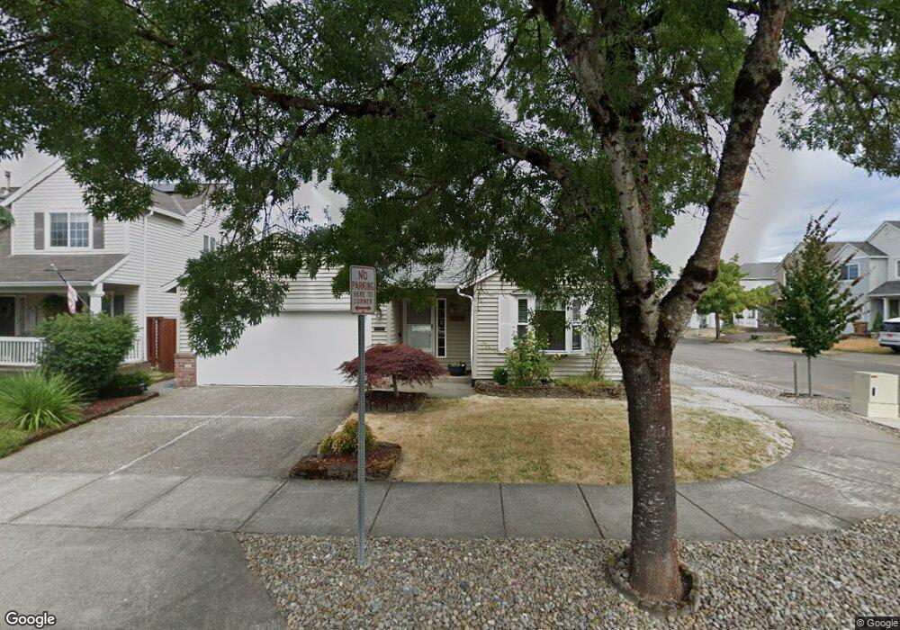
This home is located at 41613 NW Buckshire St, Banks, OR 97106 and is currently estimated at $495,554, approximately $298 per square foot. 41613 NW Buckshire St is a home located in Washington County with nearby schools including Banks Elementary School, Banks Middle School, and Banks High School.
Ownership History
Date
Name
Owned For
Owner Type
Purchase Details
Closed on
Mar 24, 2005
Sold by
Brown Steven D and Brown Patricia Lee
Bought by
Bruckner John R and Bruckner Corina L
Current Estimated Value
Home Financials for this Owner
Home Financials are based on the most recent Mortgage that was taken out on this home.
Original Mortgage
$159,960
Outstanding Balance
$80,665
Interest Rate
5.53%
Mortgage Type
Unknown
Estimated Equity
$414,889
Purchase Details
Closed on
Apr 14, 1998
Sold by
West Hills Development Company
Bought by
Brown Steven D and Brown Patricia Lee
Home Financials for this Owner
Home Financials are based on the most recent Mortgage that was taken out on this home.
Original Mortgage
$126,000
Interest Rate
6.96%
Create a Home Valuation Report for This Property
The Home Valuation Report is an in-depth analysis detailing your home's value as well as a comparison with similar homes in the area
Home Values in the Area
Average Home Value in this Area
Purchase History
| Date | Buyer | Sale Price | Title Company |
|---|---|---|---|
| Bruckner John R | $200,000 | First American Title Insuran | |
| Brown Steven D | $161,100 | Chicago Title Insurance Co |
Source: Public Records
Mortgage History
| Date | Status | Borrower | Loan Amount |
|---|---|---|---|
| Open | Bruckner John R | $159,960 | |
| Previous Owner | Brown Steven D | $126,000 |
Source: Public Records
Tax History Compared to Growth
Tax History
| Year | Tax Paid | Tax Assessment Tax Assessment Total Assessment is a certain percentage of the fair market value that is determined by local assessors to be the total taxable value of land and additions on the property. | Land | Improvement |
|---|---|---|---|---|
| 2025 | $4,868 | $264,960 | -- | -- |
| 2024 | $4,424 | $257,250 | -- | -- |
| 2023 | $4,424 | $249,760 | $0 | $0 |
| 2022 | $4,308 | $249,760 | $0 | $0 |
| 2021 | $4,156 | $235,430 | $0 | $0 |
| 2020 | $4,033 | $228,580 | $0 | $0 |
| 2019 | $3,871 | $221,930 | $0 | $0 |
| 2018 | $3,767 | $215,470 | $0 | $0 |
| 2017 | $3,608 | $209,200 | $0 | $0 |
| 2016 | $3,551 | $203,110 | $0 | $0 |
| 2015 | $3,413 | $197,200 | $0 | $0 |
| 2014 | $3,363 | $191,460 | $0 | $0 |
Source: Public Records
Map
Nearby Homes
- 41637 NW Buckshire St
- 41710 NW Oak Way
- 12734 NW Hammond Place
- 41753 NW Buckshire St
- 42015 NW Buckshire St
- 42002 NW Elmhurst Ct
- 42098 NW Broadshire Ln
- 42371 NW Banks Rd
- 0 NW Lodge Rd
- 48025 NW Strohmayer Rd
- 46345 NW Strohmayer Rd
- 45868 NW Hillside Rd
- 0 NW Green Mountain Rd Unit 1 23320324
- 0 NW Green Mountain Rd Unit 24253646
- 18282 NW Hilltop Place
- 11911 NW Seavey Rd
- 21076 NW Green Mountain Rd
- 40748 NW Verboort Rd
- 36303 NW 3 Cedars Ln
- 17034 NW Corey Rd
- 41612 NW Oak Way
- 41651 NW Buckshire St
- 12488 NW Ashton Dr
- 41634 NW Oak Way
- 12518 NW Ashton Dr
- 12534 NW Ashton Dr
- 41612 NW Buckshire St
- 12548 NW Ashton Dr
- 12504 NW Ashton Dr
- 41656 NW Oak Way
- 12564 NW Ashton Dr
- 12496 NW Ashton Dr
- 41673 NW Buckshire St
- 41634 NW Buckshire St
- 12570 NW Ashton Dr
- 41678 NW Oak Way
- 41656 NW Buckshire St
- 12494 NW Ashton Dr
- 12582 NW Ashton Dr
- 41689 NW Buckshire St