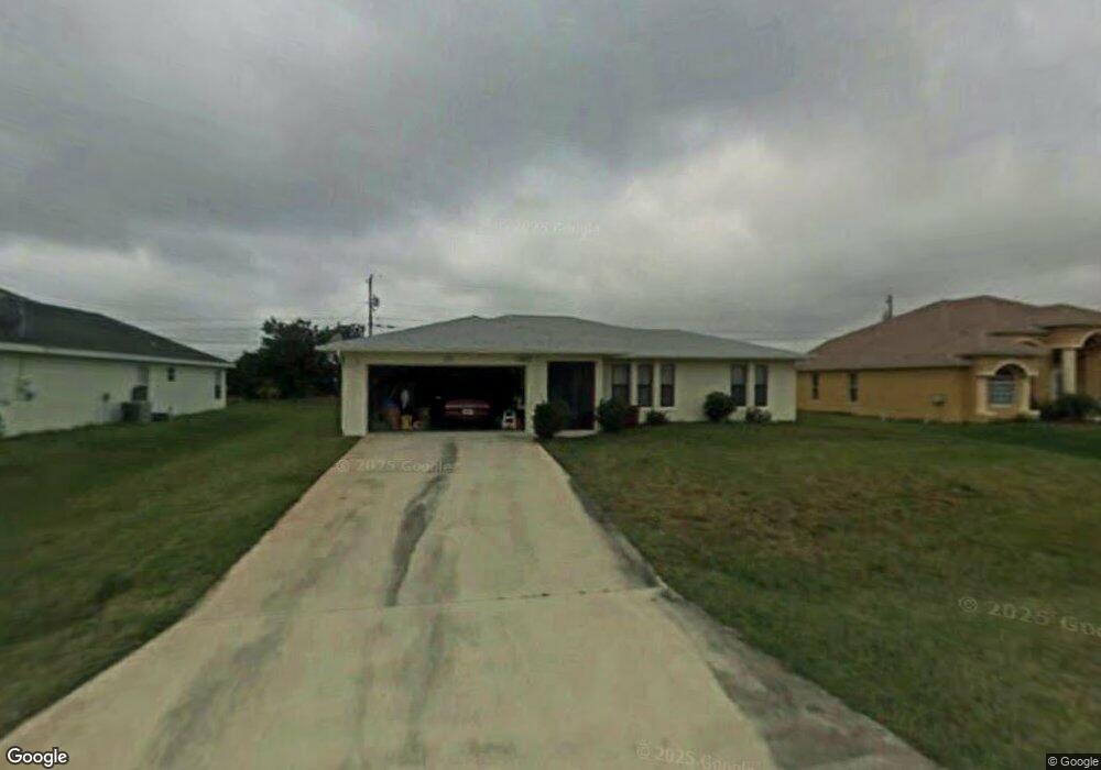
4162 SW Baird St Port Saint Lucie, FL 34953
Crane Landing NeighborhoodEstimated Value: $317,540 - $371,000
2
Beds
2
Baths
1,329
Sq Ft
$260/Sq Ft
Est. Value
About This Home
This home is located at 4162 SW Baird St, Port Saint Lucie, FL 34953 and is currently estimated at $344,885, approximately $259 per square foot. 4162 SW Baird St is a home located in St. Lucie County with nearby schools including Windmill Point Elementary School, Oak Hammock K-8 School, and Bayshore Elementary School.
Ownership History
Date
Name
Owned For
Owner Type
Purchase Details
Closed on
Jun 30, 2017
Sold by
Donfrio Michael N
Bought by
Donofrio Chery A
Current Estimated Value
Purchase Details
Closed on
Jun 1, 2017
Bought by
Donofrio Cheryl A
Purchase Details
Closed on
Dec 22, 2009
Sold by
Miller Joseph A
Bought by
Donofrio Cheryl A
Home Financials for this Owner
Home Financials are based on the most recent Mortgage that was taken out on this home.
Original Mortgage
$54,003
Interest Rate
4.82%
Mortgage Type
FHA
Create a Home Valuation Report for This Property
The Home Valuation Report is an in-depth analysis detailing your home's value as well as a comparison with similar homes in the area
Home Values in the Area
Average Home Value in this Area
Purchase History
| Date | Buyer | Sale Price | Title Company |
|---|---|---|---|
| Donofrio Chery A | -- | Attorney | |
| Donofrio Cheryl A | $100 | -- | |
| Donofrio Cheryl A | $55,000 | Superior Title Services Inc |
Source: Public Records
Mortgage History
| Date | Status | Borrower | Loan Amount |
|---|---|---|---|
| Previous Owner | Donofrio Cheryl A | $54,003 |
Source: Public Records
Tax History Compared to Growth
Tax History
| Year | Tax Paid | Tax Assessment Tax Assessment Total Assessment is a certain percentage of the fair market value that is determined by local assessors to be the total taxable value of land and additions on the property. | Land | Improvement |
|---|---|---|---|---|
| 2025 | $1,457 | $82,329 | -- | -- |
| 2024 | $1,400 | $80,009 | -- | -- |
| 2023 | $1,400 | $77,679 | $0 | $0 |
| 2022 | $1,294 | $75,417 | $0 | $0 |
| 2021 | $1,210 | $73,221 | $0 | $0 |
| 2020 | $1,446 | $72,211 | $0 | $0 |
| 2019 | $1,450 | $70,588 | $0 | $0 |
| 2018 | $1,398 | $69,272 | $0 | $0 |
| 2017 | $1,403 | $121,100 | $28,000 | $93,100 |
| 2016 | $1,402 | $108,200 | $24,000 | $84,200 |
| 2015 | $1,413 | $81,200 | $14,400 | $66,800 |
| 2014 | $1,375 | $65,468 | $0 | $0 |
Source: Public Records
Map
Nearby Homes
- 4122 SW Baird St
- 4111 SW Baltic St
- 4211 SW Tumble St
- 397 SW Jeanne Ave
- 4074 SW Kamsler St
- 4081 SW Hablow St
- 499 SW Laconic Ave
- 514 SW Laconic Ave
- 541 SW Nadell Ct
- 517 SW Lacroix Ave
- 514 SW Kabot Ave
- 4280 SW Darwin Blvd
- 4026 SW Kallen St
- 4018 SW Kallen St
- 4018 SW Kallen St Unit 65
- 514 SW Lakota Ave
- 4398 SW Verink St
- 4292 SW Whitebread Rd
- 643 SW Millard Dr
- 543 SW Kabot Ave
- 4152 SW Baird St
- 4172 SW Baird St
- 4161 SW Tumble St
- 4151 SW Tumble St
- 4171 SW Tumble St
- 4142 SW Baird St
- 4182 SW Baird St
- 4149 SW Baird St
- 4161 SW Baird St
- 4141 SW Tumble St
- 4181 SW Tumble St
- 4137 SW Baird St
- 4173 SW Baird St
- 4132 SW Baird St
- 4182 SW Tumble St
- 4192 SW Baird St
- 4125 SW Baird St
- 4131 SW Tumble St
- 4191 SW Tumble St
- 4162 SW Tumble St