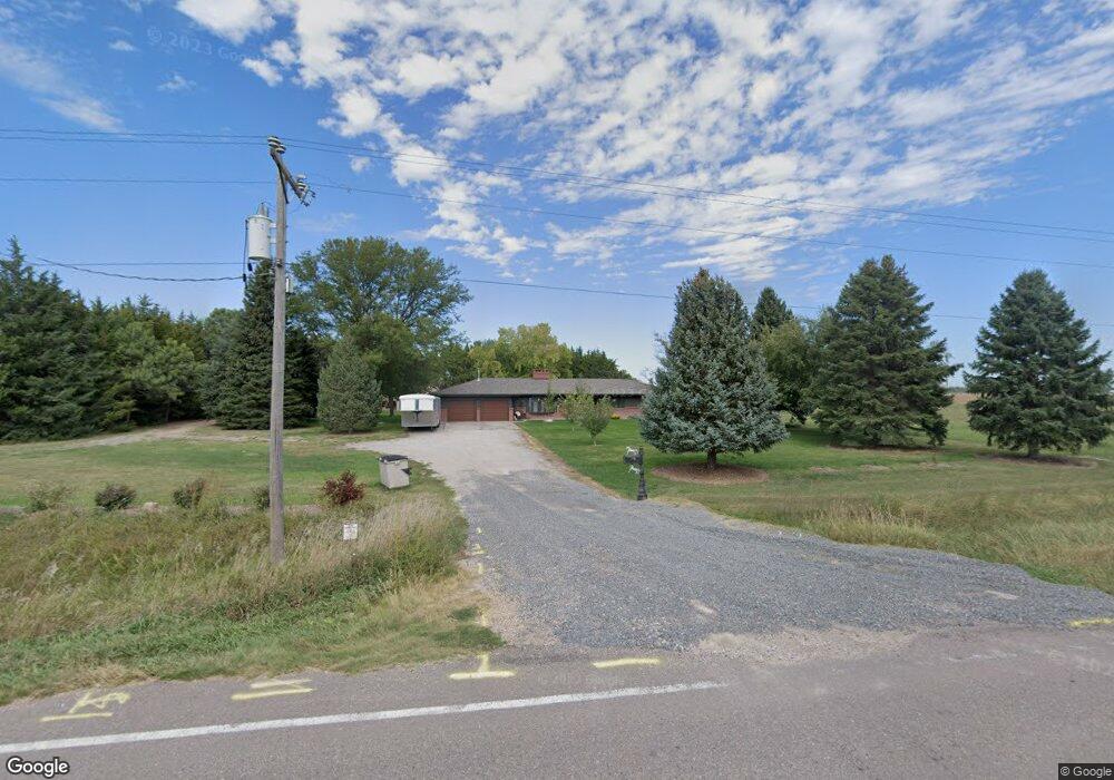
4163 W Walker Rd North Platte, NE 69101
Estimated Value: $341,000 - $435,000
3
Beds
3
Baths
2,123
Sq Ft
$179/Sq Ft
Est. Value
About This Home
This home is located at 4163 W Walker Rd, North Platte, NE 69101 and is currently estimated at $378,976, approximately $178 per square foot. 4163 W Walker Rd is a home located in Lincoln County with nearby schools including North Platte High School and Platte Valley Christian Academy.
Ownership History
Date
Name
Owned For
Owner Type
Purchase Details
Closed on
Jun 6, 2019
Sold by
Livin Reckard Robin K
Bought by
Rhoden Michael A and Rhoden Deborah L
Current Estimated Value
Home Financials for this Owner
Home Financials are based on the most recent Mortgage that was taken out on this home.
Original Mortgage
$177,600
Outstanding Balance
$156,467
Interest Rate
4.2%
Mortgage Type
Future Advance Clause Open End Mortgage
Estimated Equity
$222,509
Create a Home Valuation Report for This Property
The Home Valuation Report is an in-depth analysis detailing your home's value as well as a comparison with similar homes in the area
Home Values in the Area
Average Home Value in this Area
Purchase History
| Date | Buyer | Sale Price | Title Company |
|---|---|---|---|
| Rhoden Michael A | $265,000 | Title Services Of Plains Llc |
Source: Public Records
Mortgage History
| Date | Status | Borrower | Loan Amount |
|---|---|---|---|
| Open | Rhoden Michael A | $177,600 |
Source: Public Records
Tax History Compared to Growth
Tax History
| Year | Tax Paid | Tax Assessment Tax Assessment Total Assessment is a certain percentage of the fair market value that is determined by local assessors to be the total taxable value of land and additions on the property. | Land | Improvement |
|---|---|---|---|---|
| 2024 | $2,865 | $302,551 | $38,395 | $264,156 |
| 2023 | $3,663 | $266,509 | $27,910 | $238,599 |
| 2022 | $3,128 | $216,161 | $27,910 | $188,251 |
| 2021 | $2,851 | $195,430 | $27,940 | $167,490 |
| 2020 | $2,653 | $178,508 | $27,940 | $150,568 |
| 2019 | $3,075 | $206,206 | $11,123 | $195,083 |
| 2018 | $1,053 | $189,180 | $10,205 | $178,975 |
| 2017 | $1,117 | $189,180 | $10,205 | $178,975 |
| 2016 | $1,218 | $189,375 | $10,205 | $179,170 |
| 2014 | $666 | $145,975 | $10,345 | $135,630 |
Source: Public Records
Map
Nearby Homes
- 0 Unit 11584518
- N Platte Unit NE 69101
- 0 Unit Lot
- 0 N Buffalo Bill Grass
- N Platte Unit NE 69101
- 0 State Farm Road Long Acreage W
- N Platte Unit NE 69101
- 0 Buffalo Triangle Frontage
- 0 State Farm Road Short Acreage W
- 0 State Farm Road Short Acreage E
- N Platte Unit NE 69101
- N Platte Unit NE 69101
- 0 S Buffalo Bill Development
- N Platte Unit NE 69101
- N Platte Unit NE 69101
- 0 State Farm Road Long Acreage E
- 5005 Frazier Ln
- 5204 Frazier Ln
- 5115 Frazier Ln
- 5217 Frazier Ln
- 2850 W Walker Rd
- 2850 W Walker Rd
- 4590 W Walker Rd
- 4590 W Walker Rd Unit 4592
- 4592 W Walker Rd
- 3301 S Bare Ave
- 6641 James Way Ct
- 3120 W Walker Rd
- 3102 W Walker Rd
- 3411 S Bare Ave
- 3020 W Walker Rd
- 4254 W South River Rd
- 2702 W Walker Rd
- 4033 S Homestead Rd
- 2620 W Walker Rd
- 3643 W State Farm Rd
- 3490 S Homestead Rd
- 2602 W Walker Rd
- 4717 W South River Rd
- 3151 W State Farm Rd