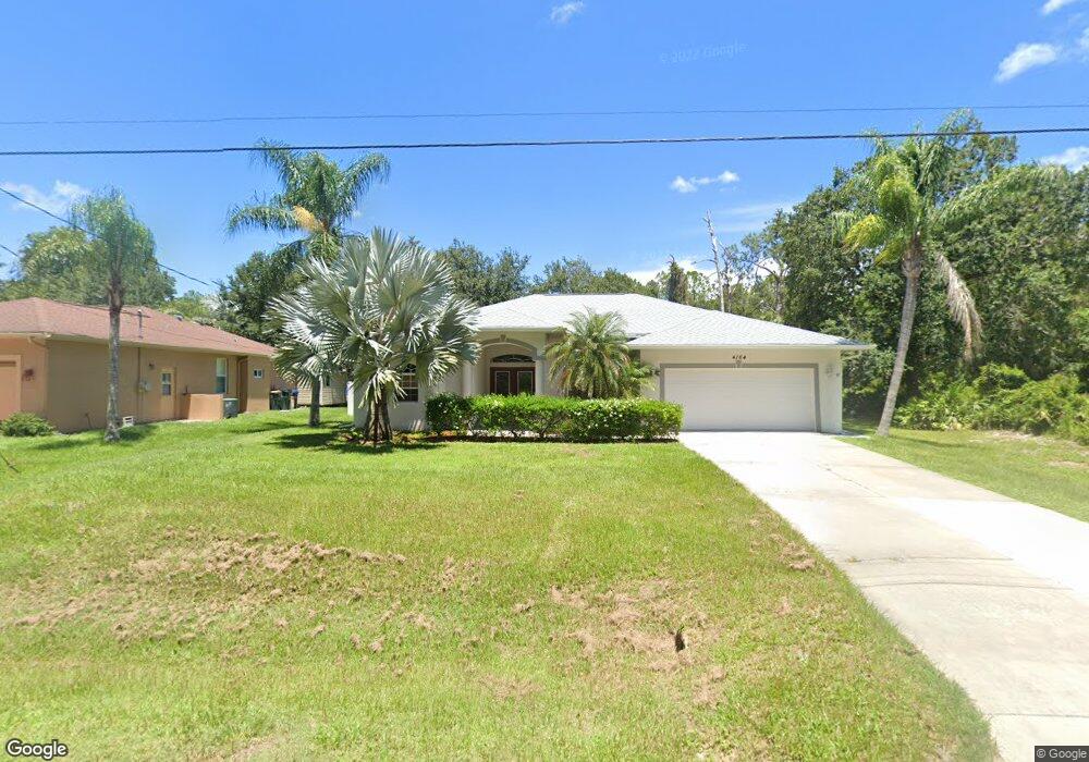
4164 Platt St North Port, FL 34286
Estimated Value: $302,621 - $415,000
3
Beds
2
Baths
1,837
Sq Ft
$187/Sq Ft
Est. Value
About This Home
This home is located at 4164 Platt St, North Port, FL 34286 and is currently estimated at $343,405, approximately $186 per square foot. 4164 Platt St is a home located in Sarasota County with nearby schools including North Port High School, Lamarque Elementary School, and Woodland Middle School.
Ownership History
Date
Name
Owned For
Owner Type
Purchase Details
Closed on
May 13, 2011
Sold by
Daniels James M and Daniels Marlene
Bought by
Brooks Steven and Brooks Lori
Current Estimated Value
Purchase Details
Closed on
Nov 30, 2007
Sold by
Daniels James M and Daniels Marlene
Bought by
Daniels James M and Daniels Marlene
Purchase Details
Closed on
Jul 23, 2004
Sold by
Windemere Homes Inc
Bought by
Daniels James M and Daniels Marlene
Home Financials for this Owner
Home Financials are based on the most recent Mortgage that was taken out on this home.
Original Mortgage
$125,900
Interest Rate
6.24%
Mortgage Type
Purchase Money Mortgage
Purchase Details
Closed on
Nov 20, 2000
Sold by
Clerk Circuit Court
Bought by
Marsala Julie and Marsala Nick
Create a Home Valuation Report for This Property
The Home Valuation Report is an in-depth analysis detailing your home's value as well as a comparison with similar homes in the area
Home Values in the Area
Average Home Value in this Area
Purchase History
| Date | Buyer | Sale Price | Title Company |
|---|---|---|---|
| Brooks Steven | $95,000 | Attorney | |
| Daniels James M | -- | None Available | |
| Daniels James M | $157,500 | Chelsea Title Company | |
| Marsala Julie | $1,400 | -- |
Source: Public Records
Mortgage History
| Date | Status | Borrower | Loan Amount |
|---|---|---|---|
| Previous Owner | Daniels James M | $125,900 |
Source: Public Records
Tax History Compared to Growth
Tax History
| Year | Tax Paid | Tax Assessment Tax Assessment Total Assessment is a certain percentage of the fair market value that is determined by local assessors to be the total taxable value of land and additions on the property. | Land | Improvement |
|---|---|---|---|---|
| 2024 | $5,082 | $274,200 | $23,500 | $250,700 |
| 2023 | $5,082 | $334,900 | $27,700 | $307,200 |
| 2022 | $4,514 | $301,500 | $25,600 | $275,900 |
| 2021 | $3,680 | $190,700 | $14,000 | $176,700 |
| 2020 | $3,449 | $174,400 | $11,200 | $163,200 |
| 2019 | $3,297 | $173,400 | $9,700 | $163,700 |
| 2018 | $2,933 | $160,000 | $8,900 | $151,100 |
| 2017 | $2,803 | $131,038 | $0 | $0 |
| 2016 | $2,711 | $149,100 | $4,900 | $144,200 |
| 2015 | $2,464 | $123,900 | $4,400 | $119,500 |
| 2014 | $2,199 | $89,500 | $0 | $0 |
Source: Public Records
Map
Nearby Homes
- 0 Platt St Unit MFRA4667068
- 4343 Carver St
- 3276 Chipley Ave
- 4035 Bruingst
- 4023 Platt St
- 0 Maywood Ln
- 0 Carver St Unit MFRC7498857
- 13 & 14 Lutz Rd
- 0 Lummus St Unit 2025005676
- 0 Lummus St Unit 225049848
- 0 Lummus St Unit MFRC7497102
- 3360 Stokie Ave
- 3355 Moncrief Ave
- 4610 Clarke St
- 4667 Shrimp Ln
- 0 Titan St Unit A4555464
- Lot 2 Titan St
- 0 N Cranberry Blvd Unit 225068009
- 0 N Cranberry Blvd Unit MFRC7504527
- 0 N Cranberry Blvd Unit MFRC7504480
- 4184 Street
- 4184 Platt St
- 0 Platt St Unit A4201391
- 0 Platt St Unit MFRC7483141
- 0 Platt St Unit D6119515
- 0 Platt St Unit A4497173
- 0 Platt St Unit D6114943
- 4202 Platt St
- 4132 Platt St
- 4305 Bruing St
- TBD Platt St
- 4110 Platt St
- 4238 Bruing St
- 0 Bruing St Unit C7403338
- 0 Bruing St Unit A4207602
- 0 Bruing St Unit C7425201
- 4103 Platt St
- 4100 Platt St
- 4288 Street
- 4355 Carver St