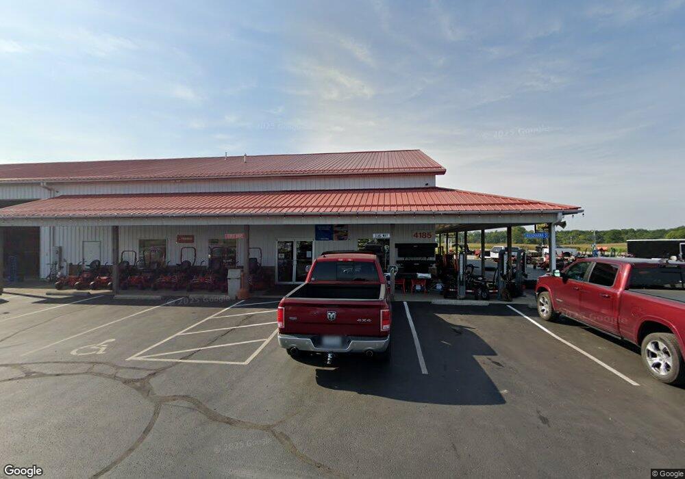
4165 Coonpath Rd NW Carroll, OH 43112
Estimated Value: $994,354
--
Bed
1
Bath
9,504
Sq Ft
$105/Sq Ft
Est. Value
About This Home
This home is located at 4165 Coonpath Rd NW, Carroll, OH 43112 and is currently estimated at $994,354, approximately $104 per square foot. 4165 Coonpath Rd NW is a home located in Fairfield County with nearby schools including Bloom Carroll Primary School, Bloom Carroll Intermediate School, and Bloom-Carroll Middle School.
Ownership History
Date
Name
Owned For
Owner Type
Purchase Details
Closed on
May 31, 2011
Sold by
Reed Ted E and Reed Maureen S
Bought by
Maw Properties Ltd
Current Estimated Value
Home Financials for this Owner
Home Financials are based on the most recent Mortgage that was taken out on this home.
Original Mortgage
$275,000
Outstanding Balance
$197,128
Interest Rate
5.5%
Mortgage Type
Future Advance Clause Open End Mortgage
Estimated Equity
$797,226
Purchase Details
Closed on
Feb 3, 1992
Sold by
Reed Fred E
Bought by
Reed Ted E
Create a Home Valuation Report for This Property
The Home Valuation Report is an in-depth analysis detailing your home's value as well as a comparison with similar homes in the area
Home Values in the Area
Average Home Value in this Area
Purchase History
| Date | Buyer | Sale Price | Title Company |
|---|---|---|---|
| Maw Properties Ltd | $375,000 | Attorney | |
| Reed Ted E | $150,000 | -- |
Source: Public Records
Mortgage History
| Date | Status | Borrower | Loan Amount |
|---|---|---|---|
| Open | Maw Properties Ltd | $275,000 |
Source: Public Records
Tax History Compared to Growth
Tax History
| Year | Tax Paid | Tax Assessment Tax Assessment Total Assessment is a certain percentage of the fair market value that is determined by local assessors to be the total taxable value of land and additions on the property. | Land | Improvement |
|---|---|---|---|---|
| 2024 | $24,244 | $300,420 | $114,520 | $185,900 |
| 2023 | $17,363 | $300,420 | $114,520 | $185,900 |
| 2022 | $17,413 | $300,420 | $114,520 | $185,900 |
| 2021 | $16,823 | $300,420 | $114,520 | $185,900 |
| 2020 | $16,985 | $300,420 | $114,520 | $185,900 |
| 2019 | $17,041 | $300,420 | $114,520 | $185,900 |
| 2018 | $16,124 | $314,600 | $114,520 | $200,080 |
| 2017 | $14,977 | $303,140 | $100,520 | $202,620 |
| 2016 | $14,791 | $303,140 | $100,520 | $202,620 |
| 2015 | $14,887 | $303,140 | $100,520 | $202,620 |
| 2014 | $14,302 | $303,140 | $100,520 | $202,620 |
| 2013 | $14,302 | $303,140 | $100,520 | $202,620 |
Source: Public Records
Map
Nearby Homes
- 3355 Old Columbus Rd NW
- 3016 Kauffman Rd NW
- 4656 Meadow Grove Dr NW
- 3515 Election House Rd NW
- 2155 Carroll-Southern Rd NW
- 53 S Beaver St
- 4400 Kauffman Rd NW
- 2445 Columbus Lancaster Rd NW Unit Lot 176
- 2445 Columbus Lancaster Rd NW Unit Lot 408 Walnut St
- 2445 Columbus Lancaster Rd NW Unit lot 463
- 6556 Castlewood Dr NW
- 1889 Salt Lick Dr
- 6415 Winchester Rd NW
- 1715 Tecumseh Dr
- 2387 Zachariah Ave
- 2422 Long Bow Ave
- 1639 Tecumseh Dr
- 2831 Sterling Dr NW
- 1638 Quail Meadows Dr
- 5842 Feldon Ct NW
- 4255 Coonpath Rd NW
- 4045 Coonpath Rd
- 0 Rt33 Coonpath Rd
- 4300 Old Columbus Rd NW
- 0 Helena Dr
- 4164 Old Columbus Rd NW
- 4410 Coonpath Rd
- 4465 Coonpath Rd NW
- 4350 Old Columbus Rd NW
- 4045 Columbus Lancaster Rd NW
- 4045 Old Columbus Rd NW
- 4240 Old Columbus Rd NW
- 4460 Old Columbus Rd NW
- 3900 Coonpath Rd
- 4200 Old Columbus Rd NW
- 4580 Old Columbus Rd NW
- 4435 Old Columbus Rd NW
- 4485 Old Columbus Rd NW
- 4455 Old Columbus Rd NW
- 4564 Old Columbus Rd NW
