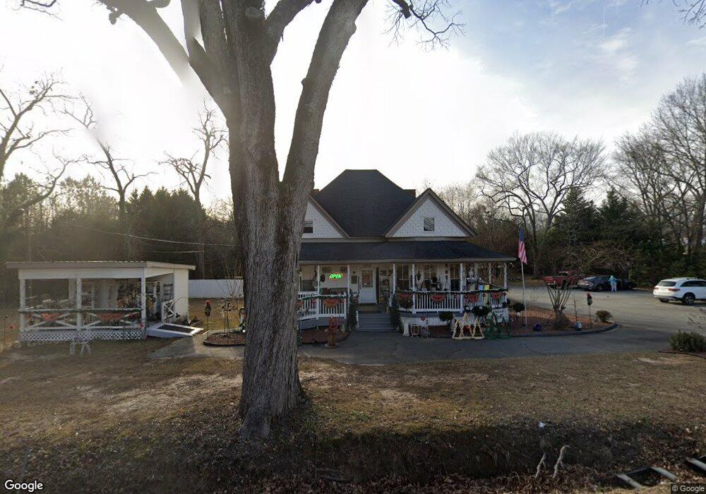
4165 Highway 53 Hoschton, GA 30548
Estimated Value: $299,000 - $585,028
3
Beds
2
Baths
1,369
Sq Ft
$334/Sq Ft
Est. Value
About This Home
This home is located at 4165 Highway 53, Hoschton, GA 30548 and is currently estimated at $457,007, approximately $333 per square foot. 4165 Highway 53 is a home located in Jackson County with nearby schools including West Jackson Elementary School, West Jackson Middle School, and Jackson County High School.
Ownership History
Date
Name
Owned For
Owner Type
Purchase Details
Closed on
Jun 29, 2018
Sold by
Oroian Angela
Bought by
4165 Hwy 53 Llc
Current Estimated Value
Home Financials for this Owner
Home Financials are based on the most recent Mortgage that was taken out on this home.
Original Mortgage
$277,500
Outstanding Balance
$205,098
Interest Rate
4.5%
Mortgage Type
New Conventional
Estimated Equity
$251,909
Purchase Details
Closed on
Nov 1, 2002
Sold by
Spealman Ray
Bought by
Oroian Cornel
Purchase Details
Closed on
Nov 4, 1998
Sold by
Spealman Anne E
Bought by
Spealman Ray
Purchase Details
Closed on
Mar 3, 1998
Sold by
Spealman Ray
Bought by
Spealman Ray
Purchase Details
Closed on
Jul 31, 1995
Bought by
Spealman Ray
Create a Home Valuation Report for This Property
The Home Valuation Report is an in-depth analysis detailing your home's value as well as a comparison with similar homes in the area
Home Values in the Area
Average Home Value in this Area
Purchase History
| Date | Buyer | Sale Price | Title Company |
|---|---|---|---|
| 4165 Hwy 53 Llc | $370,000 | -- | |
| Oroian Cornel | $130,000 | -- | |
| Spealman Ray | -- | -- | |
| Spealman Ray | -- | -- | |
| Spealman Ray | -- | -- |
Source: Public Records
Mortgage History
| Date | Status | Borrower | Loan Amount |
|---|---|---|---|
| Open | 4165 Hwy 53 Llc | $277,500 |
Source: Public Records
Tax History Compared to Growth
Tax History
| Year | Tax Paid | Tax Assessment Tax Assessment Total Assessment is a certain percentage of the fair market value that is determined by local assessors to be the total taxable value of land and additions on the property. | Land | Improvement |
|---|---|---|---|---|
| 2024 | $6,412 | $203,308 | $111,040 | $92,268 |
| 2023 | $6,412 | $193,716 | $111,040 | $82,676 |
| 2022 | $5,595 | $155,996 | $88,840 | $67,156 |
| 2021 | $5,044 | $155,996 | $88,840 | $67,156 |
| 2020 | $5,079 | $144,436 | $88,840 | $55,596 |
| 2019 | $5,171 | $144,436 | $88,840 | $55,596 |
| 2018 | $3,390 | $93,848 | $71,080 | $22,768 |
Source: Public Records
Map
Nearby Homes
- 74 White St
- 176 Bell Ave
- 289 Bell Ave
- 1774 Holman Forest Ct
- 8422 Pendergrass Rd
- 22 Huntley Trace Unit 230
- 60 Huntley Trace
- 22 Huntley Trace
- 38 Huntley Trace
- 329 Winterset Cir
- 41 Huntley Trace
- 41 Huntley Trace Unit 5
- 49 Creekside Commons Dr
- 45 Creekside Commons Dr
- 41 Creekside Commons Dr
- 372 Meadow Vista Ln
- 37 Creekside Commons Dr
- 225 White St
- 0 Georgia 332
- N Georgia 332
- 260 White St Unit 17
- 260 White St
- 254 White St
- 4188 Highway 53
- 4188 Highway 53 Unit Suite 105
- 4188 Highway 53 Unit Suite 102
- 4188 Highway 53 Unit Suite 101
- 0 White St Unit 10140721
- 0 White St Unit 7189233
- 0 White St Unit 8702456
- 0 White St Unit 8643781
- 0 White St Unit 3102602
- 0 White St Unit 3102783
- 0 White St Unit 8469886
- 0 White St Unit 8747174
- 0 White St Unit 8983844
- 0 White St Unit 8148228