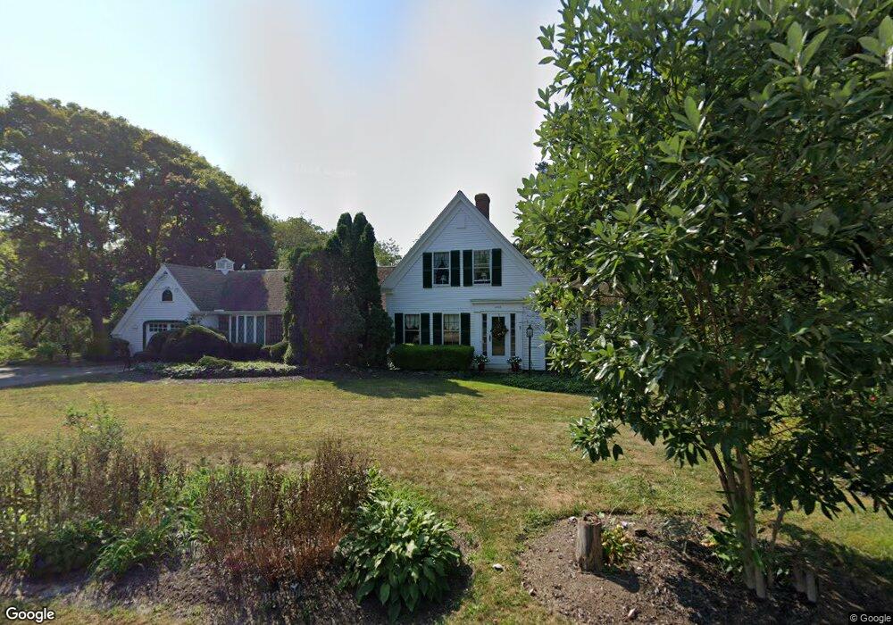
4165 Main St Barnstable, MA 2630
Barnstable Village NeighborhoodEstimated Value: $1,235,000 - $1,511,000
3
Beds
3
Baths
2,201
Sq Ft
$599/Sq Ft
Est. Value
About This Home
This home is located at 4165 Main St, Barnstable, MA 2630 and is currently estimated at $1,317,734, approximately $598 per square foot. 4165 Main St is a home located in Barnstable County with nearby schools including West Barnstable Elementary School, Barnstable United Elementary School, and Barnstable Intermediate School.
Ownership History
Date
Name
Owned For
Owner Type
Purchase Details
Closed on
Oct 5, 2021
Sold by
Kent Nathalie S and Kent John B
Bought by
Kent Ft
Current Estimated Value
Purchase Details
Closed on
Sep 6, 2001
Sold by
Shackelford Leo F and Shackelford Audrey E
Bought by
Kent John B
Home Financials for this Owner
Home Financials are based on the most recent Mortgage that was taken out on this home.
Original Mortgage
$85,000
Interest Rate
7.05%
Mortgage Type
Purchase Money Mortgage
Purchase Details
Closed on
Aug 9, 1999
Sold by
Hegarty James W and Hegarty Brenda
Bought by
Shackelford Leo F
Create a Home Valuation Report for This Property
The Home Valuation Report is an in-depth analysis detailing your home's value as well as a comparison with similar homes in the area
Home Values in the Area
Average Home Value in this Area
Purchase History
| Date | Buyer | Sale Price | Title Company |
|---|---|---|---|
| Kent Ft | -- | None Available | |
| Kent John B | $400,000 | -- | |
| Shackelford Leo F | $383,000 | -- |
Source: Public Records
Mortgage History
| Date | Status | Borrower | Loan Amount |
|---|---|---|---|
| Previous Owner | Shackelford Leo F | $110,500 | |
| Previous Owner | Shackelford Leo F | $120,000 | |
| Previous Owner | Shackelford Leo F | $85,000 | |
| Previous Owner | Shackelford Leo F | $220,000 |
Source: Public Records
Tax History
| Year | Tax Paid | Tax Assessment Tax Assessment Total Assessment is a certain percentage of the fair market value that is determined by local assessors to be the total taxable value of land and additions on the property. | Land | Improvement |
|---|---|---|---|---|
| 2025 | $7,552 | $817,300 | $299,200 | $518,100 |
| 2024 | $6,906 | $788,400 | $299,200 | $489,200 |
| 2023 | $6,577 | $732,400 | $296,000 | $436,400 |
| 2022 | $6,157 | $551,700 | $189,600 | $362,100 |
| 2021 | $5,930 | $506,400 | $201,500 | $304,900 |
| 2020 | $6,151 | $501,700 | $213,400 | $288,300 |
| 2019 | $5,892 | $482,200 | $225,200 | $257,000 |
| 2018 | $5,569 | $442,700 | $224,600 | $218,100 |
| 2017 | $5,449 | $435,900 | $230,800 | $205,100 |
| 2016 | $5,368 | $435,400 | $230,300 | $205,100 |
| 2015 | $5,655 | $467,000 | $228,900 | $238,100 |
Source: Public Records
Map
Nearby Homes
- 79 Bayberry Ln
- 4390 Main St
- 30 Indian Trail
- 44 Iris Ln
- 65 Oakmont Rd
- 41 Dromoland Ln
- 18 Sleeping Dog Path
- 112 Main St
- 100 Spy Glass Hill Rd
- 162 Route 6a
- 186 Route 6a
- 0 Indian Trail
- 34 Maushop Ave
- 28 Mariners Ln
- 933-935 W Yarmouth Rd
- 0 Phinneys Ln
- 95 Washington Ave
- 25 Union St
- 61 Coolidge Rd
- 40 Cocheset Path
- 4165 Main Route 6a Route
- 4165 Massachusetts 6a
- 4151 Main St
- 4131 Massachusetts 6a
- 4131 Main St
- 4140 Main Rte 6a ( Barn ) St
- 4140 Main St
- 4140 Main St
- 4181 Main St
- 4181 Main St
- 4170 Main St
- 4190 Main St
- 4455 Main (Rte 6a) St
- 16 Cove
- 4099 Main Rte 6a St
- 4099 Main (Route 6a) St
- 4096 Main St
- 16 Cove Ln
- 4099 Main St
- 4099 Main St Rte 6a (Barn )
Your Personal Tour Guide
Ask me questions while you tour the home.