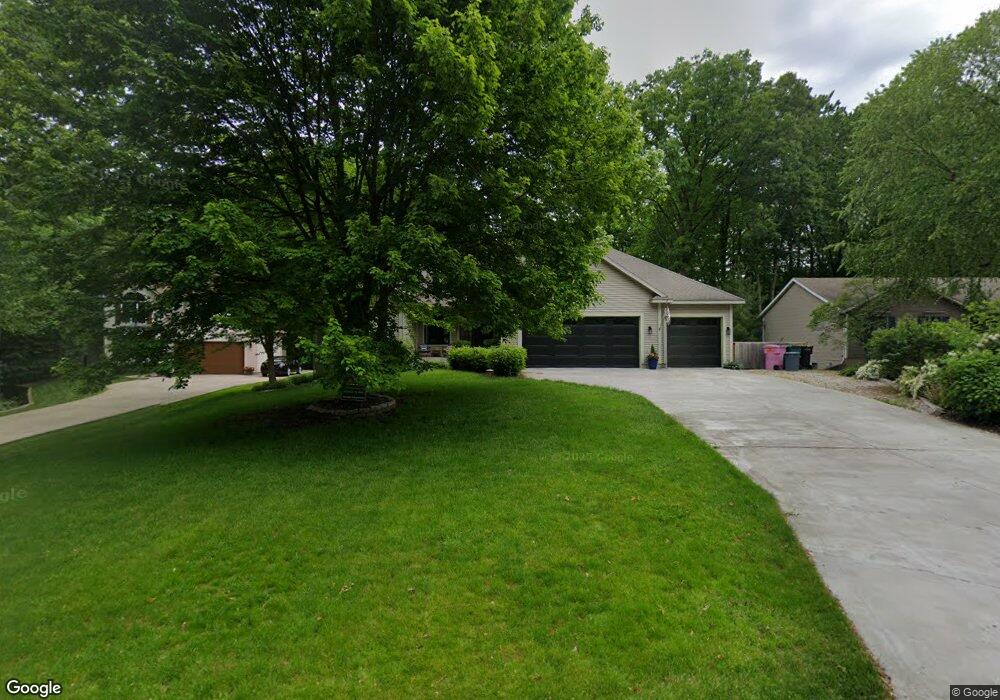
4165 Pheasant Run Dr Hudsonville, MI 49426
Estimated Value: $486,000 - $658,000
5
Beds
4
Baths
1,916
Sq Ft
$288/Sq Ft
Est. Value
About This Home
This home is located at 4165 Pheasant Run Dr, Hudsonville, MI 49426 and is currently estimated at $552,372, approximately $288 per square foot. 4165 Pheasant Run Dr is a home located in Ottawa County with nearby schools including Bauer Elementary School, Baldwin Street Middle School, and Hudsonville Freshman Campus.
Ownership History
Date
Name
Owned For
Owner Type
Purchase Details
Closed on
Nov 5, 2024
Sold by
Kunzi Gary and Kunzi Michelle
Bought by
Kunzi Michelle K and Kunzi Living Trust
Current Estimated Value
Purchase Details
Closed on
Jul 15, 2016
Sold by
Kunzi Gary and Kunzi Michelle
Bought by
Kunzi Gary and Kunzi Michelle
Home Financials for this Owner
Home Financials are based on the most recent Mortgage that was taken out on this home.
Original Mortgage
$194,255
Interest Rate
3.6%
Mortgage Type
New Conventional
Create a Home Valuation Report for This Property
The Home Valuation Report is an in-depth analysis detailing your home's value as well as a comparison with similar homes in the area
Home Values in the Area
Average Home Value in this Area
Purchase History
| Date | Buyer | Sale Price | Title Company |
|---|---|---|---|
| Kunzi Michelle K | -- | None Listed On Document | |
| Kunzi Michelle K | -- | None Listed On Document | |
| Kunzi Gary | -- | Title Source Inc |
Source: Public Records
Mortgage History
| Date | Status | Borrower | Loan Amount |
|---|---|---|---|
| Previous Owner | Kunzi Gary | $194,255 |
Source: Public Records
Tax History Compared to Growth
Tax History
| Year | Tax Paid | Tax Assessment Tax Assessment Total Assessment is a certain percentage of the fair market value that is determined by local assessors to be the total taxable value of land and additions on the property. | Land | Improvement |
|---|---|---|---|---|
| 2025 | $4,246 | $274,800 | $0 | $0 |
| 2024 | $3,674 | $278,300 | $0 | $0 |
| 2023 | $3,509 | $216,900 | $0 | $0 |
| 2022 | $3,856 | $213,200 | $0 | $0 |
| 2021 | $3,746 | $190,300 | $0 | $0 |
| 2020 | $3,658 | $180,000 | $0 | $0 |
| 2019 | $3,663 | $171,600 | $0 | $0 |
| 2018 | $3,413 | $149,300 | $0 | $0 |
| 2017 | $3,351 | $144,500 | $0 | $0 |
| 2016 | $3,320 | $134,300 | $0 | $0 |
| 2015 | $3,168 | $134,300 | $0 | $0 |
| 2014 | $3,168 | $122,900 | $0 | $0 |
Source: Public Records
Map
Nearby Homes
- 4087 Baldwin St
- 0 Baldwin St
- 7114 Tory Dr
- 7399 Hidden Forest Ct
- 6950 Meadowcreek Dr
- 7068 Jasper Dr
- 3646 Lenters Dr
- 7918 Westside Dr
- 3528 Tearose Dr
- 6863 Bridgeport Dr
- 4663 Hidden Ridge Dr Unit lot 38
- 8075 42nd Ave
- 7318 Alycia Dr
- 4372 Shady Oak Ct
- 4672 Lexem Dr
- 3546 Eagles Roost Trail Unit 3
- 4717 Lexem Dr Unit Lot 41
- 4699 Lexem Dr
- 7313 Valhalla Dr
- 3808 Port Sheldon St
- 4153 Pheasant Run Dr
- 4153 Pheasant Run Dr
- 4179 Pheasant Run Dr
- 7419 Tory Dr
- 4139 Pheasant Run Dr
- 4193 Pheasant Run Dr
- 4193 Pheasant Run Dr
- 4172 Pheasant Run Dr
- 4182 Pheasant Run Dr
- 7361 Tory Dr
- 7414 Yorkshire Dr
- 7442 Yorkshire Dr
- 7388 Yorkshire Dr
- 7433 Tory Dr
- 7454 Yorkshire Dr
- 7388 Tory Dr
- 7437 Tory Dr
- 7424 Tory Dr
- 7343 Tory Dr
- 7372 Tory Dr