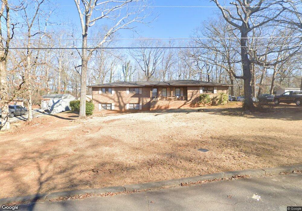
4167 Wells Cir Douglasville, GA 30135
Bill Arp NeighborhoodEstimated Value: $246,000 - $271,000
3
Beds
2
Baths
1,514
Sq Ft
$170/Sq Ft
Est. Value
About This Home
This home is located at 4167 Wells Cir, Douglasville, GA 30135 and is currently estimated at $256,965, approximately $169 per square foot. 4167 Wells Cir is a home located in Douglas County with nearby schools including Bill Arp Elementary School, Yeager Middle School, and Alexander High School.
Ownership History
Date
Name
Owned For
Owner Type
Purchase Details
Closed on
Mar 8, 2004
Sold by
Secretary Of Hud
Bought by
Foster Tony L
Current Estimated Value
Home Financials for this Owner
Home Financials are based on the most recent Mortgage that was taken out on this home.
Original Mortgage
$112,309
Outstanding Balance
$52,672
Interest Rate
5.72%
Mortgage Type
New Conventional
Estimated Equity
$204,293
Purchase Details
Closed on
Jan 3, 2001
Sold by
Adams Donald and Adams Regina L
Bought by
Powers Willie
Home Financials for this Owner
Home Financials are based on the most recent Mortgage that was taken out on this home.
Original Mortgage
$123,068
Interest Rate
6.91%
Mortgage Type
FHA
Purchase Details
Closed on
May 17, 1996
Sold by
Agee Cheryl
Bought by
Adams Donald
Create a Home Valuation Report for This Property
The Home Valuation Report is an in-depth analysis detailing your home's value as well as a comparison with similar homes in the area
Home Values in the Area
Average Home Value in this Area
Purchase History
| Date | Buyer | Sale Price | Title Company |
|---|---|---|---|
| Foster Tony L | -- | -- | |
| Powers Willie | $125,000 | -- | |
| Adams Donald | $89,900 | -- |
Source: Public Records
Mortgage History
| Date | Status | Borrower | Loan Amount |
|---|---|---|---|
| Open | Foster Tony L | $112,309 | |
| Previous Owner | Powers Willie | $123,068 | |
| Closed | Adams Donald | $0 |
Source: Public Records
Tax History Compared to Growth
Tax History
| Year | Tax Paid | Tax Assessment Tax Assessment Total Assessment is a certain percentage of the fair market value that is determined by local assessors to be the total taxable value of land and additions on the property. | Land | Improvement |
|---|---|---|---|---|
| 2024 | $1,264 | $83,680 | $17,480 | $66,200 |
| 2023 | $1,264 | $83,680 | $17,480 | $66,200 |
| 2022 | $1,151 | $67,960 | $10,360 | $57,600 |
| 2021 | $991 | $51,760 | $9,640 | $42,120 |
| 2020 | $1,005 | $51,760 | $9,640 | $42,120 |
| 2019 | $911 | $49,720 | $9,640 | $40,080 |
| 2018 | $1,000 | $57,880 | $11,400 | $46,480 |
| 2017 | $921 | $48,040 | $10,560 | $37,480 |
| 2016 | $764 | $39,120 | $8,800 | $30,320 |
| 2015 | $666 | $33,760 | $7,880 | $25,880 |
| 2014 | $693 | $34,280 | $8,440 | $25,840 |
| 2013 | -- | $33,840 | $8,440 | $25,400 |
Source: Public Records
Map
Nearby Homes
- 4153 Wells Cir
- 6464 Westerly Way
- 6407 Shore Dr
- 4045 Westview St
- 6225 Pebble Dr
- 6394 Shore Dr
- 3964 Wedgewood Dr
- 6226 Lullwater Dr
- 3980 Highway 5
- 4766 Mockingbird Ln
- 6201 Hillpine Dr
- 3948 Bright Star Rd
- 3976 Bright Star Rd
- 6290 S Skyline Dr
- 2471 Cotton Ln
- 6150 S Skyline Dr
- 6119 Lullwater Dr
- 3850 Bright Star Rd
- 4181 Wells Cir
- 4164 Wells Cir
- 6425 Westerly Way Unit 3
- 6374 Westerly Way
- 4181 Bearden Ln
- 4154 Wells Cir
- 4139 Wells Cir Unit 2
- 0 Westerly Way Unit 7145401
- 0 Westerly Way
- 4140 Wells Cir Unit 2
- 4165 Westview St
- 6404 Westerly Way
- 6394 Westerly Way
- 6419 Westerly Way Unit 3
- 6428 Westerly Way
- 4153 Westview St
- 4125 Wells Cir Unit 2
- 4191 Bearden Ln
- 4124 Wells Cir
- 4139 Westview St